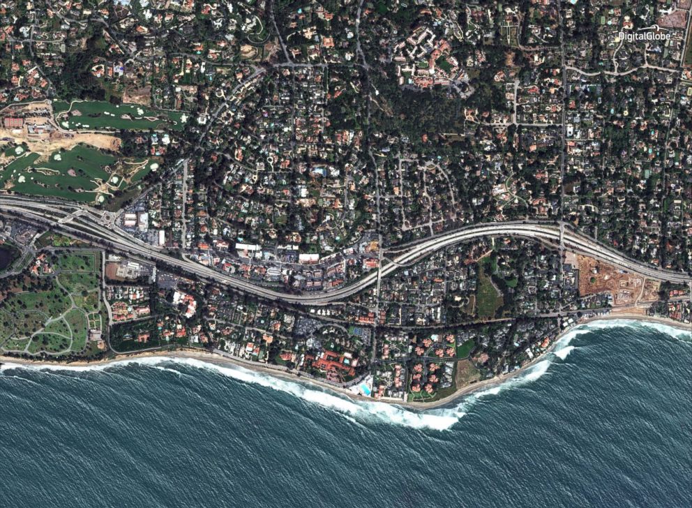
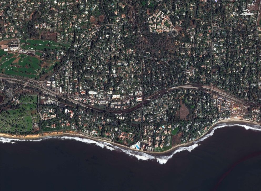
California mudslide devastation seen in satellite photos

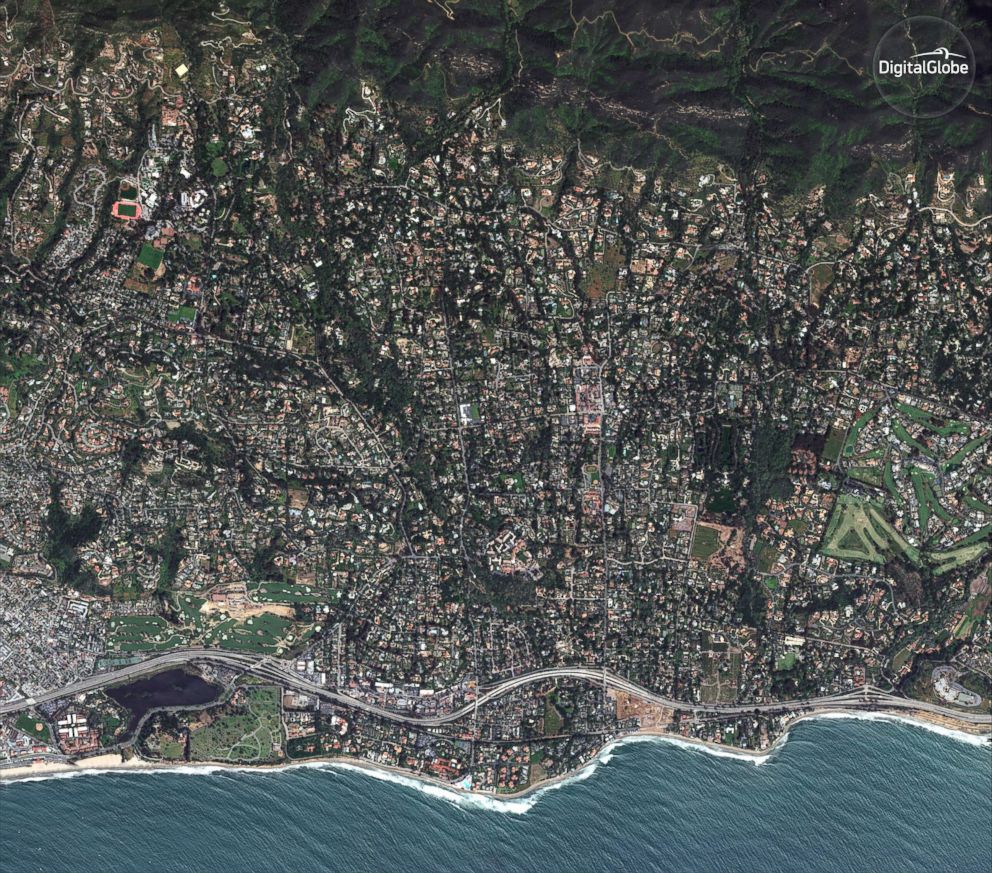
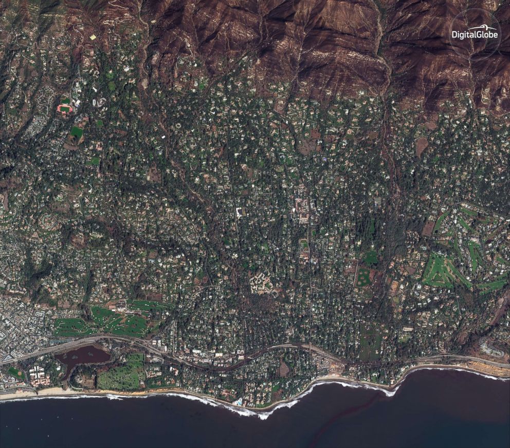
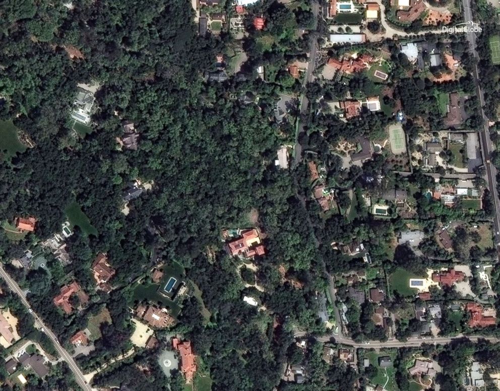
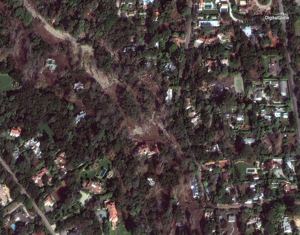
Satellite photos of Montecito, California, before and after deadly mudslides.

ByABC News
January 12, 2018, 6:25 PM

— -- Satellite images released by DigitalGlobe today show areas of Montecito, California, before and after the area was hit by heavy rainfall and deadly mudslides.

The unincorporated area of Montecito was put under a mandatory evacuation order on Thursday and more than 500 homes in the county were damaged or destroyed, according to numbers released by the Santa Barbara County Fire Department.

Seventeen people have died in the mudslides and many more are feared missing.

PHOTO: A satellite image made on April 2, 2017, shows Montecito, Calif., an an unincorporated area near the city of Santa Barbara.
A satellite image made on April 2, 2017, shows Montecito, Calif., an an unincorporated area near the city of Santa Barbara.
PHOTO: A satellite image made on Jan. 10, 2018, shows Montecito, Calif. after torrential rains caused deadly mudslides in the area.
A satellite image made on Jan. 10, 2018, shows Montecito, Calif. after torrential rains caused deadly mudslides in the area.
PHOTO: Homes in a northern section of Montecito, Calif., near Para Grande Lane and East Valley Road are pictured in a satellite image taken on April 8, 2017.
Homes in a northern section of Montecito, Calif., near Para Grande Lane and East Valley Road are pictured in a satellite image taken on April 8, 2017.
PHOTO: Mud and damaged homes are seen in Montecito, Calif., near Para Grande Lane and East Valley Road in a satellite image made on Jan. 11, 2018.
Mud and damaged homes are seen in Montecito, Calif., near Para Grande Lane and East Valley Road in a satellite image made on Jan. 11, 2018.
PHOTO: A satellite image made on April 28, 2017, shows a southern portion of Montecito, Calif., and Highway 101.
A satellite image made on April 28, 2017, shows a southern portion of Montecito, Calif., and Highway 101.
PHOTO: A satellite image made on Jan. 10, 2018, shows a southern portion of Montecito, Calif., and Highway 101 after the mudslides.
A satellite image made on Jan. 10, 2018, shows a southern portion of Montecito, Calif., and Highway 101 after the mudslides.

ABC News' Matt Gutman and Bill Hutchinson contributed to this report.