Extremely critical fire risk in California as Arctic cold heads for Northeast
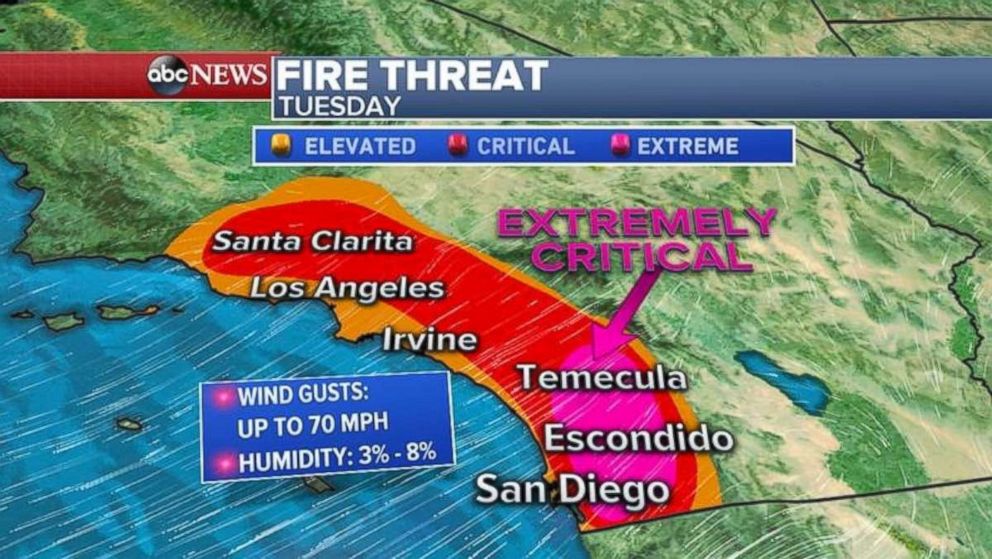
The fire risk in Southern California today is the highest NOAA issues.
As firefighters continue battling blazes in California that have claimed at least 44 lives, conditions in Southern California have worsened.
In San Diego County, the fire risk today is extremely critical, the highest level issued by the National Oceanic and Atmospheric Administration.
"Vary rapid fire growth, extreme fire behavior is expected," according to a report by the National Weather Service. "Explosive fire growth is possible with any fire starts."
Wind gusts in and around San Diego topped 80 mph last night, as a strong Santa Ana Wind event is underway in Southern California that will continue into tomorrow. A high-wind warning continues today in Los Angeles and San Diego counties, with gusts from 40 to 60 mph -- in some places as high as 70 mph.
Relative humidity will remain dangerously low -- 3 percent to 8 percent -- meaning the red flag warning remains in effect.
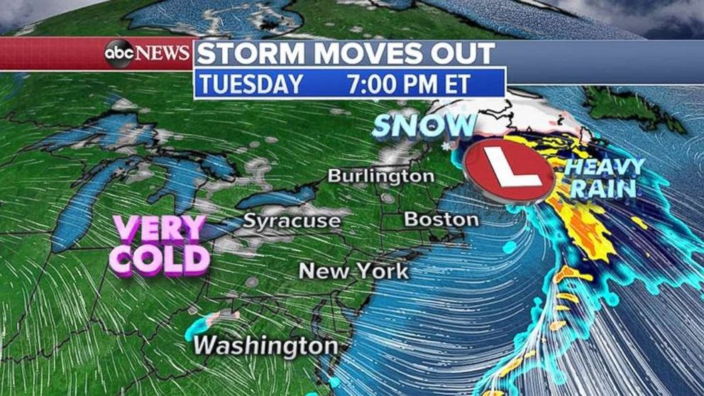
Elsewhere in the U.S., a storm system is moving through the East Coast, bringing severe weather, including snow farther inland. A tornado watch has been issued in North Carolina until later this morning.
That storm will shift into northern New England and leave the U.S. later today. Winter weather advisories are expected to continue as western Pennsylvania, New York and New England could see more than half a foot of snow.
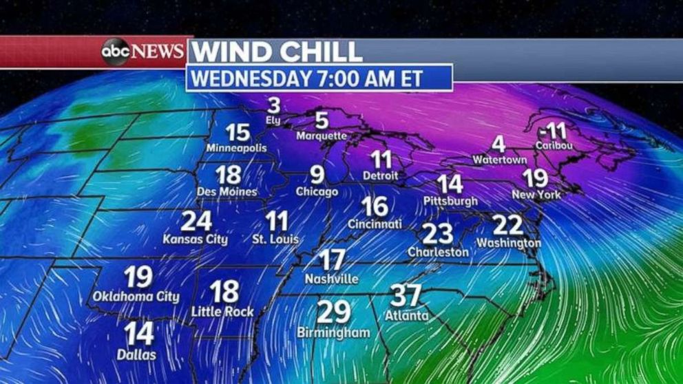
Following that storm system is a bitter Arctic blast that's taking aim at the Northeast, dropping Wednesday-morning wind chills into the single digits in some parts.
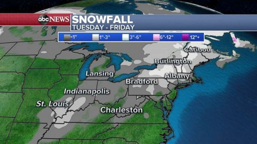
A new storm expected to form along the Gulf Coast on Wednesday also is expected to make an impact along the East Coast, with heavy rain and thunderstorms.
By Thursday afternoon or evening, that system will be moving into the mid-Atlantic, also delivering sleet and snow, which could continue into Friday morning.
Coastal flooding is possible from New Jersey to Maine.
Related Topics

Top Stories
ABC News Live