Elections Today
- Pennsylvania
Recent Projections
| State | Candidate | Delegates |
|---|---|---|
 Donald Trump | ||
Pennsylvania |  Joe Biden |
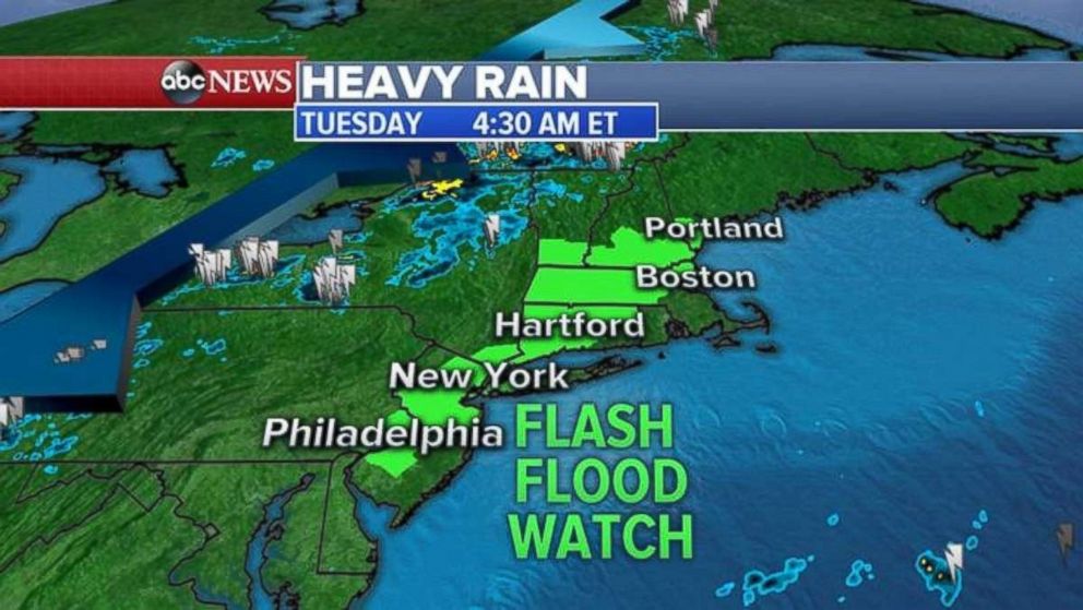
Heavy rain, severe storms move into Northeast
Thunderstorms will threaten the I-95 corridor Tuesday.
A cold front will move into the Interstate-95 corridor Tuesday afternoon with heavy rain and severe storms possible.
Because of the heavy rain and a threat of flash flooding, the National Weather Service has issued a flash flood watch from Philadelphia to New York City to Hartford, Connecticut; Boston and into Portland, Maine.
Storms lined up in western New York and Pennsylvania early Tuesday.
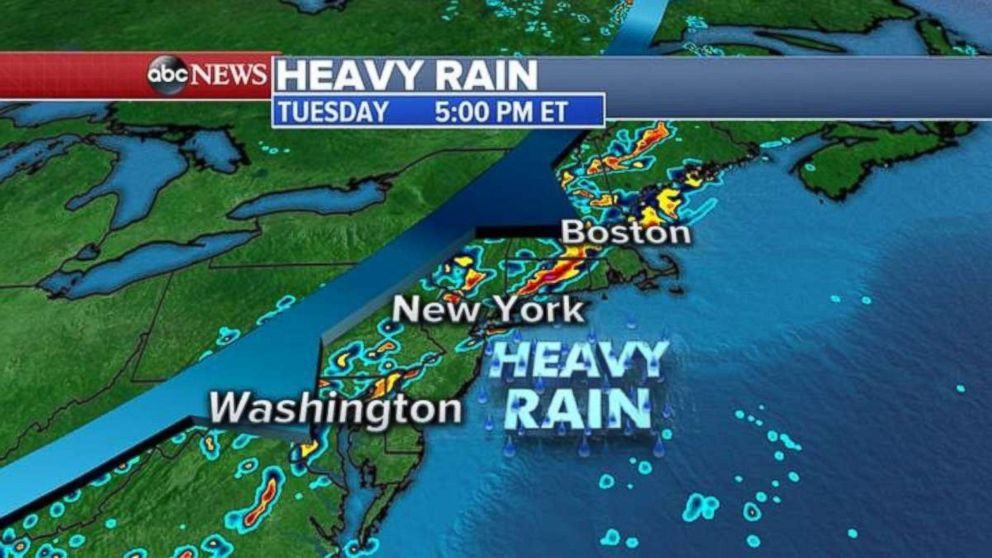
Just as the evening rush hour nears in the Northeast, strong to severe storms will develop with damaging winds, some large hail and even a rare chance for an isolated tornado in New England.
The futurecast model shows severe storms lined up right along I-95 at 5 p.m.
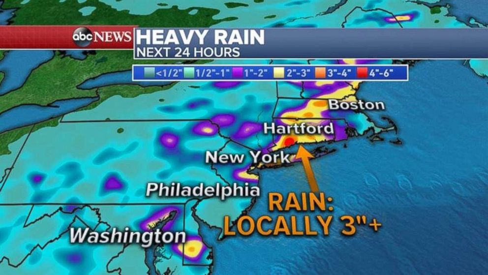
In addition to the damage possible from the severe weather Tuesday afternoon, some areas could see more than 3 inches of rain in just a few hours.
Related Topics

Related Stories
ABC News Live