Multiple rounds of severe weather expected in central US
The Great Plains will see heavy rain, hail and possibly tornadoes this week.
An active jet stream is setting up an active storm pattern that will move over the U.S. heartland and produce multiple days of severe weather starting Monday and continuing through Wednesday.
Ahead of the storm, gusty winds of more than 50 mph have enhanced wildfires from Arizona to Texas and Minnesota.
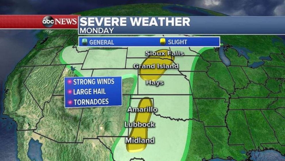
The first storm system riding that jet stream will bring a swath of severe weather on Monday from the Dakotas to western Texas. The biggest threat with today's storms will be damaging winds and hail and there is a slight chance for a few tornadoes.
The good news today is the worst of the storms will be in the open Plains for the most part where few people live.
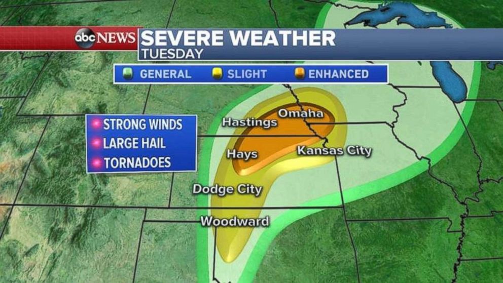
On Tuesday, the severe weather threat will ramp up with an enhanced risk issued for cities, including Omaha, Nebraska. The biggest threat will be damaging winds, hail and a few tornadoes. The tornado threat will be slightly higher on Tuesday.
Populated areas, including Omaha and parts of Kansas City, will be impacted.
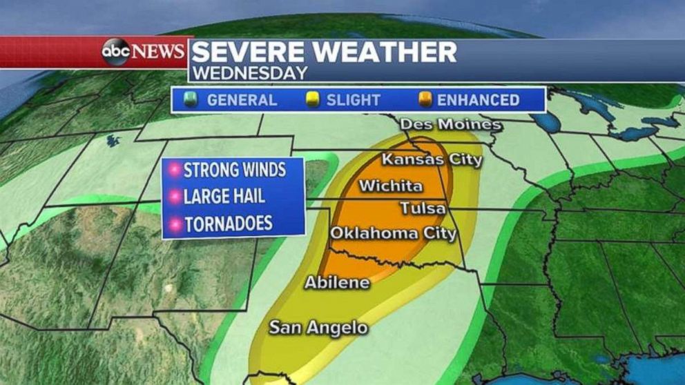
An even stronger storm system will ride the jet stream from the west into the Plains on Wednesday, bringing an even higher threat for tornadoes, damaging winds and hail to populated areas, such as Abilene, Texas; Oklahoma City; Wichita, Kansas; Kansas City, Missouri; and as far north as Des Moines, Iowa.
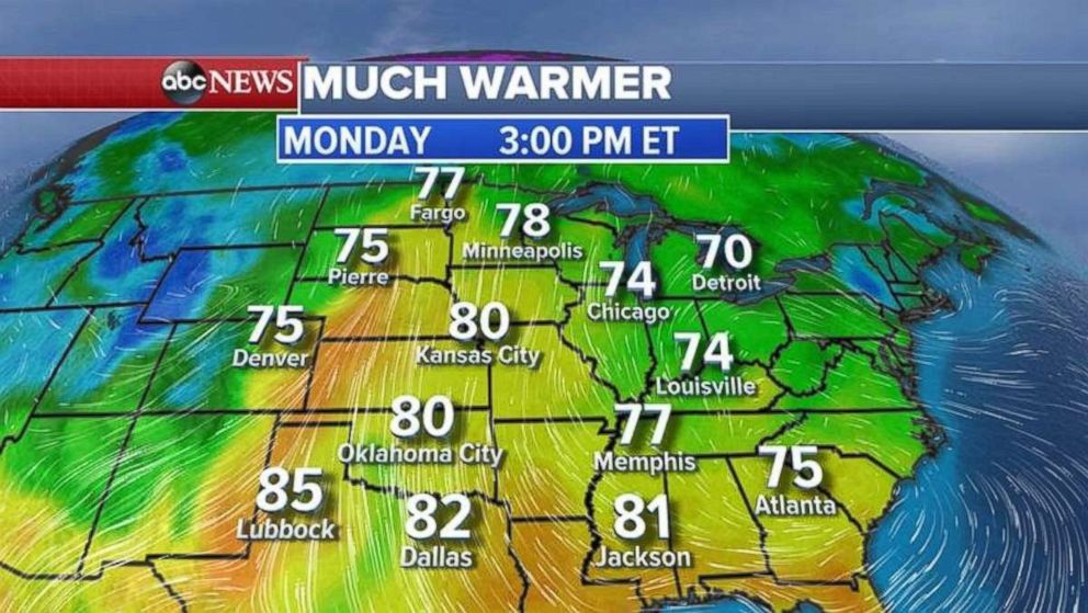
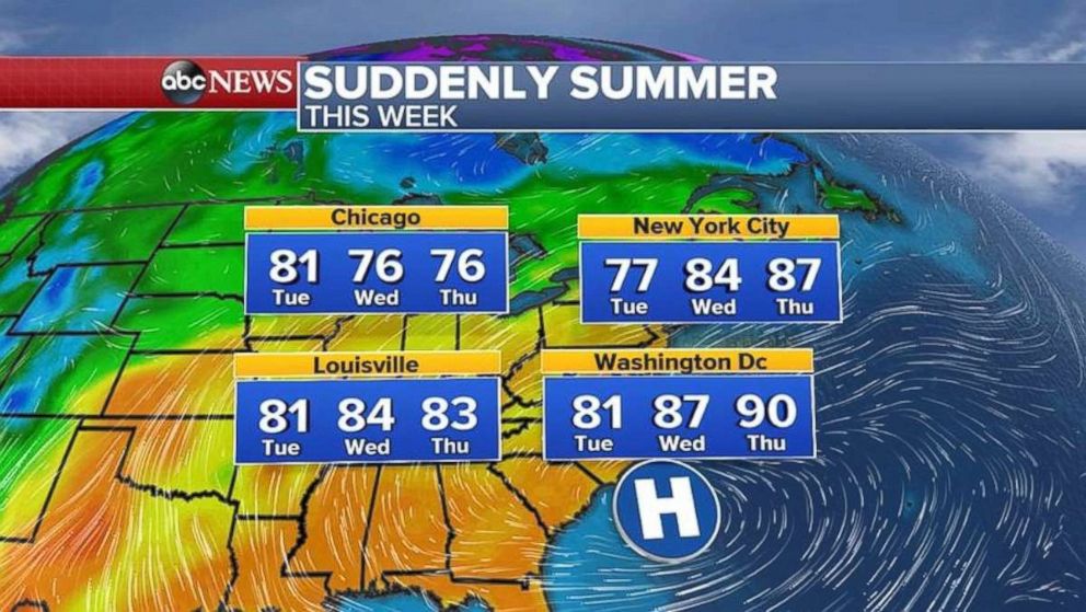
Ahead of the severe weather it will suddenly feel like summer for the Midwest and Northeast.
Related Stories
Temperatures on Monday will be up to 20 degrees above normal for the Upper Midwest and Plains with temperatures near 80 degrees possible in Minneapolis. The area had snow just a few weeks ago and the lakes are still frozen.
The unseasonably warm air will move into the Northeast and the East Coast on Wednesday, Thursday and Friday with some areas from Washington, D.C. to Boston reaching 90 degrees.
Record highs are possible in the Northeast by the end of the week. Better get that air conditioner installed.
Related Topics

Related Stories
ABC News Live