Northeast, Midwest hit by blast of cold air as Great Lakes region braces for heavy snow
Part of the Great Lakes region are bracing for up to 18 inches of snow.

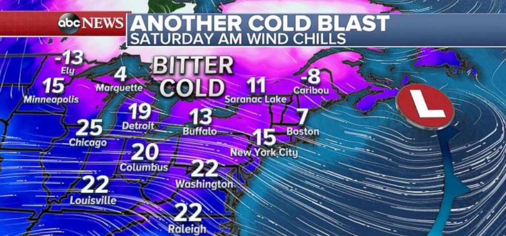
— -- Residents of the Midwest and Northeast will wake-up Saturday morning to a bone-chilling blast of cold air, with a wind chill that will make it feel like the temperature is in the teens and single digits.
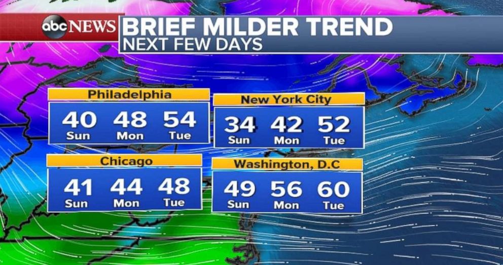
The good news? It won't last too long, with milder temperatures kicking in later Saturday and continuing over the next few days.
The Northeast was slammed with a quick-hitting winter storm Friday night to areas along the I-95 corridor.
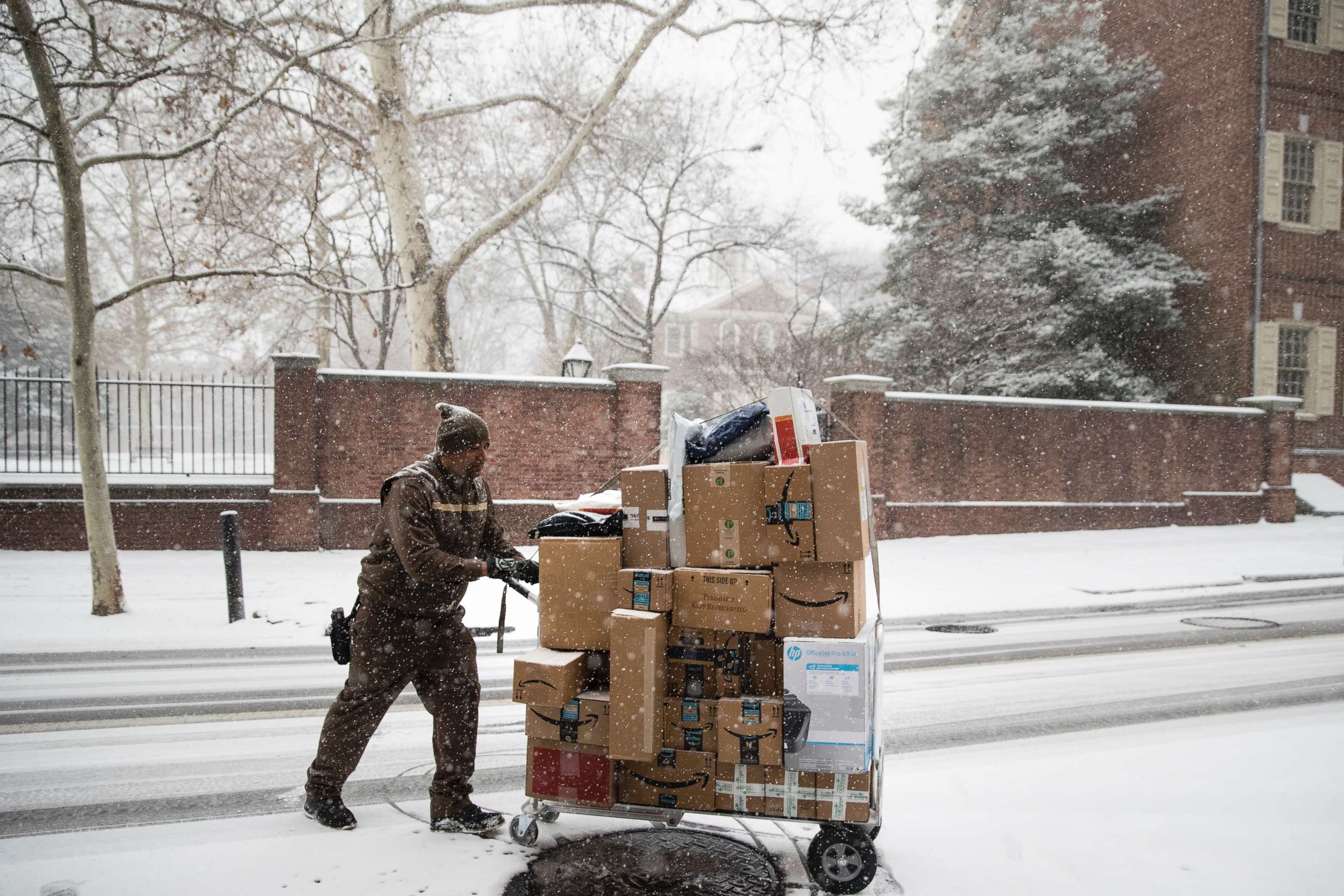
While the snow amounts were not particularly heavy, the timing of the heaviest snow bands caused a traffic nightmare for the Philadelphia and New York metro areas. Road crews attempted to keep the roads clear but traffic and cold conditions hampered their efforts. The combination of snow and a traffic light outage in Philadelphia brought chaos to Center City, with traffic at a near-standstill Friday night.
Meanwhile, heavy bands of lake-effect snow brought near whiteout conditions to parts of northwest Pennsylvania and upstate New York Friday night. Looking ahead, lake-effect snow is expected to continue through Saturday.
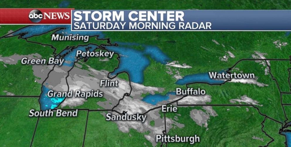
On Saturday morning, a band of heavy snow was moving through parts of Michigan and Ohio. Locally, over four inches of snow will be possible in the Grand Rapids, Michigan, region Saturday morning. And more lake-effect snow will develop later Saturday.
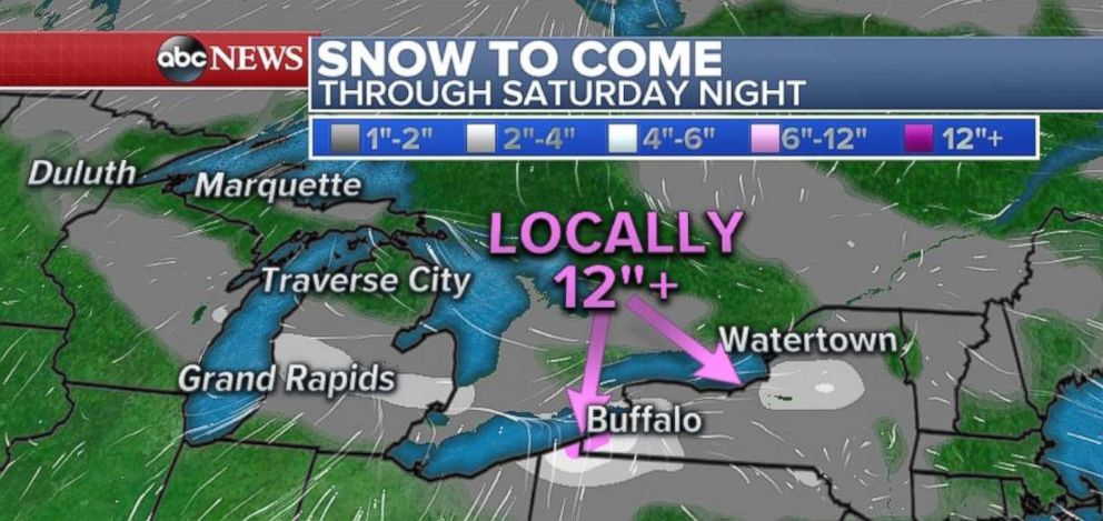
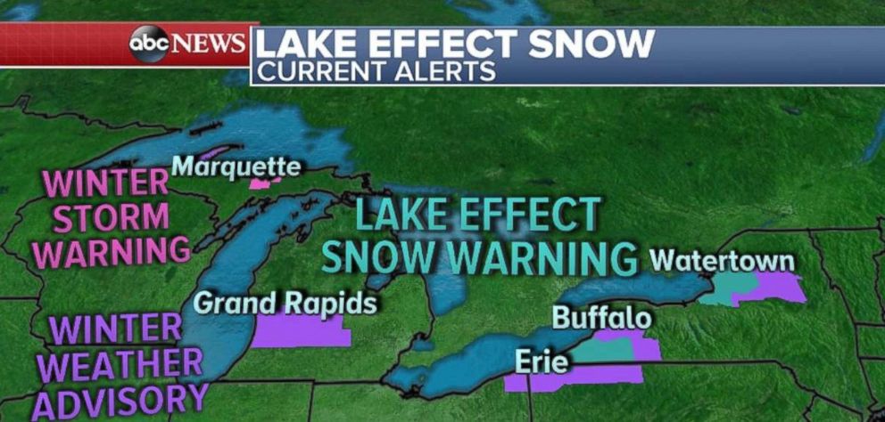
Lake-effect snow warnings and winter weather advisories have been posted for parts of Michigan, northeast Ohio, northwest Pennsylvania and upstate New York. Total snow accumulations are expected to be as high as 18 inches in the heaviest snow bands, which will be near the New York-Pennsylvania border. Winds in these heavy snow bands could gust as high as 35 mph.
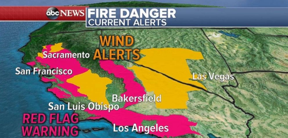
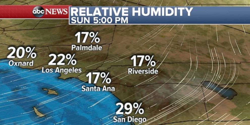
Over on the West Coast, the weather will not help the effort to contain wildfires in Southern California. Extreme fire danger is expected through the weekend for much of Southern California, especially in the mountains of Santa Barbara, Los Angeles and Ventura counties. Humidity could be as low as 5 percent in spots, with wind gusts over 50 mph possible. Elsewhere in California, much of the state is seeing critical fire danger with wind gusts over 30 mph and relative humidity as low as 5 percent. This includes the mountains and valleys outside of San Francisco.
Now, looking ahead to Christmas, which is a little over a week away, so general large-scale weather patterns can be forecast now. While the beginning of the week will offer some seasonably mild temperatures in the central and eastern U.S., it does not appear that this trend will continue toward the upcoming holiday weekend.
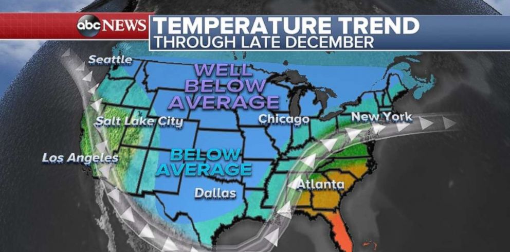
In fact, unsettled weather late this week will occur, as cold air will spill down from Canada once again. The 8-14 day temperature outlook indicates widespread below-average temperatures across much of the continental U.S., with well-below average temperatures likely in the north-central U.S. This type of pattern will also bring a favorable track for more storms that could potentially bring unsettled weather during the busy travel period.
So, bundle up and travel safely!
Related Topics
