Severe weather bears down on Midwest, Northeast
Almost 15 inches of rain fell in parts of Texas and Oklahoma over the weekend.
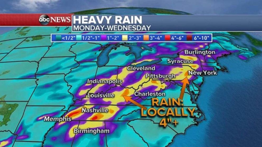
Flash flood watches are in place for five states in the Midwest on Monday as the work week is set to get off to a rainy start. Those heavy showers and a possibility for severe storms will move into the Northeast by midweek.
Almost 15 inches of rain fell in northwestern Texas and into southern Oklahoma over the weekend, causing flash flooding and washing out roads. Overnight, 4 to 6 inches of rain fell in Tennessee and Kentucky and caused flash flooding there.
Flash flood watches are in place for parts of Tennessee, Kentucky, West Virginia, Indiana and Ohio on Monday morning.
More heavy rainfall is forecast from the South into the Northeast and flash flooding is likely through Wednesday.
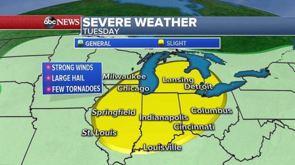
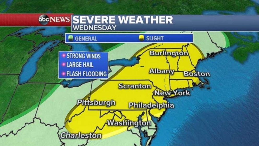
In addition to flash flooding, a new cold front is moving into the Midwest -- and eventually into the Northeast -- bringing severe weather with it.
Severe weather is expected Tuesday from Illinois into Michigan and Ohio. Damaging winds, hail and a few tornadoes are possible.
The cold front will move into the Northeast by Wednesday and threaten Boston, New York City, Philadelphia and Washington, D.C., with damaging winds, some hail and the possibility of an isolated tornado.
Related Topics
