Snow bears down on Northeast; record warmth to follow
Temperatures will warm up in the East once the snow pushes through.
— -- A pair of disturbances taking shape in the south-central U.S. will come together during the day Saturday and accelerate toward the Northeast bringing a quick hit of snow to major I-95 cities from Philadelphia to Boston.
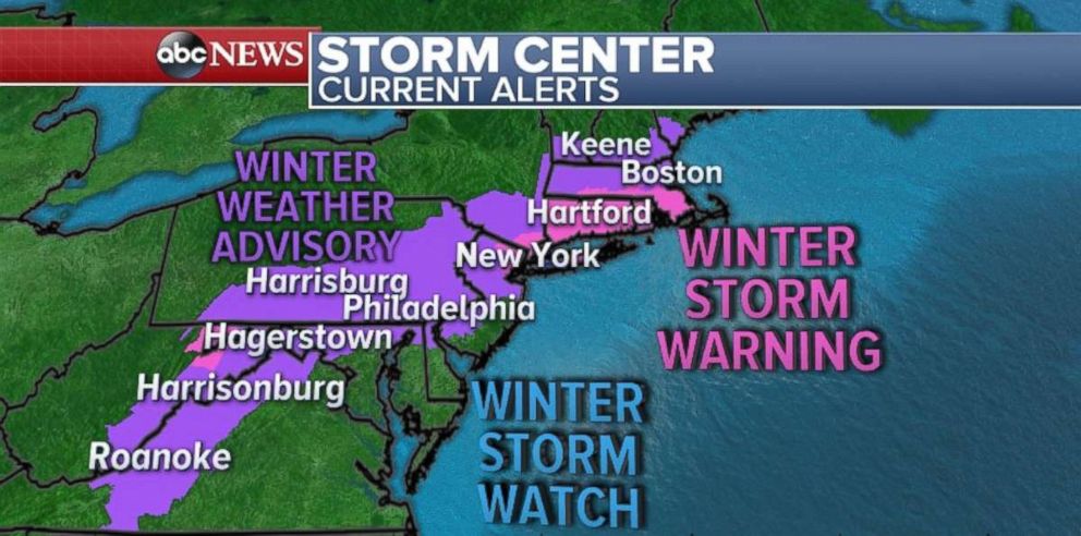
Winter storm warnings have been issued for parts of New Jersey through southern Massachusetts, including Manhattan and the Bronx. Coastal areas, such as Staten Island, Brooklyn, parts of Queens, Long Island and Cape Cod have a winter storm watch due to the uncertainty of how much warm air will inhibit snowfall accumulation.
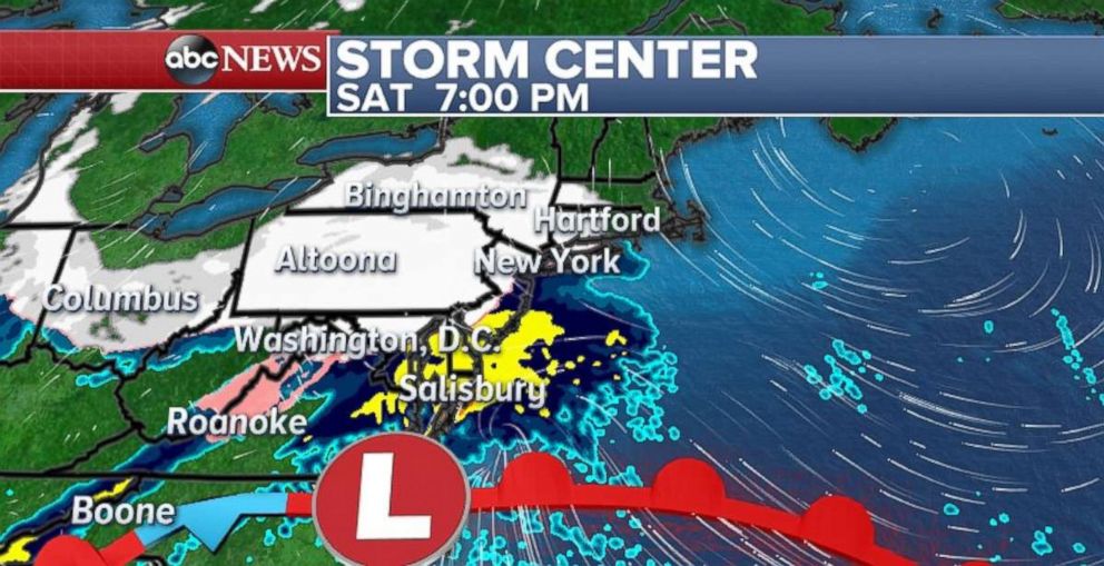
The storm begins to take shape later Saturday with snow arriving into parts of the Northeast in the early evening hours. The Rapid Precision Mesoscale (RPM) forecast model is currently showing snow falling in Philadelphia and New York City as early as 5 to 7 p.m. The storm is moving quickly though, with only about six to 10 hours of accumulating snowfall expected.
Right now, the highest uncertainty is along the coast from New Jersey to Massachusetts. The storm is currently forecast to track close to shore and keep those areas too warm to see rapidly accumulating snow.
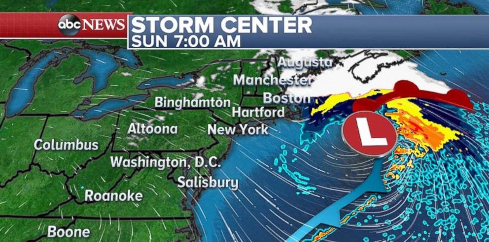
By sunrise on Sunday, the storm is already moving offshore, with only a few snow showers remaining in parts of New England.
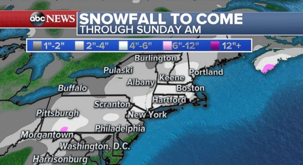
The current snowfall forecast for much of the I-95 corridor area from Philadelphia to Boston is generally 2 to 5 inches of snow. North and west of the major cities have the best chance for the exceeding and meeting the higher end of that snowfall range. Areas southeast of the major cities will see the lower end of that range.
Ultimately, the snowfall accumulation will be determined by the exact track of the storm, relatively warm ground temperatures and near-freezing temperatures. If the storm nudges just a little closer to the coast than the present forecast, the snow will not accumulate in the I-95 corridor. If the storm nudges just a little south and east, the heftier snows could accumulate in New York City, as well as many coastal regions.
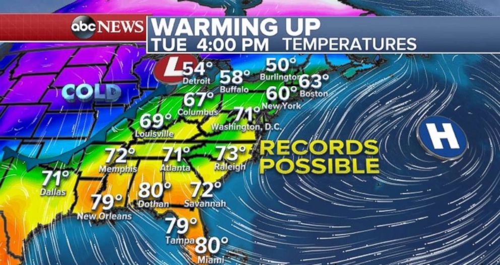
Warm weather on the way
Whatever snow does fall will not be sticking around. Temperatures are going to quickly warm up this week across the eastern U.S.
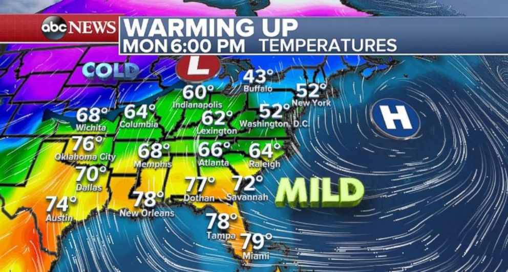
On Tuesday, daily records are possible across much of the eastern U.S. with many locations all the way into the mid-Atlantic reaching 70 degrees or higher.
Northwest also seeing snow
A potent winter storm is also currently heading into the Northwest. It will bring heavy rain along the Northwest coast, and heavy snow to the hills and mountains of the northwest and northern Rockies.
In Washington, winds up to 50 mph or higher are expected Saturday. Heavy mountain snow, including the mountain passes in the Cascades, are expected through Sunday. Totals will range up to 3 feet in some parts of Washington by Sunday afternoon.
The storm will bring a swath of snow to the northern Rockies. Blizzard like conditions are expected in parts of Idaho and Monday by Saturday night and Sunday.
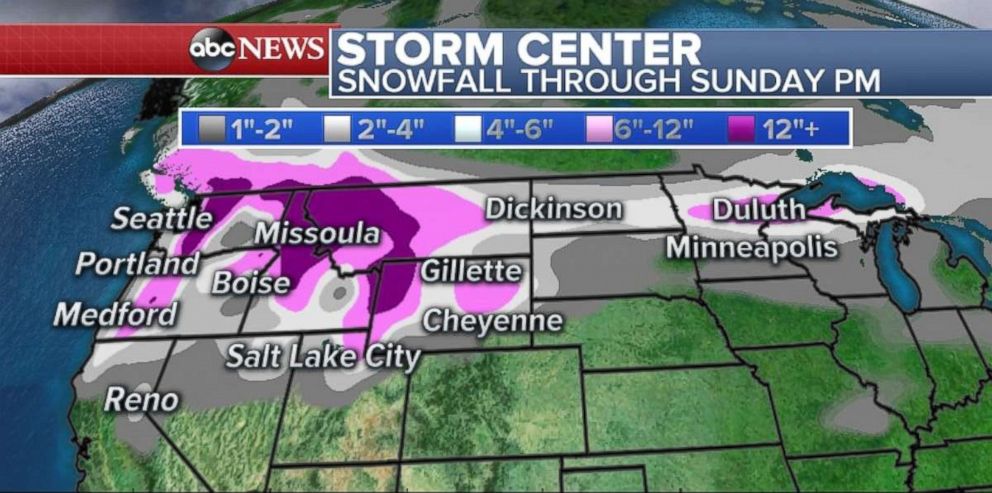
Some of the snow also will break off and head toward the Northern Plains, including Rapid City, South Dakota, and Duluth, Minnesota. The potential for snow will bring potentially dangerous travel on Sunday from Wyoming to Minnesota.
Related Topics

Related Stories
ABC News Live