Soggy weather continues with flash flooding possible from Colorado to East Coast
Rain continues to fall across much of the eastern half of the country.
Heavy rain fell across much of the country on Friday, but relief will not come this weekend.
More than 7 inches of rain fell in just a few hours across parts of western North Carolina yesterday, stranding motorists, prompting water rescues and several mudslides in the area. New Orleans saw 4.5 inches of rain in just an hour, flooding city streets. Even Boulder, Colorado, saw 2 inches of rain in a short period of time, and resulting flash flooding.
Two areas of low pressure with a frontal boundary stretch from the Plains into the mid-Atlantic on Saturday morning.
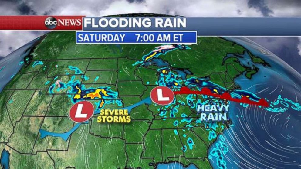
Heavy rain continues from New Jersey to the Carolinas while severe storms are expected in the Plains today.
Flood watches and flash flood warnings stretch from southern New Jersey to South Carolina.
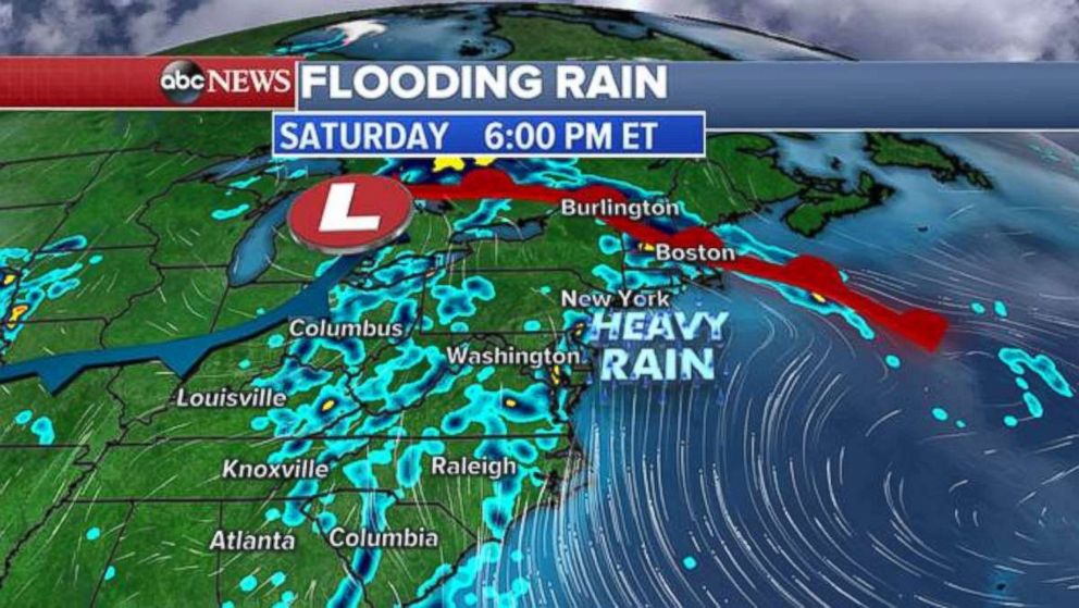
A low pressure system and a warm front will continue to move north throughout the day Saturday bringing heavy rain to the Northeast and New England.
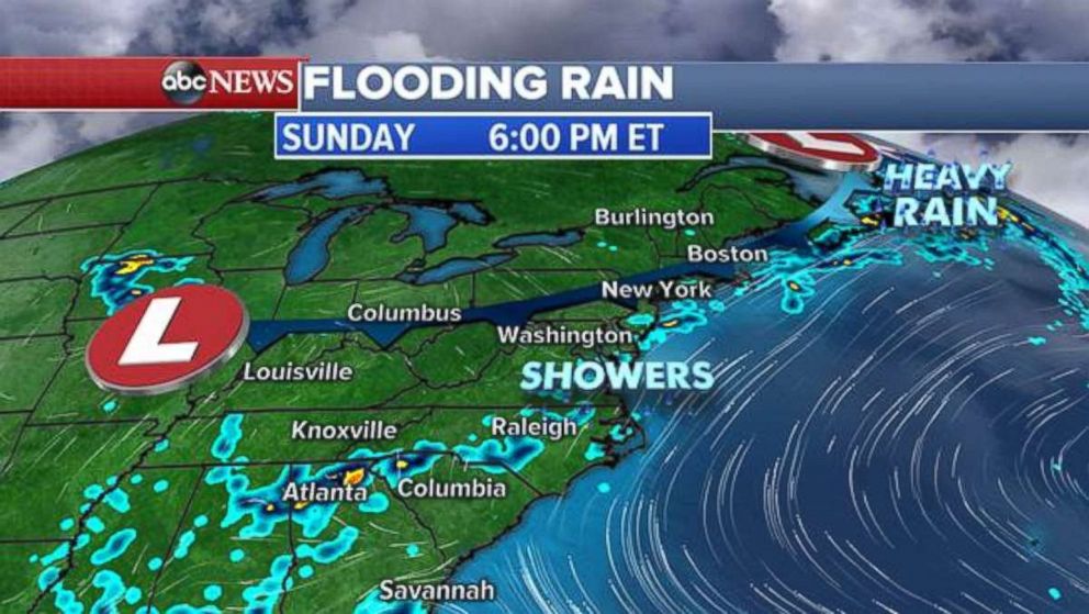
Heavy, flooding rain should be over by Saturday night as just a few showers are expected for Sunday along the East Coast.
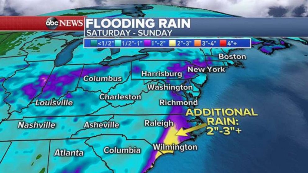
Through the next 24 to 48 hours, an additional 1 to 2 inches of rain is forecast for the East Coast. The heaviest rain will fall in the eastern Carolinas, where locally up to 2 to 3 inches are possible.
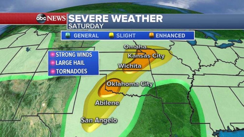
Severe weather moves East
There were five reports of tornadoes yesterday in Kansas with nearly 70 damaging storm reports mostly in the Plains.
Today, as the storm system moves east, the severe weather threat will move into more-populated areas from Iowa to Texas, including Omaha, Nebaska; Kansas City, Missouri; Wichita, Kansas; Oklahoma City; Abilene, Texas; and San Angelo, Texas.
The biggest threat today with these storms will be damaging winds, hail and a few tornadoes. Flash flooding is also possible with the slow-moving thunderstorms.
Related Topics
