Satellite Photo Shows Dramatic Scope of Devastating Mudslide
A striking satellite photo released by DigitalGlobe shows the geographic toll of the mudslide that hit Snohomish County, Wash., March 22, as rescuers continue to search the area for the 22 victims who remain missing.
The photo, above, highlights the mudslide area in Oso, Wash., where a mountainside soaked by rain crashed into neighboring communities, destroying houses and piling debris up to 75 feet high at its tallest point. Search-and-rescue workers have recovered the remains of 27 victims of the mudslide, using search dogs to find the bodies in cold and rainy weather weather conditions. Nineteen of the bodies have been identified and crews are working to identify the remaining victims.
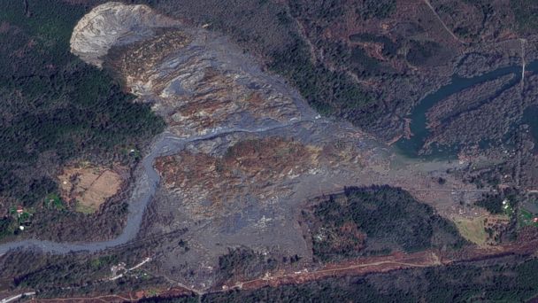
(Photo Credit: DigitalGlobe/Getty Images)
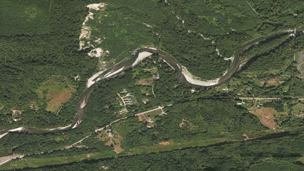
(Photo Creidt: DigitalGlobe/Getty Images)
The cliff face that was left behind from the mudslide is 1,500 feet wide and 600 feet tall, according to a report by the Seattle Times. In a letter Monday to the Federal Emergency Management Administration, Washington Gov. Jay Inslee asked President Obama to declare the mudslide a "major disaster."