Antarctica: Pine Island Glacier Has Long New Crack
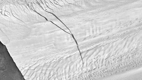
The Antarctic is so vast, so remote and so cold that it is hard to get a sense of scale when something unusual happens there. The crack in the Pine Island Glacier, seen in this satellite image, is about 19 miles long, and it is growing.
Pine Island Glacier, seen in radar image from the German TerraSAR-X satellite on Sept. 14, 2012. German Aerospace Center via NASA.
Scientists say the glacier, sliding toward the open water on the left in this image, will likely "calve" at some point, letting giant new icebergs float into the ocean southwest of the tip of South America. The crack - if that's the right word for something 800 feet across and 180 feet deep in places - was first reported by NASA's Operation IceBridge in February. The branch on the left side of the image is new. Here is how it looked in February:
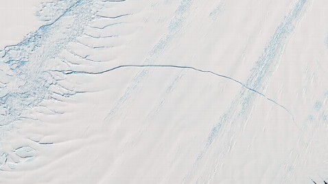
Pine Island Glacier in Antarctica, seen from NASA's Terra satellite. NASA/GSFC/METI/ERSDAC/JAROS; U.S./Japan ASTER Science Team.
"A lot of times when you're in science, you don't get to capture the big stories as they happen, because you're not there at the right place at the right time," said John Sonntag, Instrument Team Lead for Operation IceBridge, at the time, "but this time we were."
NASA scientists have been cautious about what all this means. NASA's Kelly Brunt said Pine Island is a big event, one that should not cause alarm but bears watching.
"Calving in Antarctica is generally very normal," she said in an email to ABC News. "However, given the extent of ice-front retreat and the sensitive location of this calving event, it warrants our continued monitoring of this ice/ocean system."
The time-lapse video of the glacier was compiled from satellite images shot since the rift appeared in February. NASA says that when it finally splits, the new iceberg could be the size of New York City.