Upper Midwest and central Plains bracing for heavy snow, Northeast thaws out
The Northeast will thaw out, with above average temperatures.
— -- A winter storm is beginning to intensify and snow is expected to expand into parts of the central and northern Plains on Sunday morning.
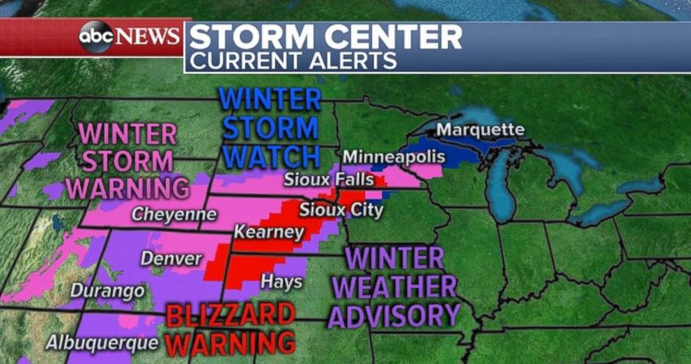
Another round of blizzard warnings were issued by the National Weather Service Sunday morning. The blizzard warnings now stretch from eastern Colorado to southern Minnesota, including a large portion of Nebraska.
This storm will track towards the upper Midwest over the next 48 hours, bringing a significant snowfall from eastern Colorado to Northern Wisconsin. This storm has already brought heavy snow to parts of the Rocky Mountains. Salt Lake City, for example, picked up over 8 inches of snow on Saturday causing treacherous travel on I-80 and I-15. Treacherous travel due to heavy blowing snow was also reported on I-80 in Wyoming.
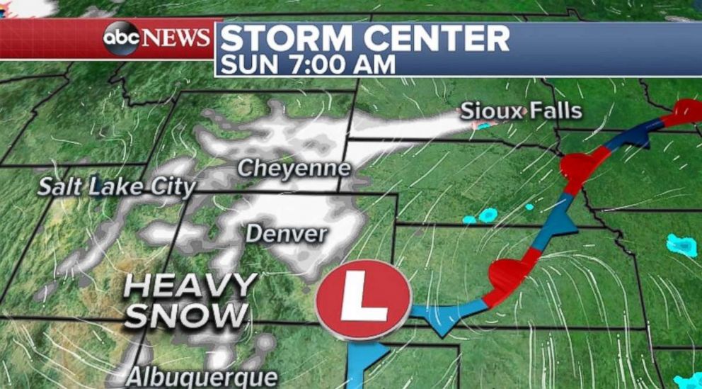
On Sunday morning the snow is falling in the Colorado Rockies and will be expanding into the metropolitan Denver area shortly. Conditions in Denver will deteriorate Sunday morning and further into the day. Locally 4 to 8 inches of snow is likely for the Denver area, with nearly a foot possible in the mountains and foothills. Flight delays and cancellations will be likely Sunday at Denver International Airport. Snow has also already expanded northward towards Cheyenne and the South Dakota-Nebraska border.
Conditions will deteriorate in Nebraska and Southern South Dakota Sunday, followed by southern Minnesota by Sunday evening. In addition to the snowfall, winds will be gusting locally over 30 mph as the storm intensifies Sunday night into Monday. Near blizzard conditions will be likely in this region during this time frame.
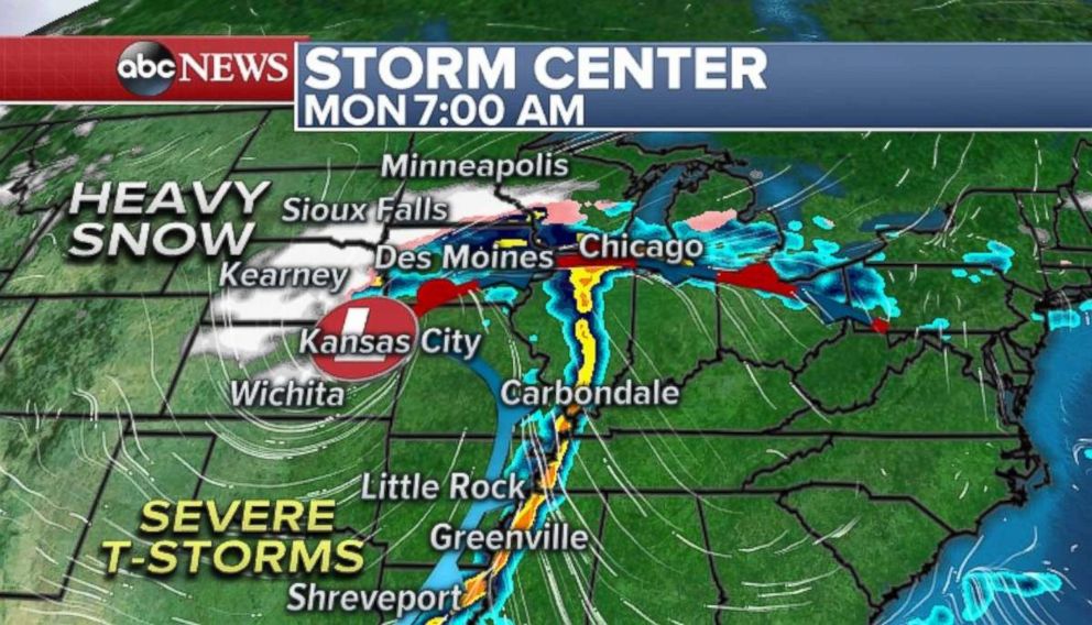
On Monday morning, heavy snow will be falling from Nebraska to Western Wisconsin. School cancellations, flight delays, and road closures will be likely in Sioux Falls, Sioux City, and Minneapolis.
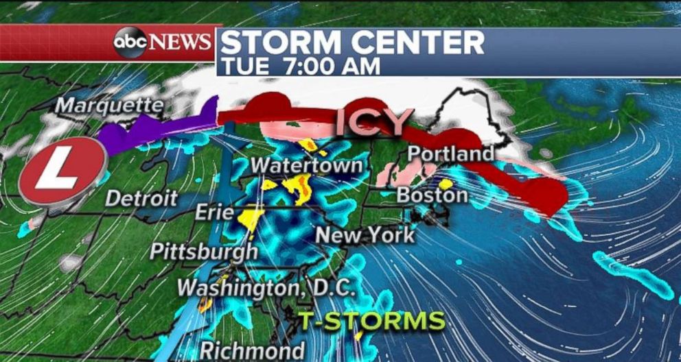
By Tuesday morning, the storm will move into the Great Lakes region and bring a heavy rain threat for the Northeast. The combination of heavy rain, mild temperatures, and existing ice jams could cause localized flooding.
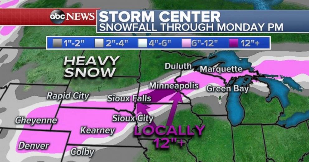
There remains some degree of uncertainty where the gradient of heaviest snow totals will be in Minnesota, Wisconsin and Michigan. The current forecast includes a narrow axis of locally over 12 inches of snow from near Sioux Falls, South Dakota, to the Southern suburbs of Minneapolis. There is a potential for this axis to expand eastward. Important to note that there will be a fairly sharp gradient from notable nuisance snowfall. The heaviest snow likely misses Rapid City just to the south as well as misses Des Moines just to the north.
In addition to the heavy snow, many locations will also see a little bit of freezing rain and drizzle ahead of the heavier snow.
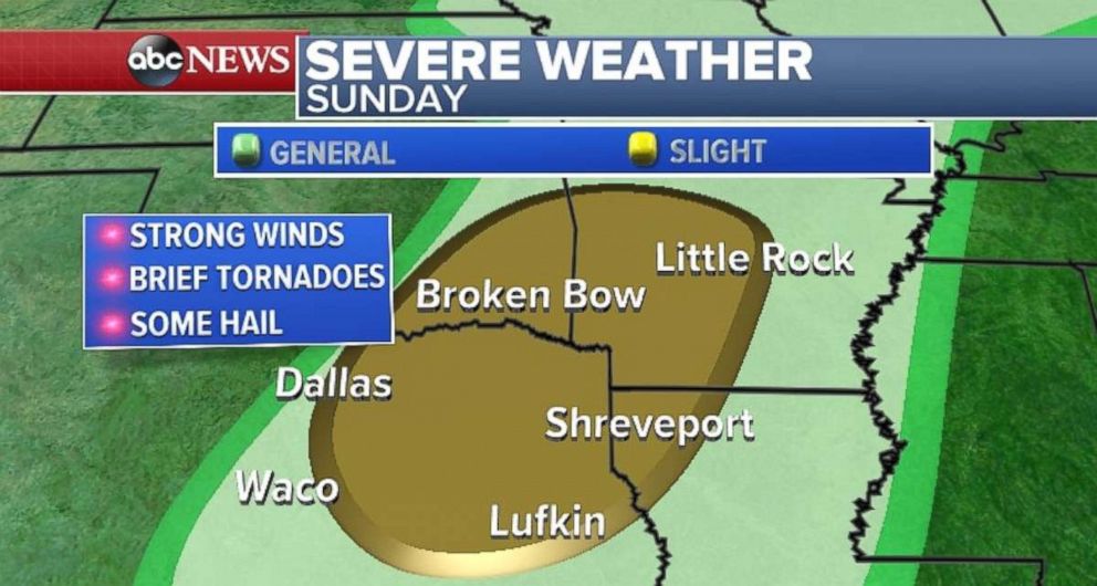
In addition the snowfall, a cold front swinging across the southern Plains and Mississippi Valley will bring the chance for severe weather. A slight risk for severe storms for parts of northeast Texas, southeast Oklahoma, southwest Arkansas and northwest Louisiana. This threat region includes Dallas and Little Rock. The main threat will be damaging winds, however brief tornadoes will be possible. The thunderstorms are expected to develop later Sunday evening near Waco to Dallas, and then move north and east during the overnight.
Sunday will be another day with above average temperatures for much of the eastern U.S. Temperatures in much of this region are forecast to be 10 to 20 degrees above average.
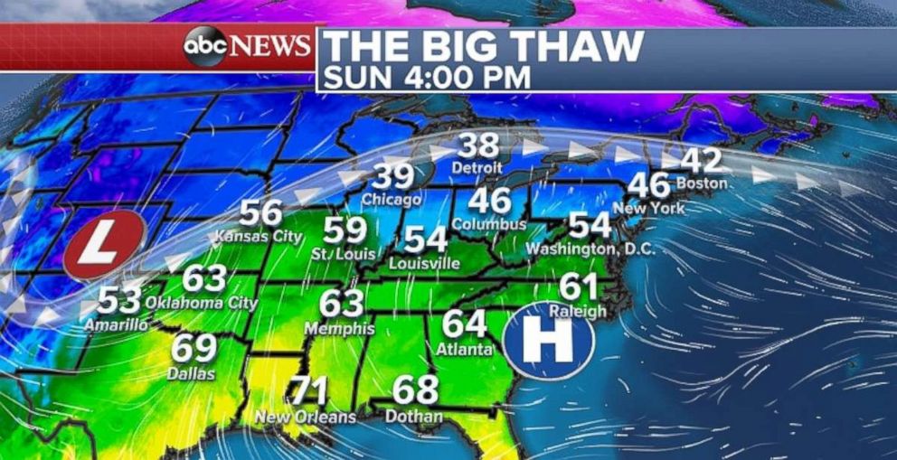
New York City, Boston and Washington, D.C. will all be 5 to 10 degrees above their average for the date. Across parts of the South, temperatures are 10 to 15 degrees above average.
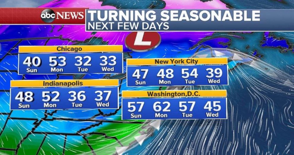
Like last weekend, with the milder temperatures, the threat for localized ice jams, and thin ice remain a concern across parts of the Northeast. As a storm approaches from the west, heavy rain will arrive in the Northeast on Tuesday, which could enhance the threat for localized flooding near area waterways affected by ice jams.
After the rain passes, it will turn more seasonable. The good news is, that the extended outlook shows another mild swing in temperatures next weekend.
Related Topics
