How Some Exercisers Are Using GPS to Create Art
See how Brett Lobree used his 52.9 mile ride to draw a turkey.
— -- Some people exercise for weight loss. Others train for marathons. Bret Lobree cycles so he can draw a really nice picture of a turkey.
Lobree is part of a growing group of exercisers who use their outdoor workouts to draw GPS images. After downloading a fitness app like RunKeeper, Nike+ or Strava Run, they turn on the global positioning system function of their smart device, then ride, run or walk through a route to trace an image or a word on a computerized map.
Lobree's best example of this ultimate form of street art is a 52.9-mile cycling journey he did before Thanksgiving this year to create a drawing of a turkey.
The 41-year-old mechanical engineer started by planning the route on a mapping website. Then he cycled to the start, turned on his GPS and rode through the intricate grid of San Francisco streets to sketch out a "Gobble Gobble Graffiti" drawing on his GPS screen.
"Ironically, I draw with GPS but I have to hold a paper map to help navigate," Lobree told ABC News.
This is his second year doing the cycled turkey art. Last year, four other riders joined him. This year, it was seven. He'd like to grow it into a yearly event, though he admits the effort "is not trivial."
Michael Oldenburg, a spokesman for Strava, said the navigation systems company noticed this budding phenomenon several years ago when the hash tags #stravaart, #rundraw and #figurerunning started popping up on social media. He said cyclists can usually do the most elaborate drawings because they can cover more mileage than walkers and runners.
"People all over the world are getting really creative with this," he said.
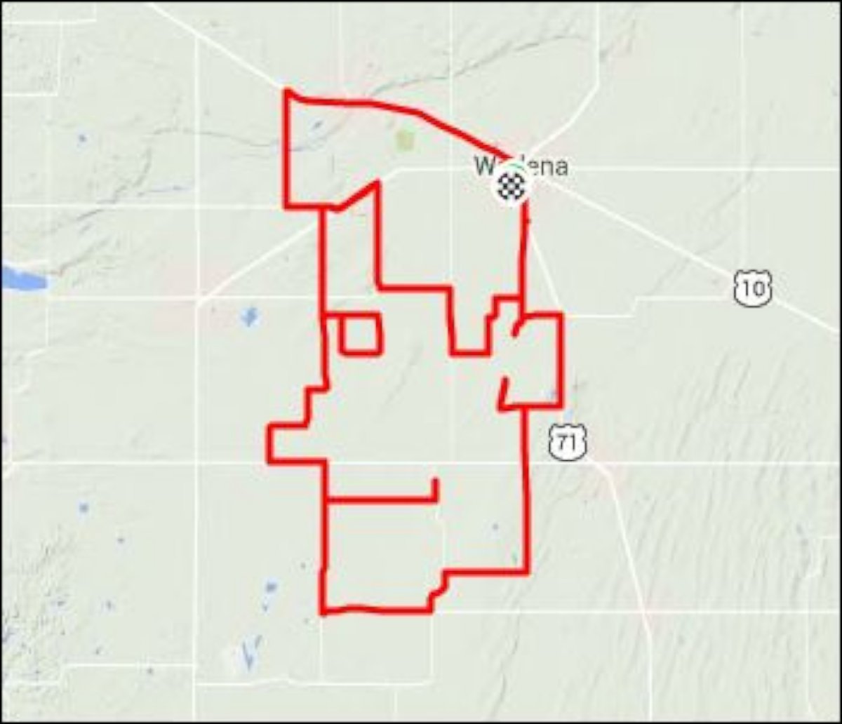
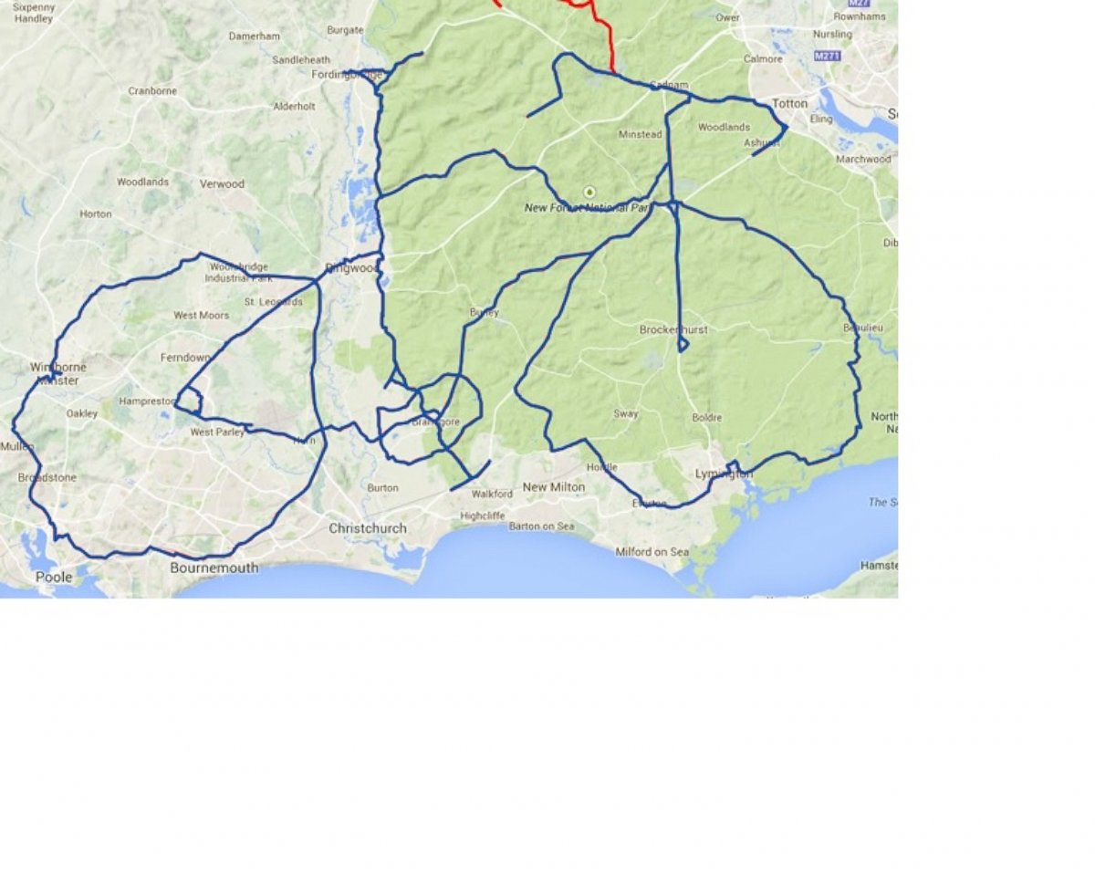
Like, for example, this 84.6 mile long self-portrait from the U.K.
Or this very dedicated cyclist who rode to 212 miles to trace out the instrument of his art.
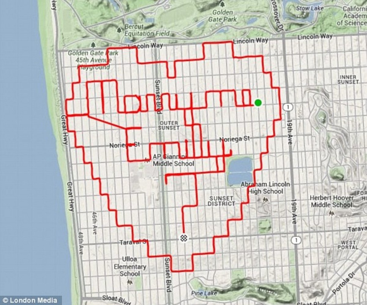
And this San Francisco cyclist who really went the distance by turning his GPS into a "Global Proposal System."
Lobree said he began his GPS drawing hobby several years ago after he'd ridden every single street in San Francisco. When he was done with that, he needed a new goal to stay motivated and noticed a few other people posting their GPS creations on Facebook. He decided to try it out for himself and was hooked right away.
Lobree said he's starting to see other exercisers out there holding maps and glancing down at their watches, including some runners.
"Why not?" he said. "It's a great way of showing people you can do things other than just ride from A to B to see your city."
