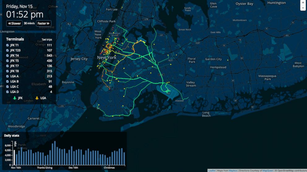
Cabbing It for the Holidays: Eerily Beautiful Animated Map Shows NYC Taxi Trips
An online map is providing insight into how busy cabs are during the holidays.

— -- Can't catch a cab in the rain? What about during the holiday season? A new data visualization map shows just how busy New York cabbies are this time of year, especially out of the city's two airports.
The map, based on data collected from the 2013 holiday season, illustrates the highs and lows in taxi rides in the form of yellow and green stripes that mark the routes and destinations that cabbies took between Nov. 15 and Dec. 31 from JFK and LaGuardia airports.
Check out the eerily beautiful map here.
The chart also features the number of rides from specific terminals, allowing people to see where most arrivals are coming from and providing insight into hotspot travel destinations. The map also features an option that allows a user to speed up and slow down the passage of time to see the average number of trips completed in a particular time frame.
The map was designed by Open Street Map Contributors, a site that distributes graphic information of various regions throughout the globe. The individual designer is unknown and could not be reached for comment.


