Elections Today
- Pennsylvania
Recent Projections
| State | Candidate | Delegates |
|---|---|---|
 Donald Trump | ||
Pennsylvania |  Joe Biden |
Nearly 40 million at risk of severe weather over weekend
The first round of storms stretches from Texas to Mississippi.
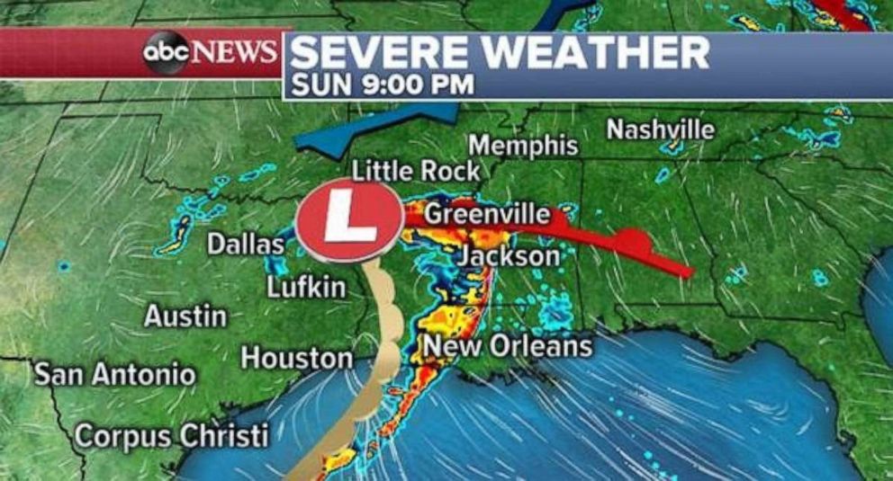
A new storm is beginning to organize along the Texas-New Mexico border, and it's expected to deliver a first round of severe weather today from Texas to Mississippi.
Gusts of almost 60 mph and golf ball-sized hail already have been reported in west Texas this morning.
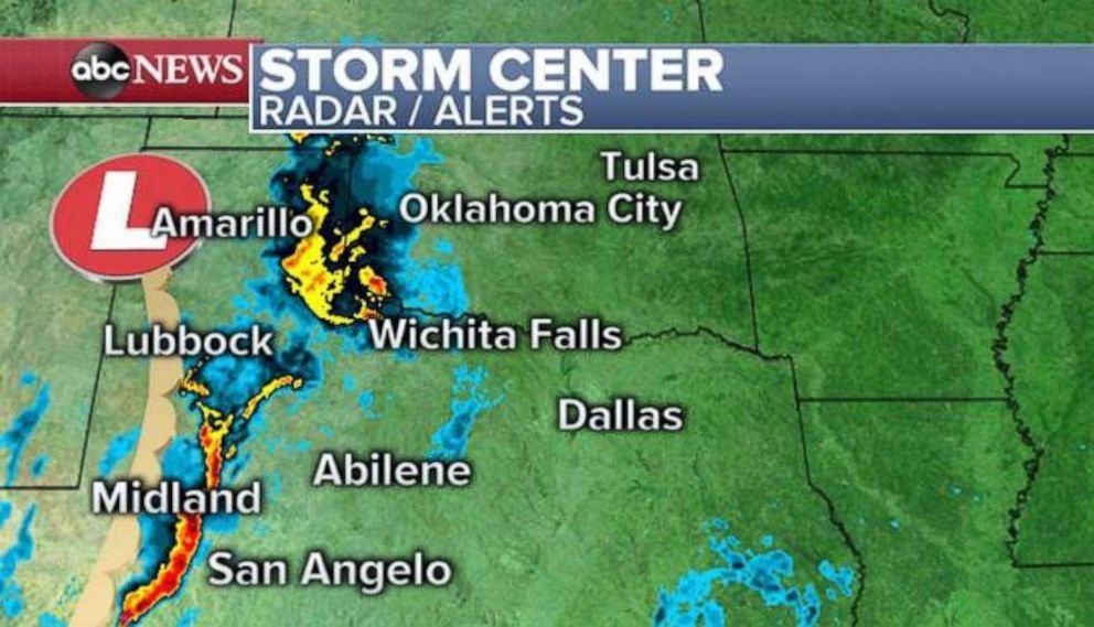
The system will head east across the southern Plains from San Antonio toward Dallas, with numerous severe storms predicted for later this afternoon.
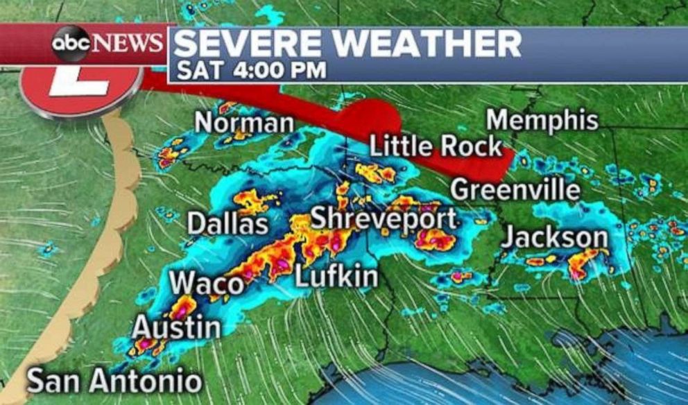
Weather models also are showing intense local storms in northwest Louisiana and southern Arkansas over that time period.
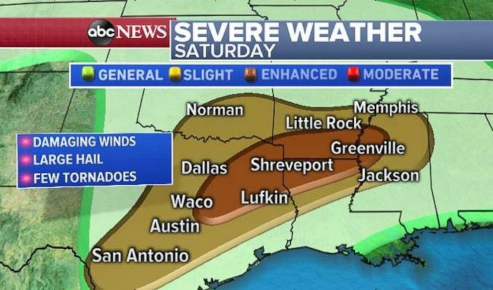
In an enhanced risk region, there's the greatest chance of damaging wind, large hail and tornadoes, as even outside that region, several storms will be developing from San Antonio all the way to Memphis. The main storm is expected to move north into the Midwest overnight.
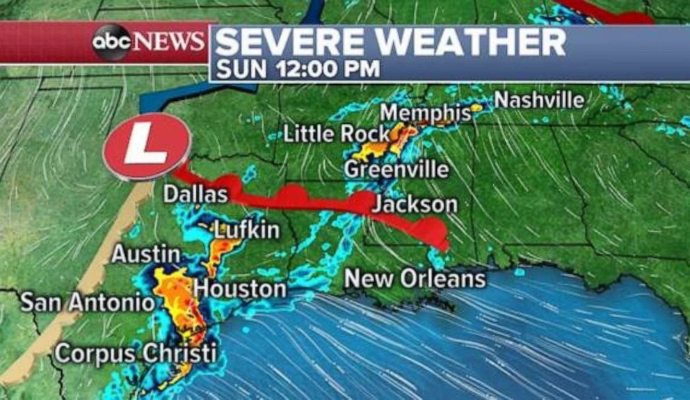
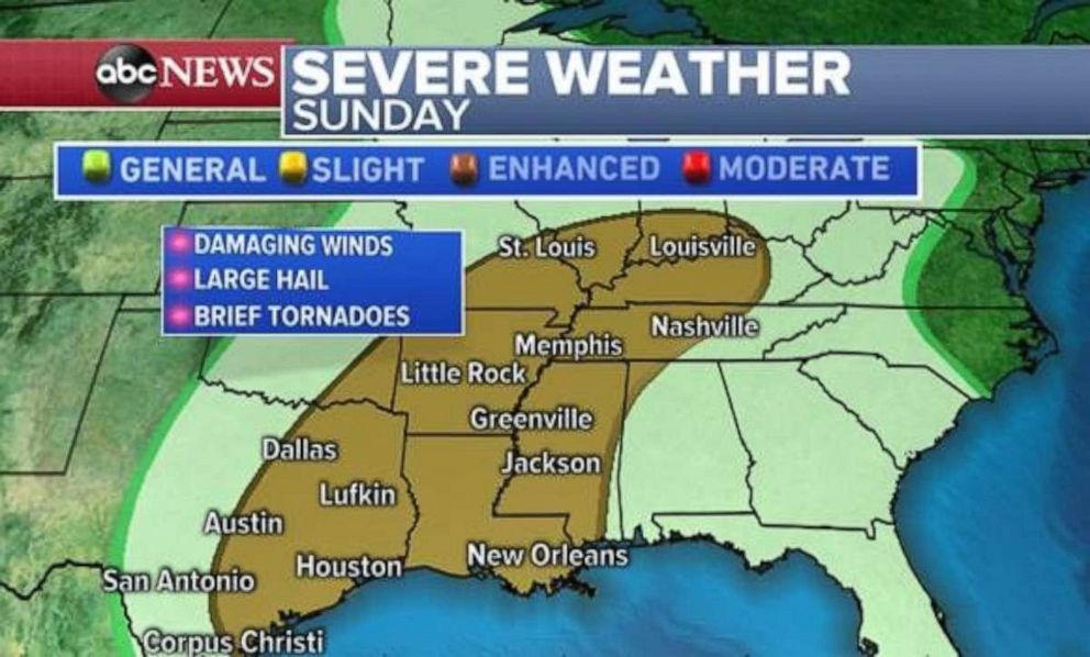
Tomorrow, another system is expected to develop, delivering a second ground of severe weather across that same area -- roughly San Antonio to New Orleans -- as severe scattered storms spread into the Mississippi and Ohio River valleys. A larger region at slight risk for severe weather on Sunday stretches from Texas to Kentucky and includes major cities such as Houston, Nashville and Louisville. The biggest risk, again, will be damaging wind, hail and potential tornadoes.
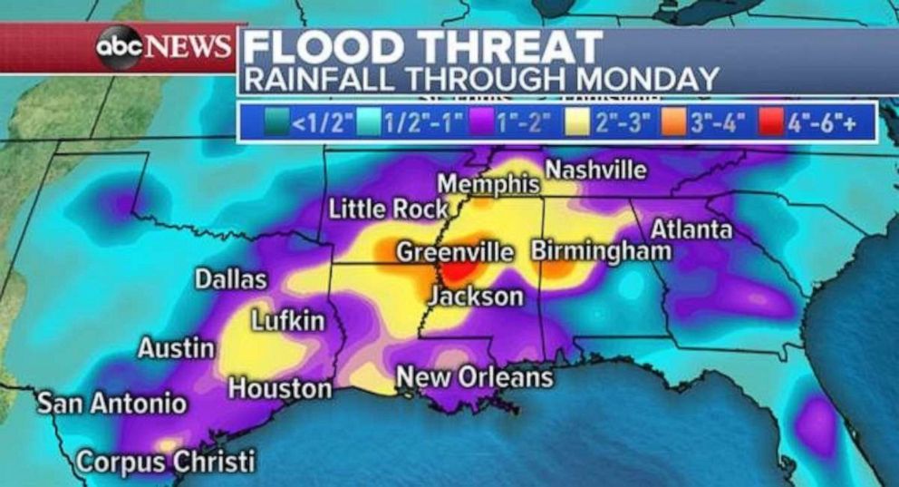
More than 4 inches of rain could be possible through Monday, especially along the Mississippi River Valley, where flash flooding from a massive or slow-moving storm remains be a concern. Fewer severe threats are expected on Monday.
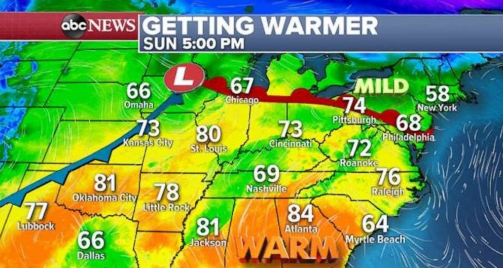
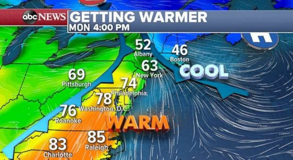
Following the storms across the U.S. should be temperatures 10 to 15 degrees above normal. Atlanta may see 84 as a high on Sunday, with St. Louis predicted to reach 80. That warm air will slide east and push north on Monday, probably increasing temps along the east coast to about 15 degrees above historical averages.
Cooler air over the Atlantic Ocean will begin pushing back to the west over New England on Monday, keeping parts of the region cool and cloudy and potentially with drastic temperature differences over just a few hundred miles.
Related Topics

Top Stories
ABC News Live