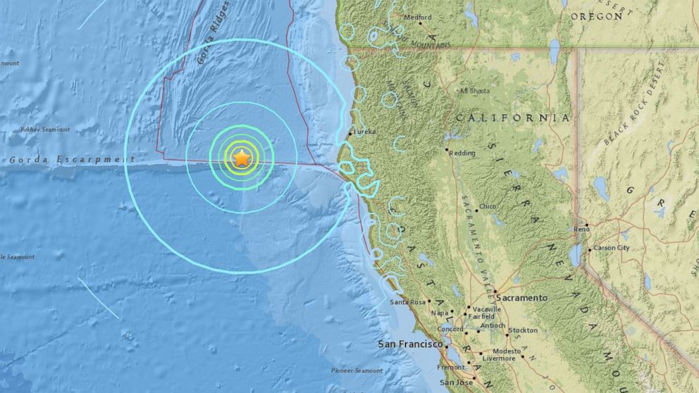
6.5 Magnitude Earthquake Recorded off the Coast of California
The quake's center was some 281 miles northwest of Sacramento.

— -- A 6.5 magnitude earthquake was recorded off the coast of Northern California this morning, according to the U.S. Geological Survey.
The USGS said the quake was about 6.2 miles in depth, with its center some 103 miles west of Ferndale and 281 miles northwest of Sacramento. The USGS initially reported the earthquake had a magnitude of 6.8.
The National Weather Service confirmed the earthquake and said there is no danger of a tsunami for Hawaii.
"Based on all available data, a destructive Pacific-wide tsunami is not expected, and there is no tsunami threat to Hawaii," the National Weather Service Pacific Tsunami Warning Center in Ewa Beach, Hawaii, said in a statement.
This is a breaking news story. Check back for updates.