Eastern storm moves offshore, second storm heads east
Alerts remain in place this morning across 8 northeastern states.
There were 9 reports of severe weather yesterday in northern Florida, including a confirmed EF-1 tornado in Elkton, Florida packing winds up to 110 mph.
This same storm system brought over 5 inches of rain to parts of coastal New England causing flooding in some areas.
Alerts remain in place this morning across 8 northeastern states as a storm system continues to push offshore.
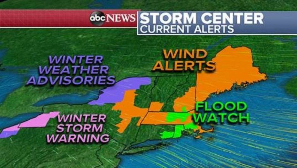
High winds will be a concern through the remainder of the weekend with gusts above 40 mph possible across New England.
Lake effect snow bands are impacting the typical lake effect snow regions of the eastern Great Lakes where accumulations may vary but are not likely to be significant through the remainder of Sunday.
By Sunday evening, conditions clear up, for the most part, across the Northeast as colder air is whisked into place by a strong northwest wind.
Most of the Northeast from the Great Lakes to Maine will see high wind gusts through Sunday causing a risk for downed trees and power lines following yesterday’s heavy rain, ice and snow. The wind should calm down overnight into Monday morning.
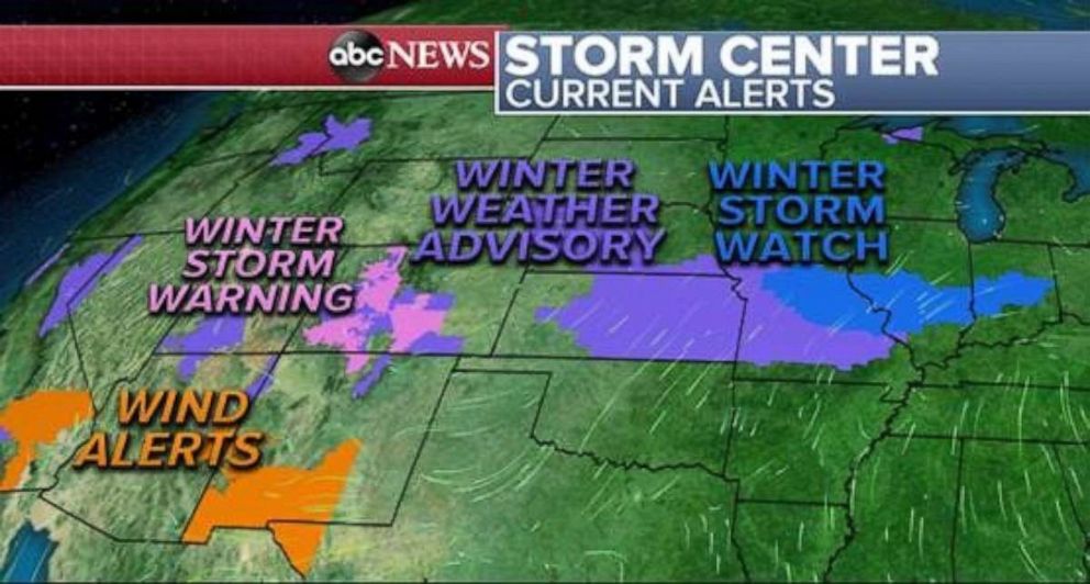
Several weather alerts are in place this morning from the plains to the West Coast with winter-related weather alerts in effect for 16 states.
Heavy mountain snow continues in the Colorado Rockies this morning and will do so through the rest of the weekend.
An additional 18 inches of snow is expected in some areas today with a high avalanche risk remaining through Sunday afternoon.
In total, including snowfall from the past few days, some areas of the Colorado Rockies will have received 1 to 3 feet of snow.
By Sunday night, this storm will move into the Tennessee and Ohio River Valleys, bringing another threat for wintry weather from Missouri to Virginia, with heavy rain impacting areas along the warm front.
By Monday morning, the system slows down a bit and a risk for severe storms sets up Monday afternoon in the Mississippi River Valley with strong storms, high winds, hail and even a few isolated tornadoes possible.
Further north, rain will move into the Mid-Atlantic states while a wintry mix sets up along an area stretching from southern Illinois into the New York City tri-state area.
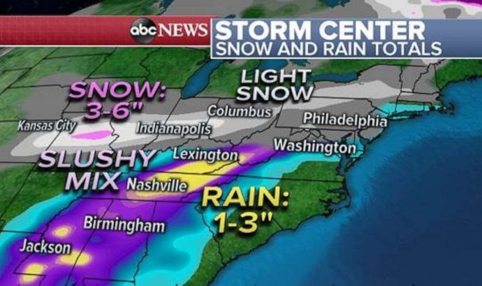
By Tuesday morning, 3 to 6 inches of snow is expected to have fallen in parts of the Midwest, while heavy rains may cause some flooding issues from Kentucky to the southern Gulf States.
As this next system passes through the Northeast early Monday through Tuesday afternoon, temperatures will be marginal across the highly populated areas of our major cities.
A slushy and icy mix can be expected between the I-95 and I-80 corridors with intermittent periods of snow and rain.
Ground surfaces are likely to be too warm to see any significant accumulations, however conditions will likely be unfavorable for travel but the storm should push offshore by Wednesday morning.
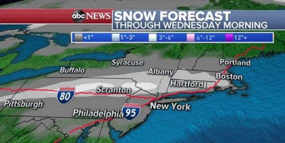
The main concern for accumulation of wintry precipitation will occur mainly west of the I-95 corridor through this storm.
Higher elevations in Pennsylvania and southern New York may see above 3 inches.
Related Topics
