Huge storm pounding West Coast as East sees warm-up
The storm created massive waves in Oregon on Thursday.
— -- A series of storms have lined up to bring rain, snow, wind and more waves to the West Coast over the weekend.
Waves of 20 to 40 feet pounded the Pacific Northwest coast from Washington to Oregon, producing flooding and damage to coastal cities. At least one man was swept to sea in Depoe Bay, Oregon, and presumed dead after the Coast Guard stopped a search for him late Thursday, ABC affiliate KATU reported.
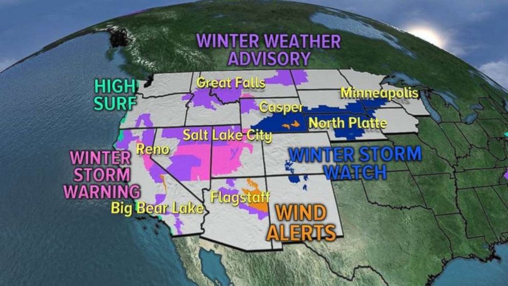
On Friday, 15 states were under winter storm watches, warnings and advisories for winter storm moving from the West Coast to the Plains and Midwest through the weekend.
Early this morning, the first two storms began to bring snow to the West, including the mountains outside of Los Angeles and San Diego, where several inches of snow could accumulate Friday.
The storm that brought coastal impacts to the Pacific Northwest Thursday is now moving inland, bringing snow to the mountains, including the Sierra and Rocky Mountains, where winter storm warnings are in effect from Friday night into Saturday.

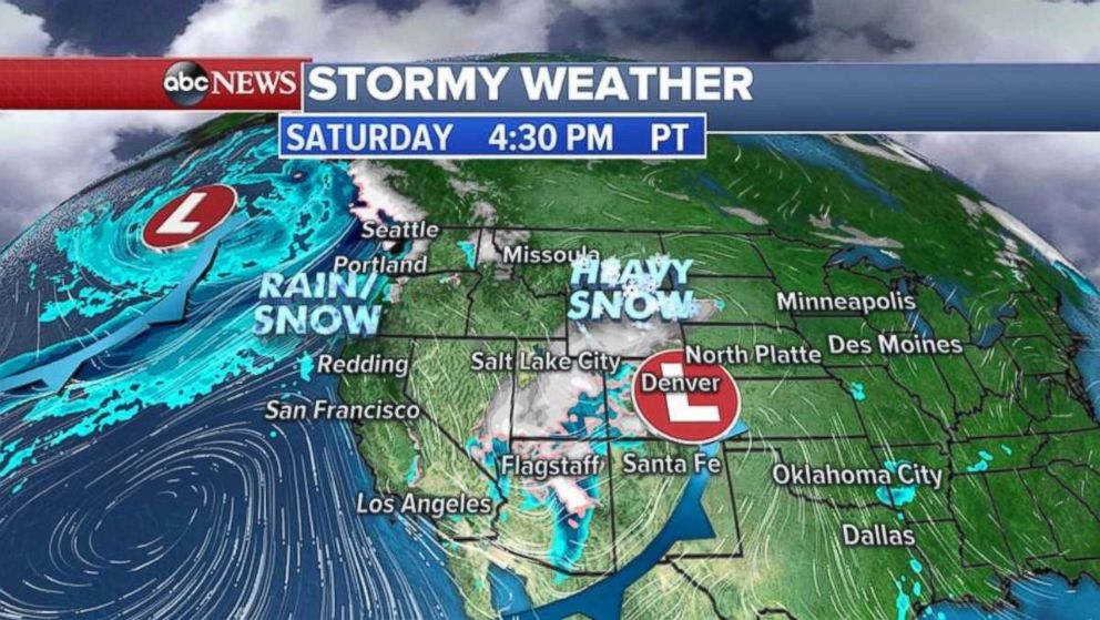
By Saturday, the storm system will be moving through the Rockies with heavy snow expected to add up to 1 to 2 feet locally. Snow will be falling in Salt Lake City and Denver as well.
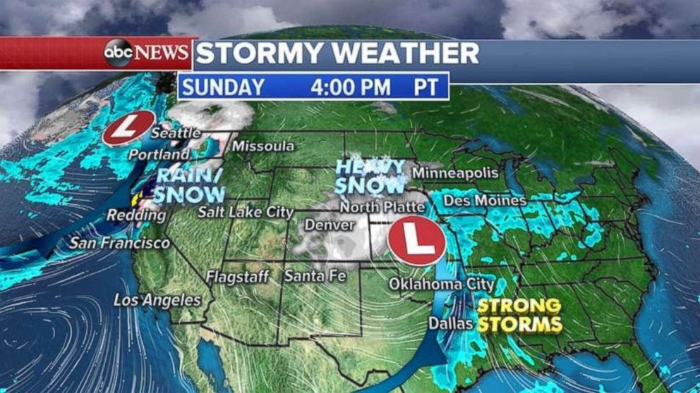
The storm system will move into the Great Plains by Sunday, strengthening and bringing a chance for heavy wet snow to the western Great Lakes and the Northern Plains, including the Twin Cities.
Heading south, thunderstorms are possible from Dallas to Oklahoma City. Some of the storms could be strong to severe with gusty winds and lightning.
At the same time, a new storm system will bring more rain, snow, high surf and wind to the Pacific Northwest beginning Sunday afternoon.
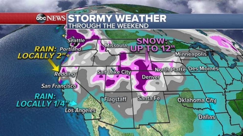
Some rain is expected today even in Southern California, around Montecito, Santa Barbara and Los Angeles, but most rainfall amounts will be less than one-quarter of an inch.
Snow will be measured in feet in the Sierra Nevada mountains and the Rockies, where up to 2 feet is possible.
Major warm-up in the East
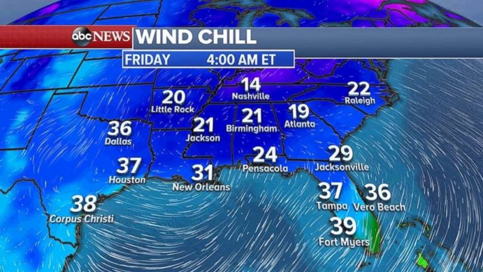
The final morning of freezing temperatures in Florida and the Gulf Coast comes Friday.
Wind chill readings are still relatively cold for the South this morning with 20s and 30s in Florida and the teens for Atlanta and Nashville, Tennessee.
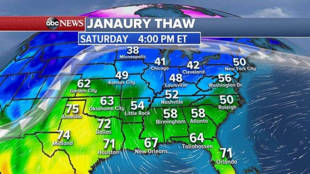
But you won’t have to wait too long for warmer temperatures, as already a major warm-up is on the way for the Gulf Coast, Great Lakes and the Northeast.
Temperatures will be in the 70s from Texas to Florida and in the 50s and 60s for most of the mid-South.
The temperatures are expected to be in the 40s and 50s from the Midwest into the Northeast.

Related Topics
