Hurricane Joaquin: What We Know About the US Impact
The storm is likely to bypass the United States, but produce extreme weather.
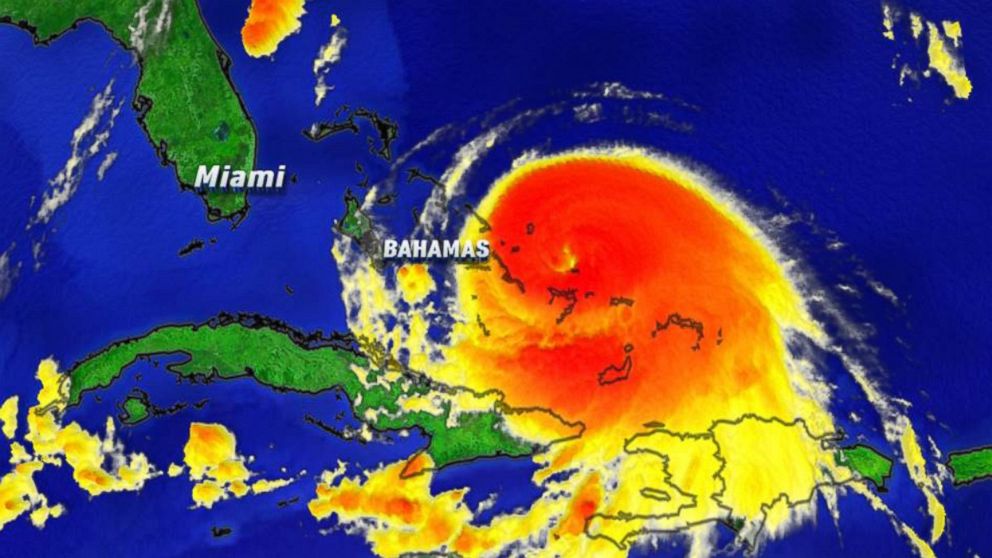
— -- Hurricane Joaquin is creating "extremely dangerous conditions" in the Bahamas today, according to the National Weather Service, and the United States won't be immune to its extreme side effects, on top of a separate storm system.
Though forecast models indicate the hurricane's track will remain offshore of the Carolinas to Mid-Atlantic states, the National Weather Service said today it's still uncertain how close Joaquin will come to the northeastern areas of New England and Cape Cod, as well as Nova Scotia and Bermuda, during the next several days.
Hurricane Joaquin was upgraded to a Category 4 storm Thursday, according to the National Hurricane Center. Its maximum sustained winds are near 130 mph with higher gusts, the National Weather Service said today.
Here's what you should know about this weekend's extreme weather:
1. Strong Winds:
Even if Hurricane Joaquin remains offshore, "strong onshore winds associated with a frontal system" are expected through the weekend, the National Weather Service said, along the coasts of the Mid-Atlantic and northeastern states.
2. Flooding:
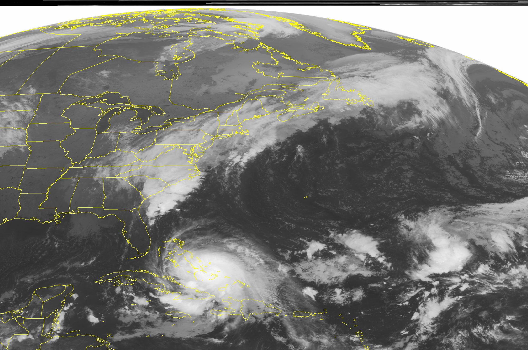
In those same areas of the United States, people should prepare for "minor to moderate coastal flooding" this weekend, even if Joaquin stays offshore, the National Hurricane Center stated today.
Swells have begun to affect portions of the southeastern coast of the United States and will spread northward along the East Coast through the weekend.
"These swells are likely to cause life-threatening surf and rip current conditions," the National Hurricane Center said in a public advisory this morning. "Regardless of Joaquin's track, a prolonged period of elevated water levels and large waves will affect the mid-Atlantic region, causing significant beach and dune erosion with moderate coastal flooding likely."
3. Aside From Joaquin
The United States may be hit with a double whammy of extreme weather that's not related to Hurricane Joaquin. The National Weather Services said today that "very heavy rains, not associated with Joaquin, are expected to produce flooding over portions of the Atlantic coastal states."
In New York, nor'easter-like weather, with strong wind and rain, is expected to cause delays at JFK, LaGuardia and Newark airports.
Forecasts predict wind gusts of up to 60 mph in the New York area, with warnings of power outages from trees that may fall into power lines.
4. What Is Being Done to Prepare?
Governors in many coastal states are warning residents to be ready for wet storms, power outages and road closures. States like New Jersey and New York that were devastated by Hurricane Sandy in 2012 are particularly wary.
Gov. Chris Christie declared a state of emergency in New Jersey, as have governors in North Carolina, Maryland, South Carolina, and Virginia.
Christie said Thursday "the immediate threat is for severe flooding on Friday and Saturday."
New Jersey Health Commissioner Cathleen Bennett Thursday reminded residents using portable generators during power outages to follow manufacturer's guidelines to reduce the risk of fire or carbon monoxide poisoning. After Superstorm Sandy, there were five carbon monoxide deaths in New Jersey because of improper use of portable generators, Bennett said.
Where Is the Storm Right Now?
ABC News will be running a live radar tracker throughout the day, seen below:

Top Stories
ABC News Live