Ice jams cause flooding in Northeast as more cold and snow loom
A new blast of cold air is slamming the Northeast and the Great Lakes region.
— -- Winter weather conditions continue to plague the Northeast.
The combination of melting snow, mild temperatures, and heavy rain have caused numerous ice jams to form in several Northeast states, including Pennsylvania, New York, Connecticut, Vermont and Massachusetts. The ice jams have caused some evacuations in areas near rising creeks and rivers. The ice jams are also responsible for shutting down parts of roadways.
Despite much colder temperatures than the end of last week, the threat of ice jam-related flooding will remain on Sunday across much of the Northeast. Runoff from heavy rain in area waterways, combined with chunks of ice will continue to cause water levels to change. Some parts of the region have flood watches and advisories through Sunday. Some waterways will begin to refreeze on Sunday.
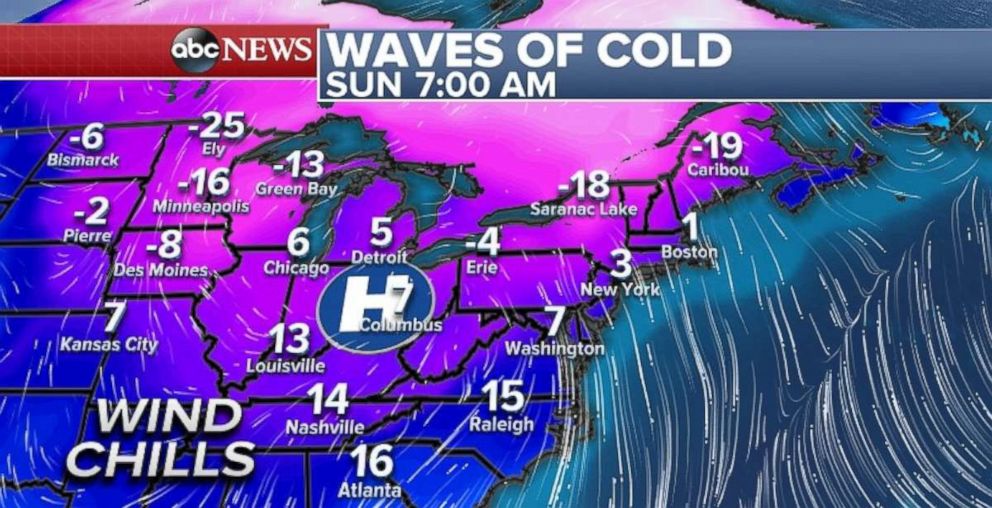
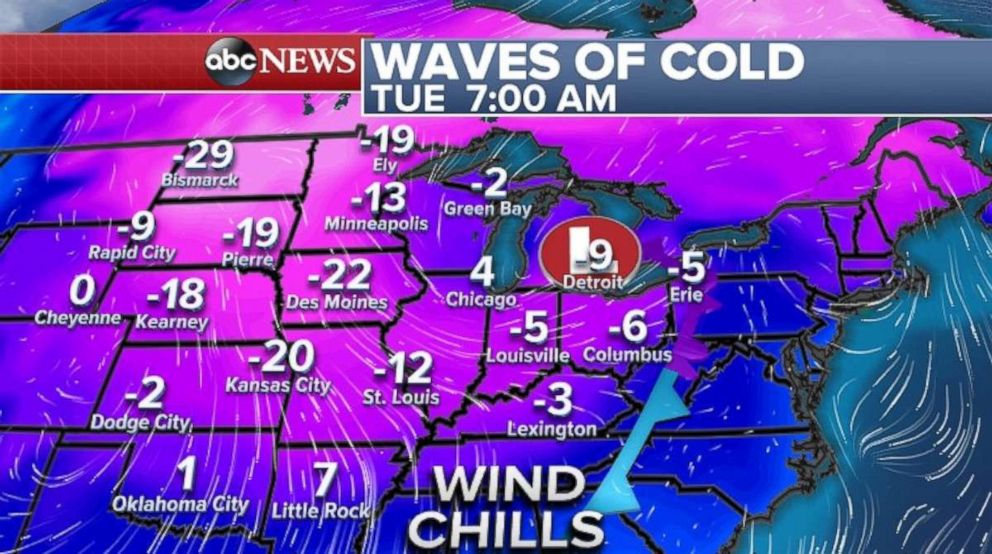
It is a frigid Sunday morning across much of the eastern U.S. Some parts of the Northeast quickly dropped in temperature on Saturday and most locations were 30 to 50 degrees colder than they were compared to Friday. This latest cold blast extends all the way to the Southeast coast where it is feeling like teens this morning.
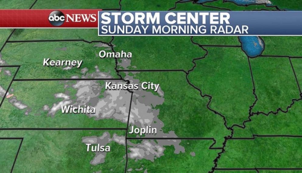
A weak disturbance is moving Sunday morning through parts of the Central Plains, including Kansas and Missouri. Accumulations are expected to be light with only a couple of inches expected, but slick roads will be likely through the day on Sunday. The disturbance will dissipate as it moves south and east this morning.
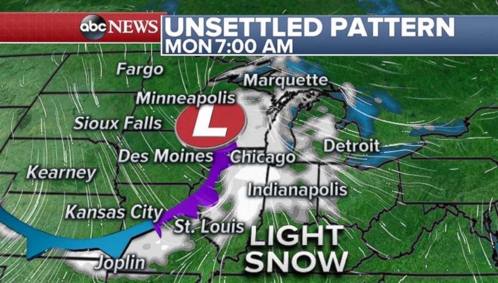
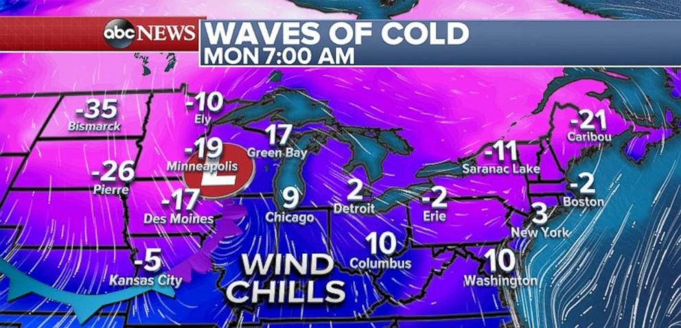
Another Arctic front is moving in from Southern Canada and will bring another punch of colder air and light snow to the central U.S. Light snow will be possible all the way from the Dakotas and Minnesota by Sunday tonight, and to the central Plains and Midwest by Monday Morning. Behind it, another intense blast of cold air will move in with wind chills heading into minus 20s and minus 30s in the Northern Plains and Upper Midwest by Monday morning.
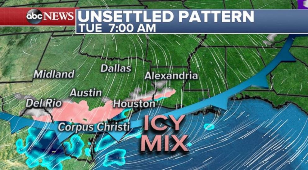
By late Monday and early Tuesday, the light snow will reach the Ohio and Tennessee valley, as well as parts of northern Texas, Oklahoma and Arkansas. Concern is growing for a more notable wintry mix event through much of Central and Southern Texas by Tuesday. The snow and wintry mix could hamper travel in the region on Tuesday. The cold air will surge southward and bring wind chills to near zero for parts of the southern Plains.
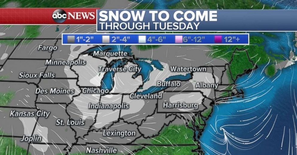
Despite plenty of cold air, the fast moving nature of the front and the limited moisture will hold accumulations to only a couple of inches at best over the next few days. Locally enhanced accumulations over 2 inches will be possible in parts of the Great Lakes, as well as parts of eastern Kansas and western Missouri.
Snow along the front will also reach the east coast by late Tuesday and Wednesday, with a possible new storm developing near the coast line during this time frame.
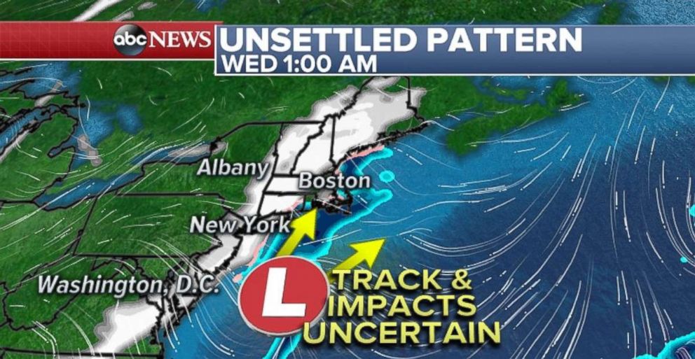
There is a possibility that at least part of this new, more organized storm will affect some portion of the East Coast during this time frame. At this point, there isn't a clear signal to determine the magnitude of the impacts to the mid-Atlantic and Northeast. It appear, however, that there is at least some potential for some snow during this time frame. However, at this time, it is too early to determine the exact track of this new system, and therefore it remains unclear the magnitude the system could have on the Northeast.
Related Topics

Related Stories
ABC News Live