Elections Today
- Pennsylvania
Recent Projections
| State | Candidate | Delegates |
|---|---|---|
 Donald Trump | ||
Pennsylvania |  Joe Biden |
Life-threatening tornado outbreak, flash flooding possible Monday in Southern Plains
There have been 38 reported tornadoes in the U.S. since Friday.
The second day of an outbreak of severe weather Saturday brought 10 reported tornadoes to to the Plains, part of 38 reported tornadoes since Friday.
In addition to the tornadoes, widespread damaging winds have been reported, with gusts as high as 78 mph in parts of Oklahoma on Saturday.
There was a tornado watch in effect Sunday morning for parts of Louisiana and Mississippi until 10 a.m. Central time as a line of powerful storms with widespread damaging winds moved through the region. There were reports of a dangerous and large tornado in Beauregard Parish, Louisiana, early Sunday morning.
The severe risk will be less intense Sunday, but it will move east into some major population areas. However, attention will turn immediately to the next system, which will bring another round of severe weather.
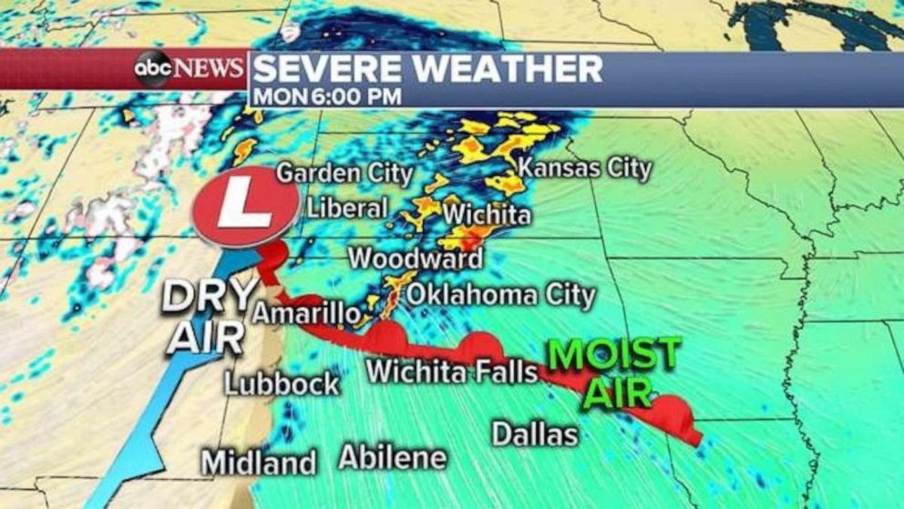
On Monday, a new system will develop off the High Plains and slide east into the Southern Plains. The dry line will interact with an increasingly moist and unstable air mass that will develop across parts of Texas, Oklahoma and Kansas.
Unfortunately, that means very favorable conditions for violent severe weather in parts of this region.
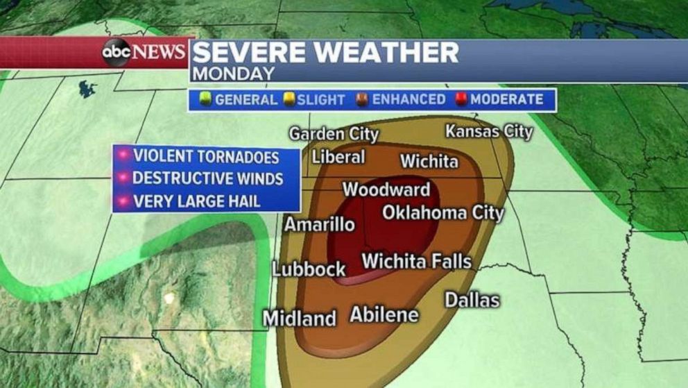
There is a moderate risk for severe weather in parts of Oklahoma and Texas, including Oklahoma City, on Monday. There is a chance for violent, long-track tornadoes, destructive winds and very large hail in this region. Additionally, damaging winds, large hail and strong tornadoes will be possible across parts of the Southern Plains from Midland, Texas, to Wichita, Kansas.
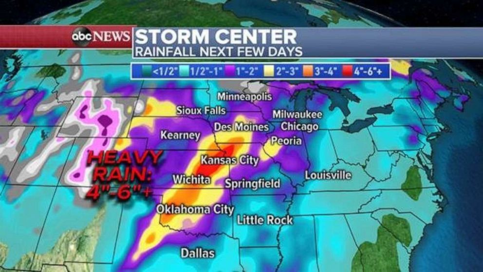
In addition to the severe weather threat, torrential rain will likely cause flash flooding, especially in parts of this region already saturated from storm activity the last few months.
Locally, 4 to 6 inches of rain is possible in parts of the Southern Plains over the next few days. Torrential rain, causing flash flooding, combined with potentially extremely dangerous severe weather, will likely make this a life-threatening weather event in parts of this region.
The severe weather threat will move into parts of eastern Texas to western Illinois on Tuesday. However, the atmosphere will begin to lose some of the ingredients that are needed to have widespread intense severe weather.
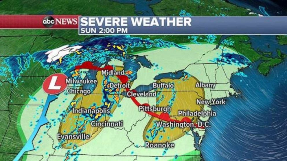
Meanwhile, there is a separate severe weather threat on Sunday for parts of the Midwest and Northeast, including parts of the Chicago, Detroit, Indianapolis, Washington, D.C., and Philadelphia metro areas.
Storms will likely fire up during the afternoon and persist into the evening hours. Damaging winds, large hail and brief tornadoes are possible.
Related Topics

Top Stories
ABC News Live