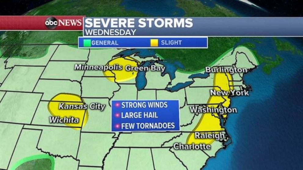
Severe storms expected from the Plains to the Northeast
Heat is the main concern in the West and South.
Strong storms brought more than 5 inches of rain and 70 mph wind gusts in Baltimore on Tuesday, while Nebraska saw a gust over 80 mph.
More severe weather is expected Wednesday as two cold fronts move through the eastern half of the U.S.
These storms will strike in several areas. The first spot is a cold front along the East Coast from Vermont to North Carolina. The biggest threat there will be damaging winds and some hail, but there's also an isolated threat for a quick, weak tornado. Also, flash flooding is possible in the East with these storms.
The second cold front will bring severe storms from the Great Lakes into the Plains. The biggest threat will be damaging winds and large hail, while an isolated tornado cannot be ruled out. Flash flooding could also be a threat for parts of Kansas and Missouri.
Scorching summer heat
The heat is on from Pacific Northwest and into the Deep South.
Nine states from Washington to Mississippi are under heat advisories on Wednesday.
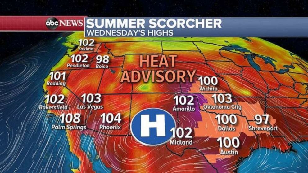
In the Deep South, the humidity will make it feel like it's 110 degrees.
Also, there is a high fire danger from California to Nevada and into the Pacific Northwest. Fires could spread easily in these areas with gusty winds, dry conditions and hot temperatures.
Related Topics

Top Stories
ABC News Live