Severe Weather Outbreak for Parts of the Country This Weekend
Some 35 million Americans will experience the bad weather.
— -- Some 35 millions Americans from Texas to Mississippi to Kansas are at risk for tornadoes, large hail and damaging winds starting today.
The widespread severe weather is expected to last into Saturday and a possible severe outbreak situation is expected to unfold going into the weekend. Six states are all in the storm zone today -- Corpus Christi to New Orleans to Dallas, Tulsa and Wichita -- but there are two pockets with an enhanced risk that brings more concern.
Heavy rain this morning in parts of Texas, Louisiana and Arkansas has already saturated the ground enough to spark flash flooding once additional rain moves through. A flash flood watch has been issued for Dallas through tonight.
The biggest threat for tornadoes today is the enhanced area in the South, including Dallas, Waco, Shreveport and parts of southwest Arkansas. Very large hail and damaging straight line winds are also likely. Southern Louisiana in under a tornado watch through the evening.
The other, much smaller, enhanced area is for Kansas, north of Wichita. This is also a hot spot for possible tornado formation -- but probably not until a little bit later this evening and into the night. The biggest threat here will be for very large hail.
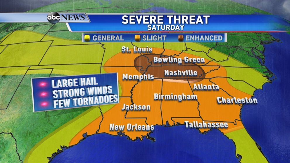
Severe weather is expected to continue overnight, into the morning hours and throughout the day Saturday as the threat shifts east.
Much of the Southeast will see severe storms Saturday, even in the early morning, in Memphis, Jackson, Birmingham, Atlanta and Charleston. Damaging winds and large hail are the main threats in those cities, but isolated tornadoes can’t be ruled out.
By Saturday afternoon and evening, enhanced severe weather development is expected in the lower Ohio Valley, including Nashville, Bowling Green, Evansville and south of St. Louis. Very large hail and a few, perhaps strong, tornadoes are possible.
