Snowy blast moving from Midwest to New England, followed by bitter cold
By Tuesday morning, the bitter cold will be in place across the Northeast.
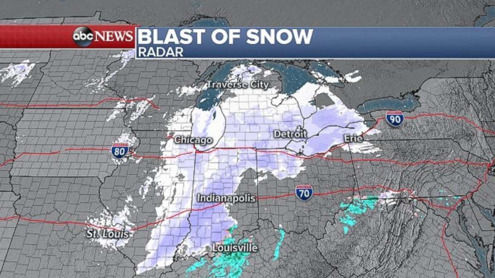
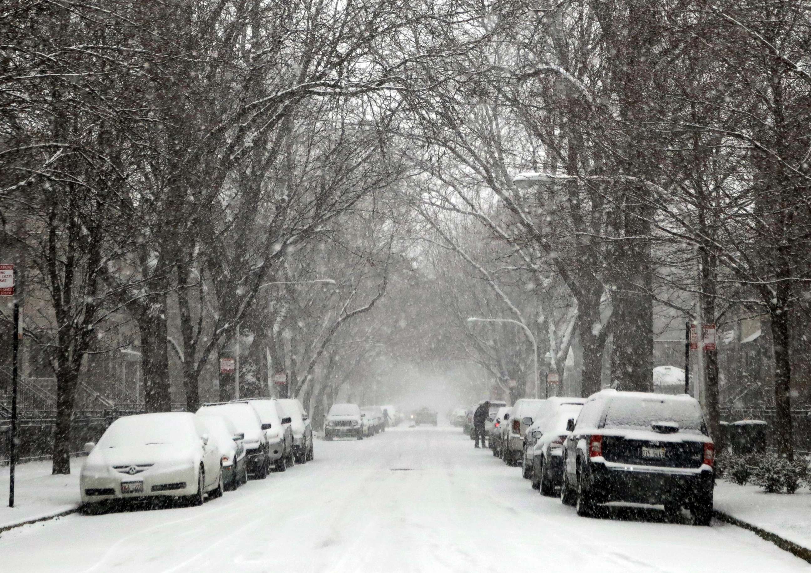
— -- A quick-moving blast of snow is continuing to sweep east, impacting parts of the Midwest today and heading into the interior Northeast this evening.
Snow is falling and bringing slick roads to Chicago, Indianapolis and Detroit this afternoon. By later this evening, some rain will be falling along the Interstate 95 corridor from Washington, D.C., to New York City, likely beginning between 7 to 9 p.m. ET, with snow falling north and west of the major cities and lasting overnight.
Warmer air along the coast will keep the weather mostly rainy across much of the Northeast coastline.
As the storm moves into New England and eventually exits by later Monday afternoon, strong, gusty winds will develop in its wake across the Northeast.
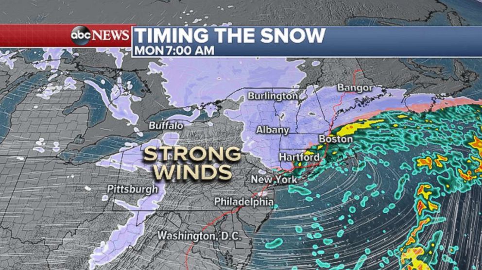
Wind advisories have been issued for much of the region, including D.C., Philadelphia, New York City and Boston. Wind gusts of 40 to 50 mph are possible and could cause scattered tree damage and power outages.
Further north, lingering snow in northern New England and the increasing winds could bring whiteout conditions. As the winds begin to increase, lake-effect snow will develop along the eastern Great Lakes, and whiteout conditions will be possible there as well.
Winter storm warnings are now in effect from northern New York state to Maine, where the greatest impacts and highest accumulations will be.
A significant lake-effect snow event is now looking likely across portions of western New York state in the coming days. Lake-effect snow warnings are in effect for some areas and in addition to the 10-plus inches expected through Monday, isolated spots south of Buffalo and north of Syracuse could get 2 to 3 feet of snow by midweek.
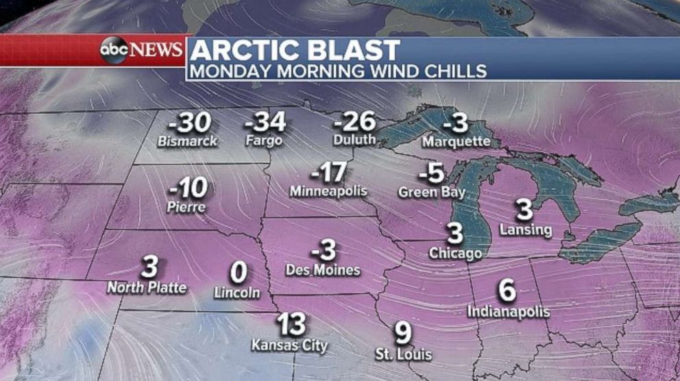
An arctic blast will be sweeping into the northern Plains and upper Midwest on Christmas, bringing bitter cold. It will feel like it’s 25 to 30 degrees below 0 much of the day Monday in portions of North Dakota and Minnesota. In Minneapolis, wind chills will be -15 to -20 all day, with single digits wind chills expected Monday morning in Chicago, Indianapolis and St. Louis.
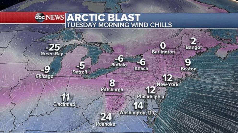
By Tuesday morning, the bitter cold will be in place across the Northeast, with temperatures in the teens from D.C. to New York City, and in single digits in Boston.
Related Topics

Popular Reads
ABC News Live