Spring Has Sprung, but Winter Just Won't Go Away
Just When You Thought It Was Spring, Winter Pulls Us Back In
— -- The official first day of Spring is Friday. Unfortunately, Old Man Winter is feeling extra grumpy toward the Northeast this year, bringing more cold and snow to the region.
First, it's the cold.
Gusty winds and frigid morning temperatures are making it feel more like January instead of March this week. Thursday morning will feature temperatures 10 to 15 degrees below normal, in the twenties from Pittsburgh to New York City, teens in Boston and even single digits in Northern New England.
With the wind it will feel about 10 degrees colder than the numbers you see below.
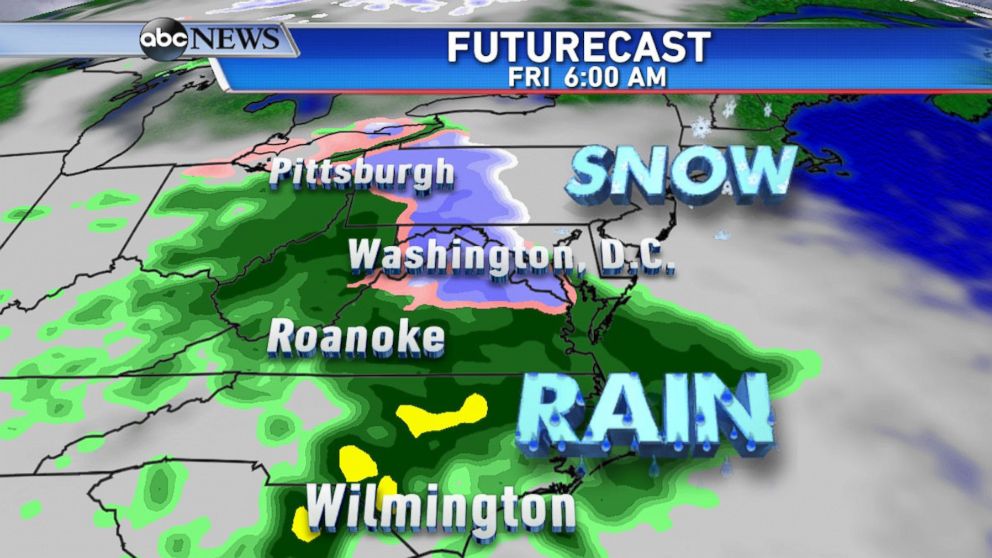
This cold air will stay in place right into the weekend, and that sets the stage for accumulating snow as a storm system tracking towards the Northeast on Thursday night into Friday.
A wintry mix of rain and snow for many of the big cities along the I-95 corridor is also a likely scenario, especially in the Mid-Atlantic. Farther North and West it should be cold enough for a mostly snow event.
By early Friday, rain and snow will stretch from Virginia to portions of western Pennsylvania, and could cause problems for the morning commute.
Snowfall may melt as it hits roads, so expect accumulations to be less the further south you go.
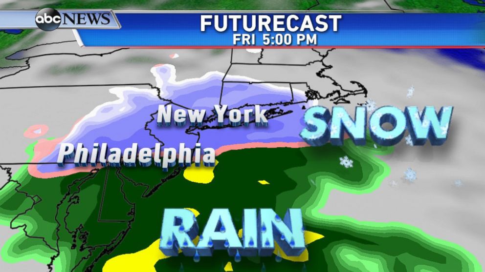
Friday afternoon and evening is when snow is expected in the Philadelphia and New York City areas, causing airport delays and travel issues for the evening commute. A couple of inches could accumulate especially North and West of the cities.
Boston could get clipped with a bit of snow later on Friday night, but not expecting much as of right now. After having the snowiest winter on record with over 9 feet there, I doubt they would mind being left out of this one.
Luckily, this is a fast moving storm and will clear the region overnight Friday, leaving behind a much drier and more pleasant Saturday for the first weekend of Spring.
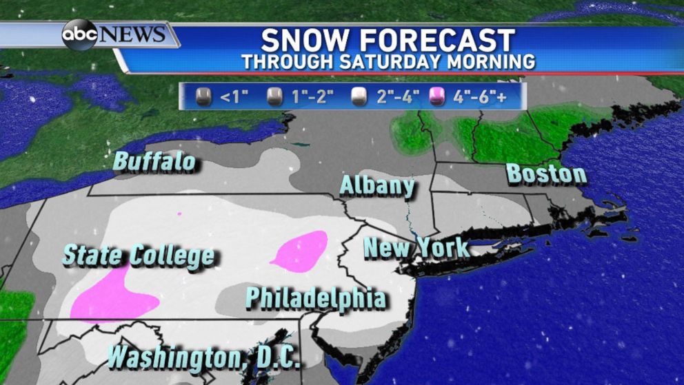
As it goes for all snow storms a few days out, this snow forecast is subject to change. The current general consensus is about 1 to 4 inches of snow for much of the area.
Parts of Northern and Western Pennsylvania, and Northwest New Jersey will likely see the highest amounts, up to inches.
Washington D.C. and points South will likely be on the lower end of the scale, with 1 to inches, and as much as 3 inches is forecast for Philadelphia to New York City. The outer suburbs could possibly picking up a bit more.
