Strong storm system moving toward East Coast with more flash flooding possible
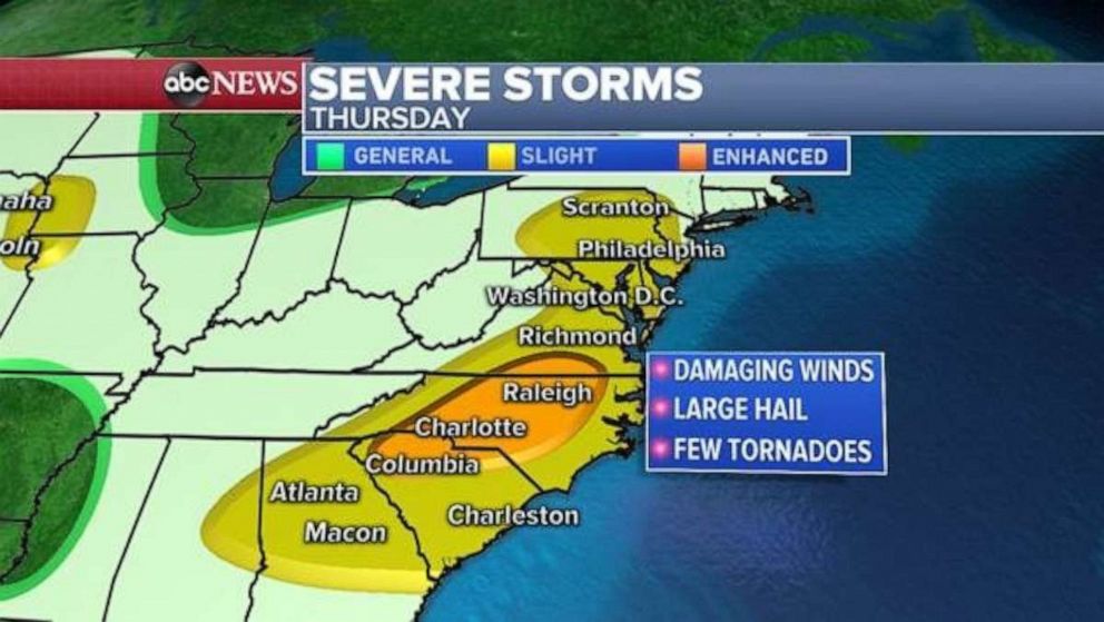
There also is the potential for tornadoes in the Carolinas.
Heavy rain fell overnight Thursday, stranding cars in flooded streets in the Philadelphia metro area. The rain was a precursor to another day of wet weather up and down the East Coast.
Areas just south and east of Philadelphia got a whopping 4 to 6 inches of rain since Wednesday. In addition, severe storms caused damage in several parts of the country Wednesday night, including a possible tornado in Greenville, Texas, and damaging winds up to 70 mph in Little Rock, Arkansas.
Finally, the stagnant stationary weather pattern will begin to move on Thursday, with more heavy rain and severe storms moving from the Midwest into the Northeast Thursday.
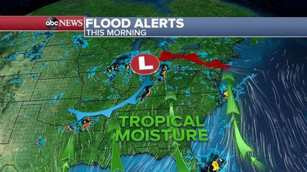
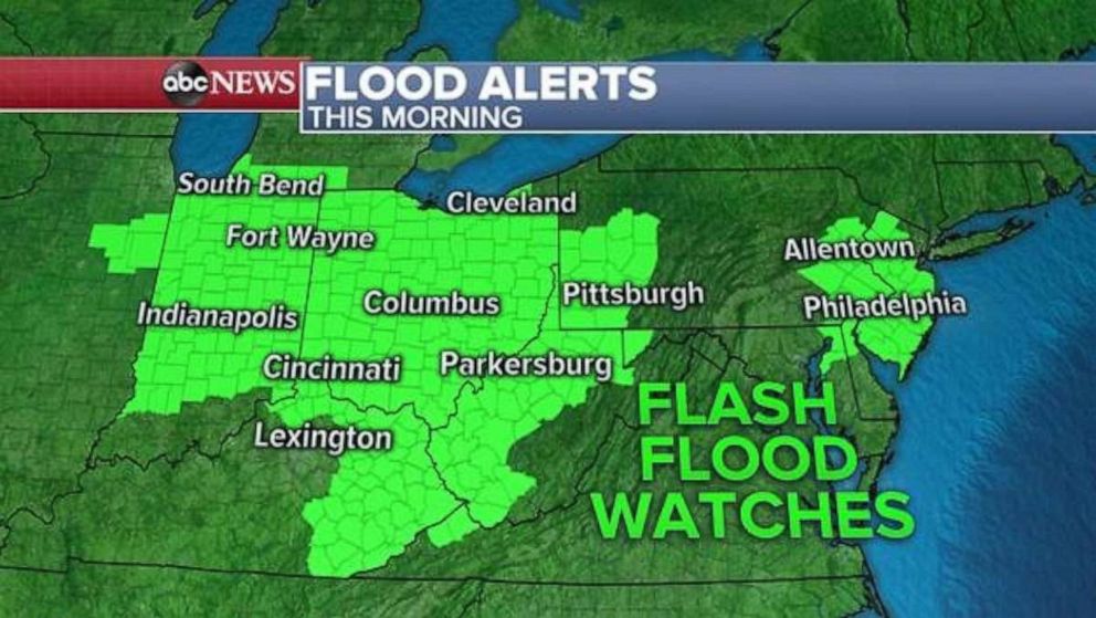
Flash flood watches remain in place Thursday morning from Illinois to New Jersey.
There are over 52 million people at risk for more severe storms Thursday, including along the East Coast from New York to Georgia and Alabama. The area will see damaging winds, hail and even a few tornadoes.
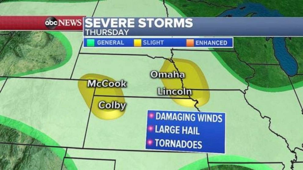
Severe storms are also possible in the Plains Thursday, from Colorado to Iowa, where damaging winds and hail will be the biggest threat, but a tornado is possible.
Related Topics
