Temperature whiplash as cold returns to Northeast, coastal storm brings heavy rain
Millions are experiencing a temperature roller-coaster this week.
It’s a temperature whiplash, from record cold this week, to mild weather today, then back into the freezer tomorrow as millions experience a temperature roller-coaster,
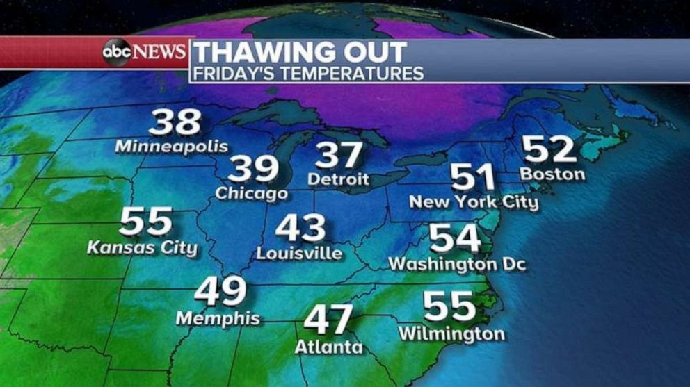
We start out mild for most of the Eastern U.S. today, with every major city above freezing in the Midwest. Even Minneapolis and Chicago will be near 40 degrees, with 50 degree temps from Kansas City to New York City and Boston.
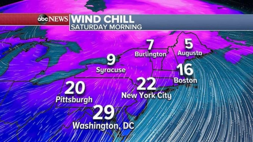
Then a dose of Arctic air is aimed at the Northeast for Saturday. Temperatures will plummet below freezing again, and with wind it will feel like it’s again in the single digits, with teens and 20s from Boston to New York and even Washington, D.C.
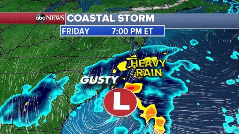
Meanwhile, a coastal storm will be developing today in the Carolinas with heavy rain stretching from Georgia to North Carolina. Gusty winds up to 65 mph are possible and some areas could see up to 4-6" of rain, with localized flash flooding possible.
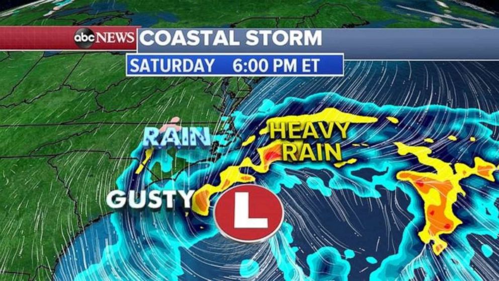
By Saturday evening, the storm system will slowly crawl near the Carolina coast, continuing to bring very heavy rain and gusty winds. Flash flooding will be possible in the coastal Carolinas.
Then by Sunday late afternoon and into the evening hours, the coastal storm will really strengthen off the Virginia coast and will bring gusty winds and rain from the coastal Mid-Atlantic to eastern New England.
Northeast cities that will see this nasty weather will include Philadelphia, New York and Boston.
Further inland, from the Poconos to the Catskills and into higher elevations of eastern New England, some of the rain could freeze on contact and become freezing rain, which will produce treacherous road conditions Sunday night.
Related Topics
