Thunderstorms, with potential flash flooding, hit Midwest, mid-Atlantic to start the week
The mid-Atlantic region has been deluged with rain this past few weeks.
Several rounds of thunderstorms, with gusty winds and heavy rain, are expected to develop across a stalled front from the Midwest to the mid-Atlantic through Monday.
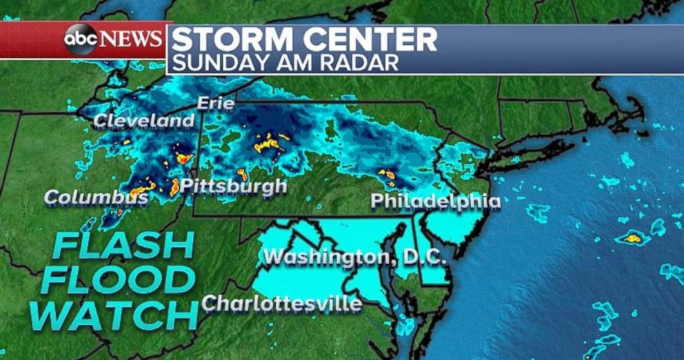
Heavy rain from thunderstorms is still falling in northern Illinois and southern Wisconsin on Sunday morning and flash flooding remains a possibility through the morning hours.
Farther east, light rain is falling from Ohio to New Jersey. This activity will begin to slip slightly south during the day today and rainfall rates are expected to intensify. A new flash flood watch has just been issued from northern Virginia to southern New Jersey, including Philadelphia and Washington, D.C.
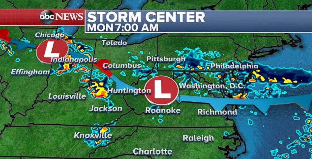
On Monday, much of the same region will see more clusters of thunderstorms, some of which will carry heavy rainfall and isolated flash flooding. By Monday night, the heavy rain will be concentrated in the Carolinas, where storms could produce rainfall rates of 1 to 2 inches per hour.
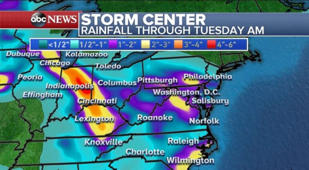
Parts of the Midwest and mid-Atlantic could see 1 to 3 inches of rain through Tuesday, with locally higher amounts.
The latest forecast guidance is suggesting that some of the heaviest rainfall could fall from northern Indiana into eastern Kentucky, as well as parts of northern Virginia and Maryland.
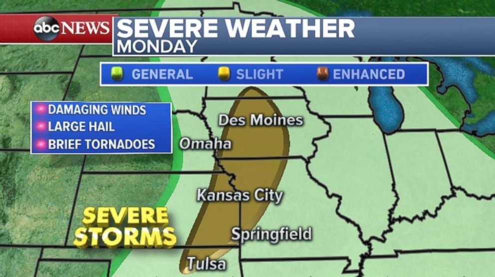
Meanwhile, a new system moving in from the west will bring another round of severe weather. Late Sunday into early Monday the severe threat will be over the Dakotas.
The severe threat moves on Monday into the central Plains from northern Oklahoma to southern Minnesota, including Kansas City, Missouri, and Des Moines, Iowa. Damaging winds, large hail and brief tornadoes remain possible both days in the slight risk area.
Fire danger continues
The 416 fire near Durango, Colorado, is now 8,691 acres, growing 1,500 acres since Friday. The fire has been burning for more than a week and remains only 10 percent contained. New evacuations were ordered in La Plata County on Saturday, according to Denver ABC affiliate KMGH.
In Santa Clarita, California, a brush fire sparked on Saturday, burning 175 acres of land. The fire caused some mandatory evacuations in Santa Clarita. The fire was 30 percent contained by Saturday night, according to Los Angeles ABC station KABC.
The Soldier fire in New Mexico has burned over 2,500 acres and is at 5 percent containment. Mandatory evacuations that were in place late last week have been lifted, ABC affiliate KOAT reported.
Red flag warnings have been posted for parts of the Southwest again on Sunday. Gusty winds, low relative humidity and warm temperatures will promote growth of any burning fires in the region.
Wind gusts could exceed 30 mph near the fires in Colorado, New Mexico and Southern California.
Related Topics

Top Stories
ABC News Live