Millions without power after Isaias slams into Carolina coast
The storm is causing flooding and damaging homes on its way up the coast.
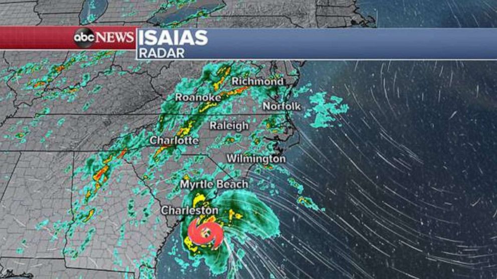
Isaias slammed into southern North Carolina late Monday night, buffeting the coast with heavy winds and rain as it made landfall near Ocean Isle Beach with maximum sustained winds of 85 mph.
The storm weakened from a hurricane to a tropical storm at approximately 3 a.m. Tuesday morning as it traveled up the East Coast.
As of 3 p.m. Tuesday, nearly 3 million customers were without power up and down the coast.
In Brunswick County, North Carolina, emergency crews responded to several fires and there were reports of possible tornadoes, officials said.
Isaias approached the coast as a tropical storm with winds of 74 mph, but picked up speed as it slammed into the coastline.
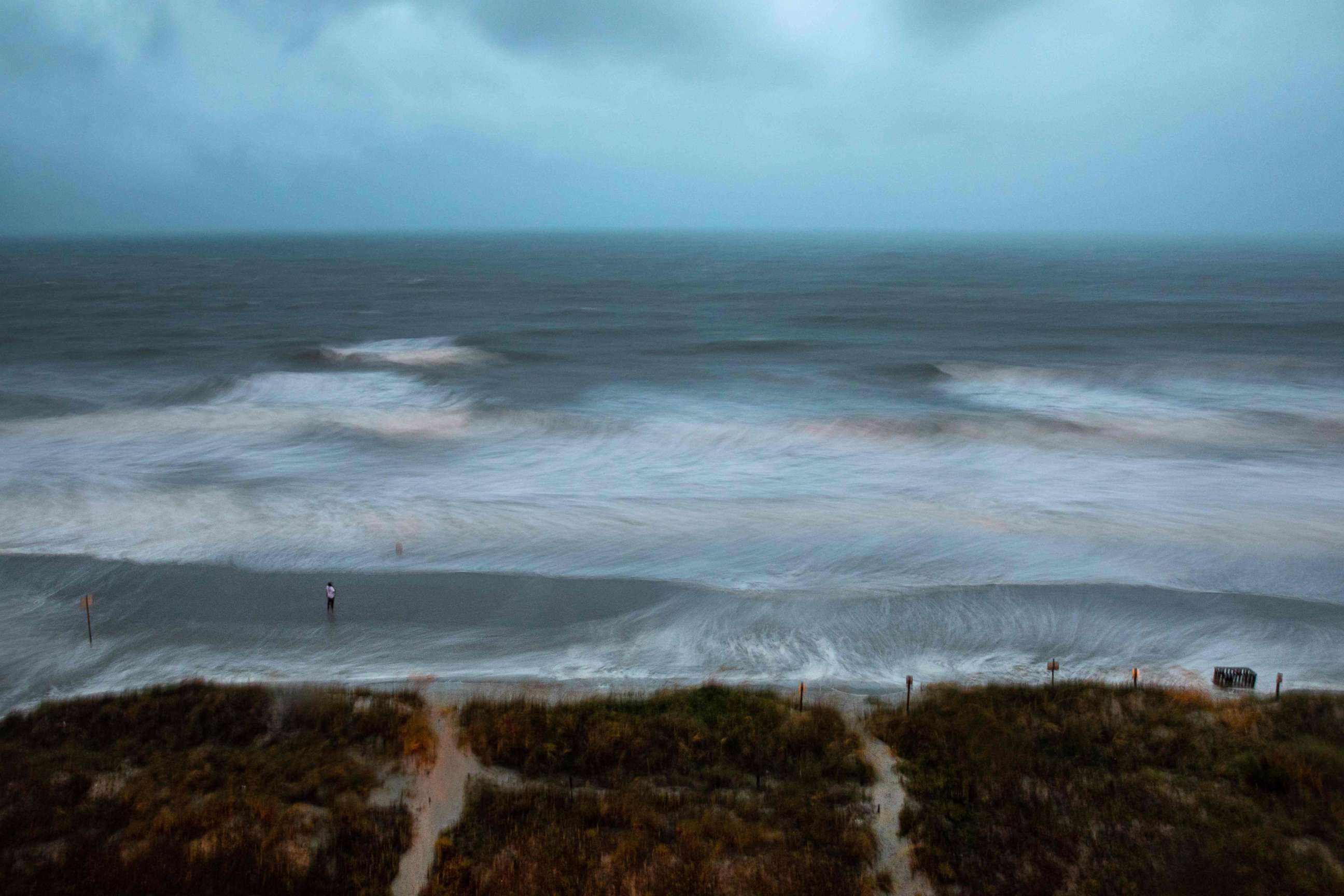
Strong winds ripped through Apache Pier in Myrtle Beach, South Carolina, while rough waves and high water battered North Carolina's Oak Island.
The storm has caused flooding and damaged homes as it batters coastal towns in North and South Carolina.
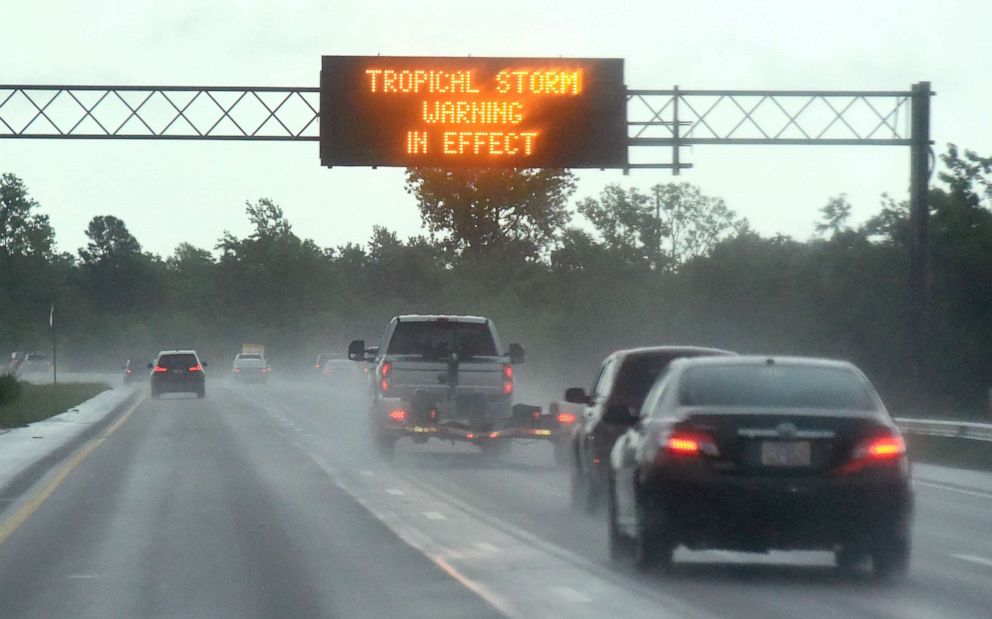
Officials ordered residents in affected areas to shelter in place and not leave their homes, especially in light of the ongoing coronavirus pandemic.
Myrtle Beach Emergency Manager Bruce Arnel said emergency support personnel were taking every COVID-19 precaution in responding to the storm.
"We're prepared, but it is challenging in this COVID environment to do anything like this," he told ABC News.
North Carolina Gov. Roy Cooper also urged residents to stay inside and warned them to be mindful of downed trees and power lines.
The last hurricane to make landfall in North Carolina was Hurricane Dorian in 2019. The last hurricane to make landfall in South Carolina was Hurricane Matthew in 2016.
Tropical storm alerts stretch all the way up to New England, as Isaias is now expected to weaken as it makes its way up the East Coast.
The storm is forecast to bring torrential rain, flash flooding and storm surge up the coast, as well as dangerous winds to the Northeast.
Isaias will reach the Mid-Atlantic by early morning Tuesday and the Northeast by Tuesday night.
More than six inches of rain are forecast for the Mid-Atlantic.
The heaviest rainfall is expected to hit along the Interstate 95 corridor from Washington, D.C., to Philadelphia and New York City.
Damaging winds are also forecast for New Jersey, New York City and Long Island.
Late Monday night New Jersey Gov. Phil Murphy declared a state of emergency for the Garden State, effective 5 a.m. Tuesday.
Rip currents and storm surge are expected at the Jersey Shore, Murphy warned on Monday, recommending that residents stay inside on Tuesday.
Wind gusts at the shore may climb over 70 mph, which officials said could cause widespread power outages.
New York City is expected to get hit by tropical-storm force winds, storm surge and several inches of rain, city officials said.

Lower Manhattan is particularly vulnerable to storm surge, New York City Mayor Bill de Blasio said Monday. Emergency management crews are deploying flood protection measures, he said.
"We are not taking any chances at all," de Blasio said.
Related Topics
