Dozens of vehicles crash in snowy Michigan pileup amid threat of 3rd nor'easter
Three people were hospitalized with minor or moderate injuries, officials said.
Lake-effect snow caused dozens of vehicles to pile up on a Michigan highway today.
At least 35 vehicles, including semitrailers, were involved in the crash on Interstate 94 in southern Michigan, the Jackson County Sheriff's Office said. The collision sent three people to the hospital with minor or moderate injuries, authorities said.
Traffic on both the eastbound and westbound lanes stopped completely but the highway has since reopened, the sheriff's office said.


The Northeast recovers
Along the East Coast, residents are still digging out from the second nor’easter to hit the region in a week.
There were 435,000 customers without power in the Northeast this morning, including 169,000 in Massachusetts and 141,000 in New Jersey, officials said.


The forecast
Cold air is bringing lake effect snow across the eastern Great Lakes from Michigan to New York today, leading to dangerous travel and road conditions.
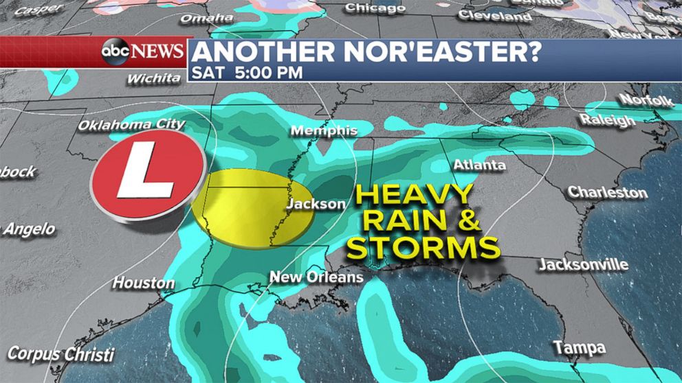
A storm system will move across the Southeast Saturday into Sunday bringing severe weather and heavy rain for parts of the South.
There may be damaging winds, hail and isolated tornadoes late Saturday and early Sunday as the system moves east.
A third nor'easter?
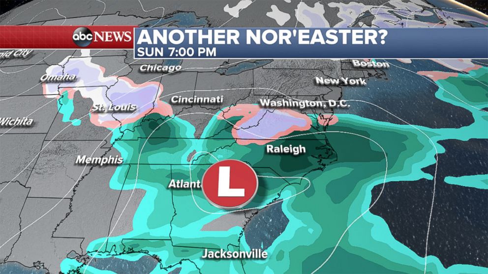
All eyes are on the possibility of yet another nor’easter to hit early next week, but it’s still too far away to know what will happen.
By Sunday the low pressure will reach the Carolinas and beyond that is where uncertainty grows regarding the track that the coastal storm will take.
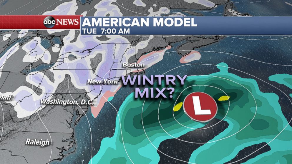
The American model for Monday into Tuesday shows the storm off the coast -- far enough away to spare the Northeast from major impacts -- but it could still bring gusty winds, a wintry mix and some accumulating snow.
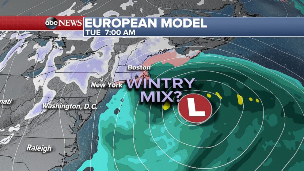
The European model for Monday into Tuesday passes slightly closer to New England, so the majority of the precipitation would be confined to that area.
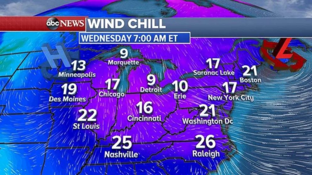
Cold is coming
Regardless of the storm's track, winter is not over: Cold, February-like weather will continue into the middle of March.
One of the coldest days will be Wednesday when wind chills will drop into the single-digits and teens from the Midwest into the Northeast, according to the forecasts. Wind chills will be in the 20s Wednesday morning from the Tennessee River Valley to the Carolinas.
ABC News' Alexandra Faul contributed to this report.
Related Topics

Popular Reads
ABC News Live