New Central US storm expected to dump more snow
A new storm in the central U.S. is expected to deliver more snow.
— -- While parts of Los Angeles received about one-third of an inch of rain on Saturday, northern parts of California have received much more preciptation, with San Francisco seeing about 1.5 inches over the last three days.
Away from the coast, June Lake has seen about 6 feet of snow over the last two days. Mammoth Mountain, which experienced an avalanche Saturday, has received more than 5 feet of snow, at times receiving more than 2 inches per hour.
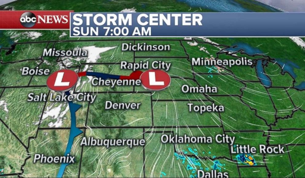
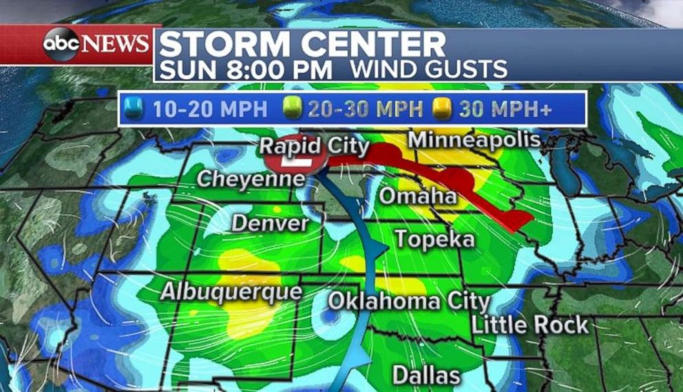
That storm is now bringing plenty of wind and snow to the Rockies and is expected to evolve into a significant system over the Central U.S. tomorrow, with heavy snow expected in the Upper Plains and Midwest. By midweek, the storm may play a role in a another major coastal storm in the Northeast.
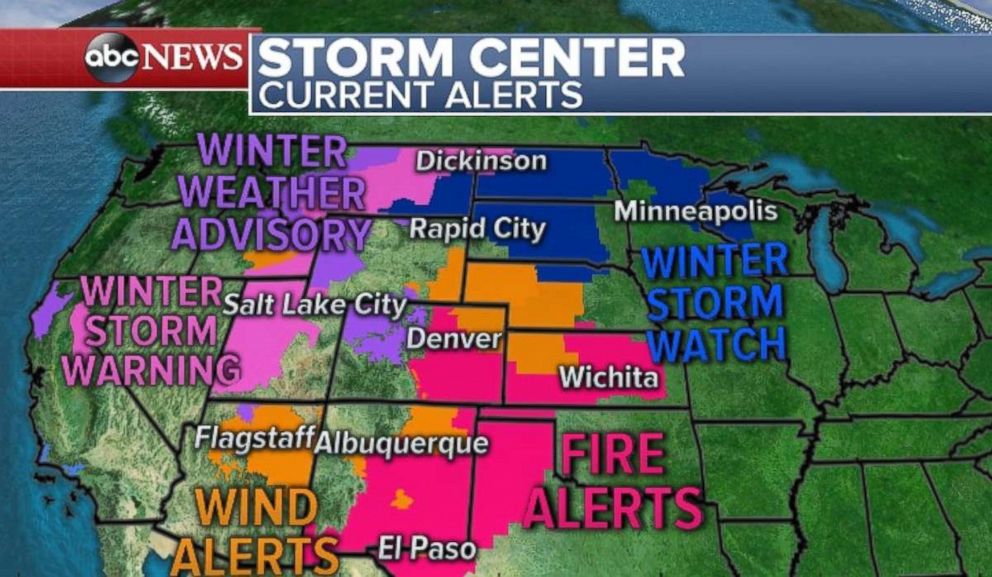
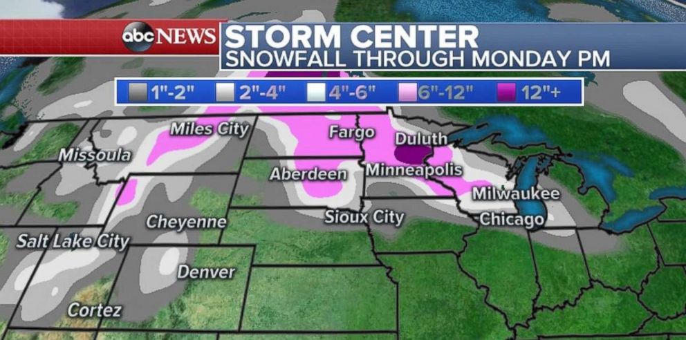
Snow is expected today throughout the Rockies, with heavy snowfalls expected in Salt Lake City and Missoula.
Beginning late tonight and continuing into early tomorrow, the storm will slide eastward and bring snow to the Northern Plains and Upper Midwest, with heavy snowfall expected near the Twin Cities.
Winds of 30-40 mph are expected Monday across the Northern Plains and could lead to whiteout conditions.
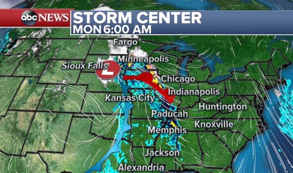
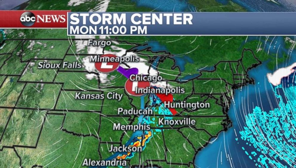
Snow is expected through Monday evening evening from Fargo all the way to northern Indiana, with more than a foot expected in parts of Minnesota. The Dakotas and Wisconsin also could see enough to break out the plows.
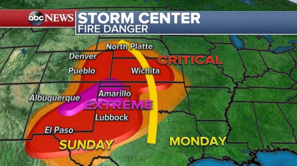
The Southern Plains are expected to experience dry, windy conditions, which puts that region at risk of wildfires. Conditions are critical from El Paso to near Wichita over the next 24-36 hours, with extreme fire conditions likely in the Texas Panhandle and Eastern New Mexico. Since Jan. 1, Amarillo has received only .01 inch of rain, well below the city's year-to-date average of 1.37 inches.
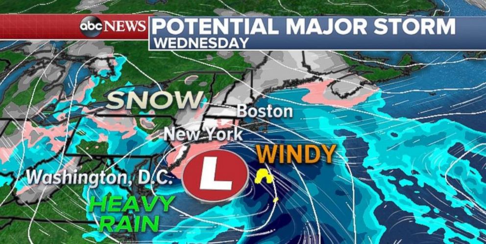
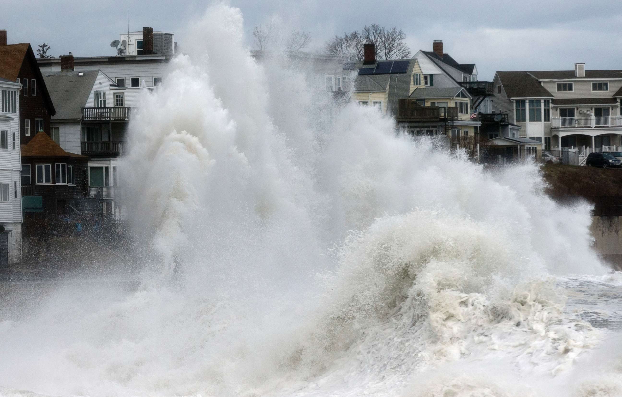
It appears likely another significant weather event is approaching the Northeast, also impacting many of the cities along Interstate-95. If there's good news, it's that this new storm probably will be less powerful than the one that just rocked much of the region, battering coastlines including Massachusetts'.
Related Topics

Popular Reads
ABC News Live