Damaging winds, heavy rain moving onto East Coast to start week
There were 18 tornadoes reported in the South the last two days.
The major storm system that brought flash flooding and a record-breaking blizzard is moving east Sunday morning. The storm will bring another round of severe weather for nearly the entire Southeast -- including several tornadoes -- and will spread more snow and ice from Minnesota to Maine through Monday.
Additionally, very heavy rain is heading to the Northeast for Monday morning when flooding is possible.
So far there have been 18 reported tornadoes in five states across the South since the outbreak began. There have been over 290 reports of severe weather from Texas to Wisconsin to Alabama.
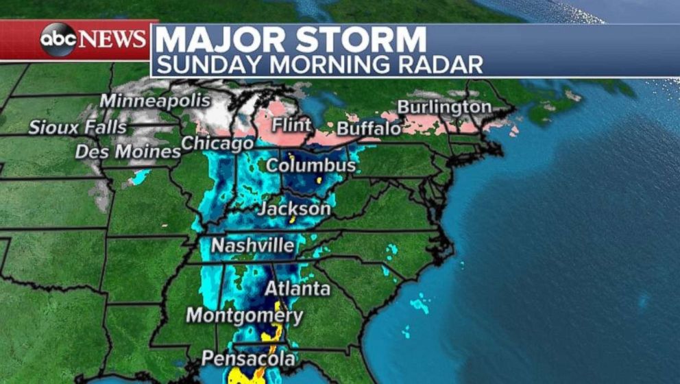
Heavy snow is still falling Sunday morning across parts of the upper Midwest with 1 to 2 inch per hour snowfall accumulation being reported. An icy mix is now extending across Michigan and into parts of New England. An ice storm warning has been issued for western New York state.
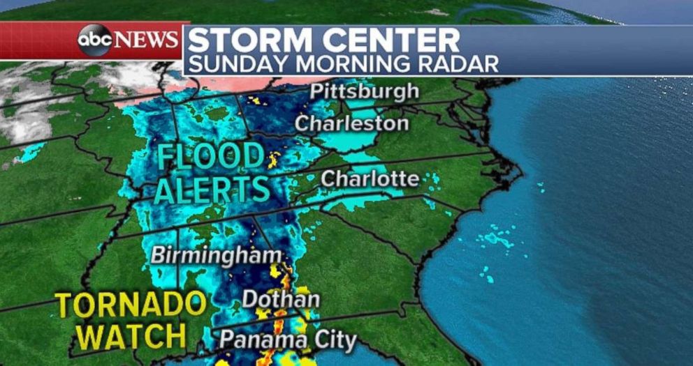
In the South, a tornado watch remains in effect for parts of Florida, southern Georgia and southwest Alabama Sunday morning as a line of storm moves through that region. Very heavy rain is falling with this line of storms, including rainfall rates up to 3 inches per hour. The radar is estimating that 7 to 10 inches of rain has fallen near Mobile, Alabama. Therefore, the flood risk continues this morning along parts of the Gulf Coast.
While the storms are losing their intensity, they will strengthen later Sunday as they head toward the Southeast coast. Storms are expected to be widespread from Florida to Virginia. A slight risk for severe weather has been issued from Miami to Roanoke, Virginia, with the threat being damaging winds, large hail and a few tornadoes.
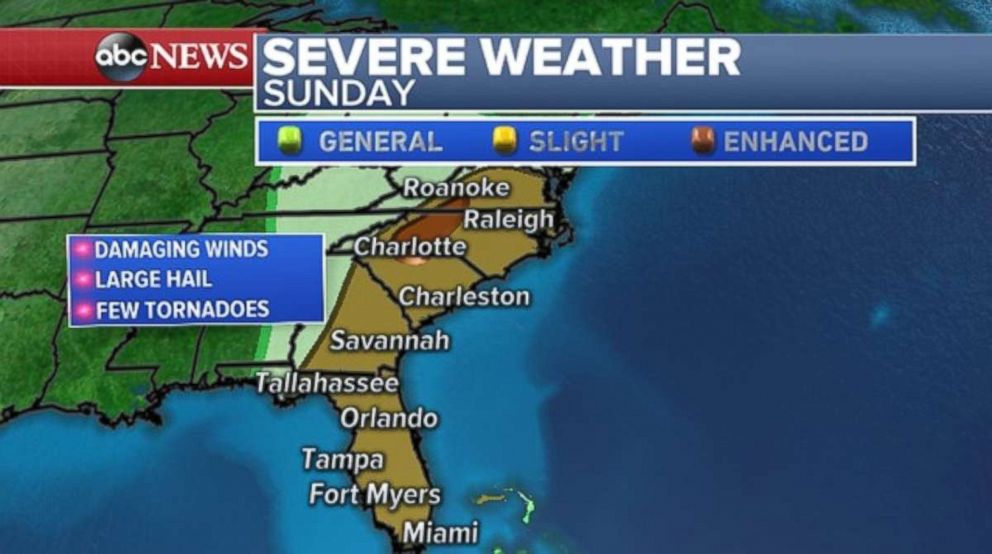
The tornado threat is locally enhanced in parts of the interior Carolinas and southern Virginia -- including Charlotte and Winston-Salem. A few tornadoes are likely in this highly populated area of the country and the impacts from severe storms could be notable.
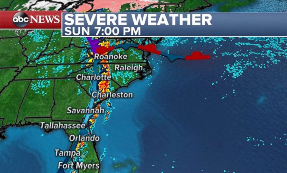
The slow-moving nature of the storms will also re-ignite a flash flood risk across nearly the entire Southeast coast -- with rainfall rates of 1 to 2 inches per hour likely.
Ice, rain in Northeast
Dangerous blizzard conditions caused a travel nightmare in parts of Minnesota, Iowa and Wisconsin on Saturday with multiple counties having to ban travel altogether due to whiteout conditions.
Minnesota State Police reported on Saturday night there had been over 400 crashes, 738 spinouts and 16 jackknifed semis. The snow fell so fast on Saturday that motorists all over the region became stranded due to rapidly accumulating snow. With 13.7 inches of snow in Sioux Falls, it is now the snowiest April day on record, and also has pushed April 2018 into the snowiest April on record.
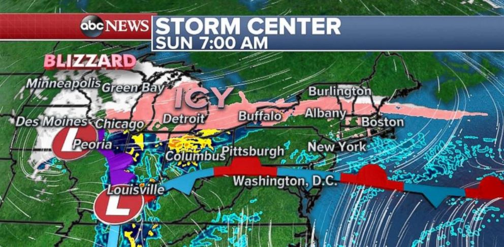
The storm will move to the east Sunday and Monday spreading snow and ice from Minnesota to Maine. The heaviest snow will move into Wisconsin and Michigan on Sunday.
On Sunday and early Monday, rounds of an icy mix are expected to stretch into parts of the interior Northeast. Sleet and freezing rain are expected from Buffalo to Boston. Travel will be treacherous in upstate New York -- especially near Buffalo and Syracuse -- due to icy roads. Icy roads are expected in parts of New England through Monday morning. Locally, half an inch of ice is expected.
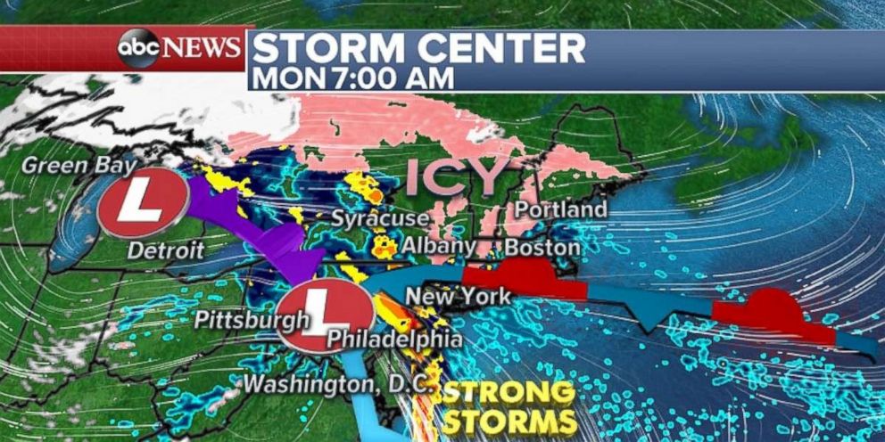
On the warmer side of this system, heavy rain and isolated strong thunderstorms will move over the Appalachians on Sunday and could bring flash flooding from Pittsburgh to Asheville, North Carolina. Then on Monday morning, the heavy rain will hit New York City and Philadelphia. Localized flash flooding is possible. Some isolated gusty thunderstorms will also be possible with a line of storms from Washington, D.C. to New York late Sunday into Monday.
Another temperature drop
After reaching the upper 70s on Saturday and 80s on Friday, the wind chill in New York City on Sunday morning is 40 to 50 degrees colder.
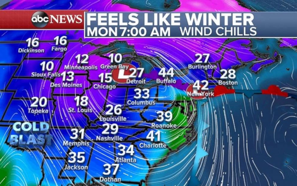
Behind the major storm, temperatures are plummeting in yet another return to winter. Wind chills through much of the central U.S. are in the teens and 20s Sunday morning. The cold air will move to the east with wind chills in the 30s all the way to the Gulf Coast by Monday morning.


