Flash flooding threat continues for East Coast after wet weekend
The Northeast received flooding rains over the weekend.
A slow-moving storm system and stationary front produced heavy amounts of rain for the Northeast this weekend and the area remained under siege Monday, as relentless rain turned neighborhoods and roads into swamps.
The stormy weather pattern continued as workers headed back to work Monday, attempting to cross through dangerous, fast-moving waters.
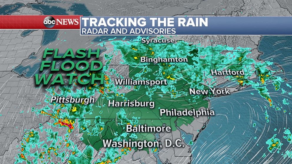
A new flash flood watch was issued for seven states Monday -- Virginia, West Virginia, Maryland, Delaware, New Jersey, Pennsylvania and New York -- due to more rain in the forecast. The rounds of heavy rain also prompted the cancellation of more than 1,000 flights and more than 4,000 delays at area airports.
There were water rescues across Pennsylvania Monday morning.
In Schuylkill County, boat after boat shuttled trapped residents to higher grounds. Outside of Philadelphia, first responders used ropes to rescue residents from apartments after a foot of water rushed into their homes.
"Everything was wet," Brachi Bais told ABC station WPVI-TV. "I was so scared."
Three inches of rain an hour left the Schuylkill Expressway and Pennsylvania Turnpike under water, engulfing cars, during the height of the morning commute.
And in Upper Darby, police said that several citizens needed to be rescued from flash floods in the morning.
"Cops were losing equipment right off their belt," the department tweeted. "An officer is being treated at [a] hospital as he was almost swept away."
In Lynn, Massachusetts, just north of Boston, 8.14 inches of rain fell over the weekend -- stalling cars and trapping drivers. The flooding was so bad in Little Falls, New Jersey, that cars were washed down a local creek like toys.
A low pressure system will move up the coast Monday bringing more rain this afternoon and evening from the mid-Atlantic into the Northeast.
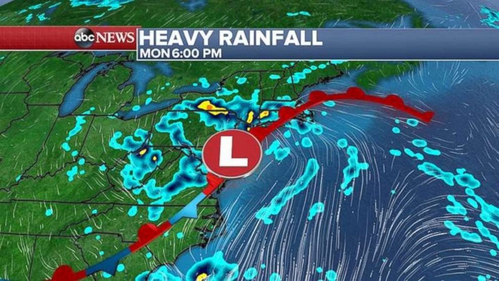
Heavy rain is forecast for the Northeast, with the heaviest coming from Pennsylvania into western New York. Locally, more than 4 inches of rain is possible.
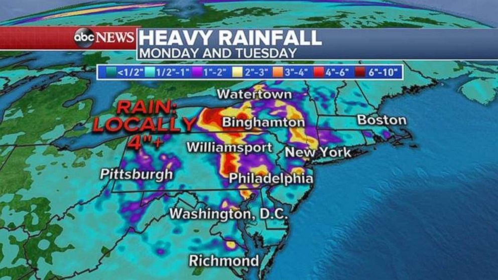
More heavy rain is also forecast for parts of Texas and into the southern Plains, but the rain is much needed there since parts of the area are under a drought.
Western heat, fire conditions
There was a slight reprieve from the extreme heat, dry conditions and gusty winds over the weekend for most of West Coast.
Temperatures will be back on the rise in the Pacific Northwest on Monday though, and gusty winds and dry thunderstorms are possible this week.
Fire watches and warnings have been issued for five states because of the erratic gusty winds forecast: Wyoming, Nevada, California, Oregon and Washington.
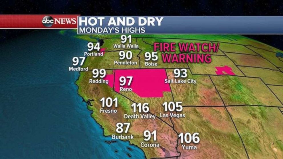
Temperatures in Portland will reach nearly 100 degrees, and Seattle will see readings into the 90s.
There will not be a record heat in California, but it will stay hot and dry with temperatures near 100 degrees for most inland areas, from Redding to Bakersfield.
Related Topics

Related Stories
ABC News Live