Hurricane Joaquin Strengthens to Category 4 But Expected to Miss US
Forecasters suggest that the storm is likely to stay out to sea.
— --
The Hurricane:
A looming hurricane that some thought was headed right toward the U.S. East Coast as it gained strength appears now to be headed out to sea and will possibly miss the U.S. altogether. The National Hurricane Center it is "optimistic" that the Carolinas and mid-Atlantic states will avoid the direct effects from Hurricane Joaquin.
But Hurricane Joaquin was upgraded to a Category 4 storm earlier on Friday, according to the latest reports from the National Hurricane Center.
"Hurricane Joaquin is now an extremely dangerous Category 4 Hurricane wreaking havoc in the central and eastern Bahamas tonight through Friday morning," ABC News meteorologist Melissa Griffin said. "It then turns north and begins a weakening trend."
Where Is It Headed Next?
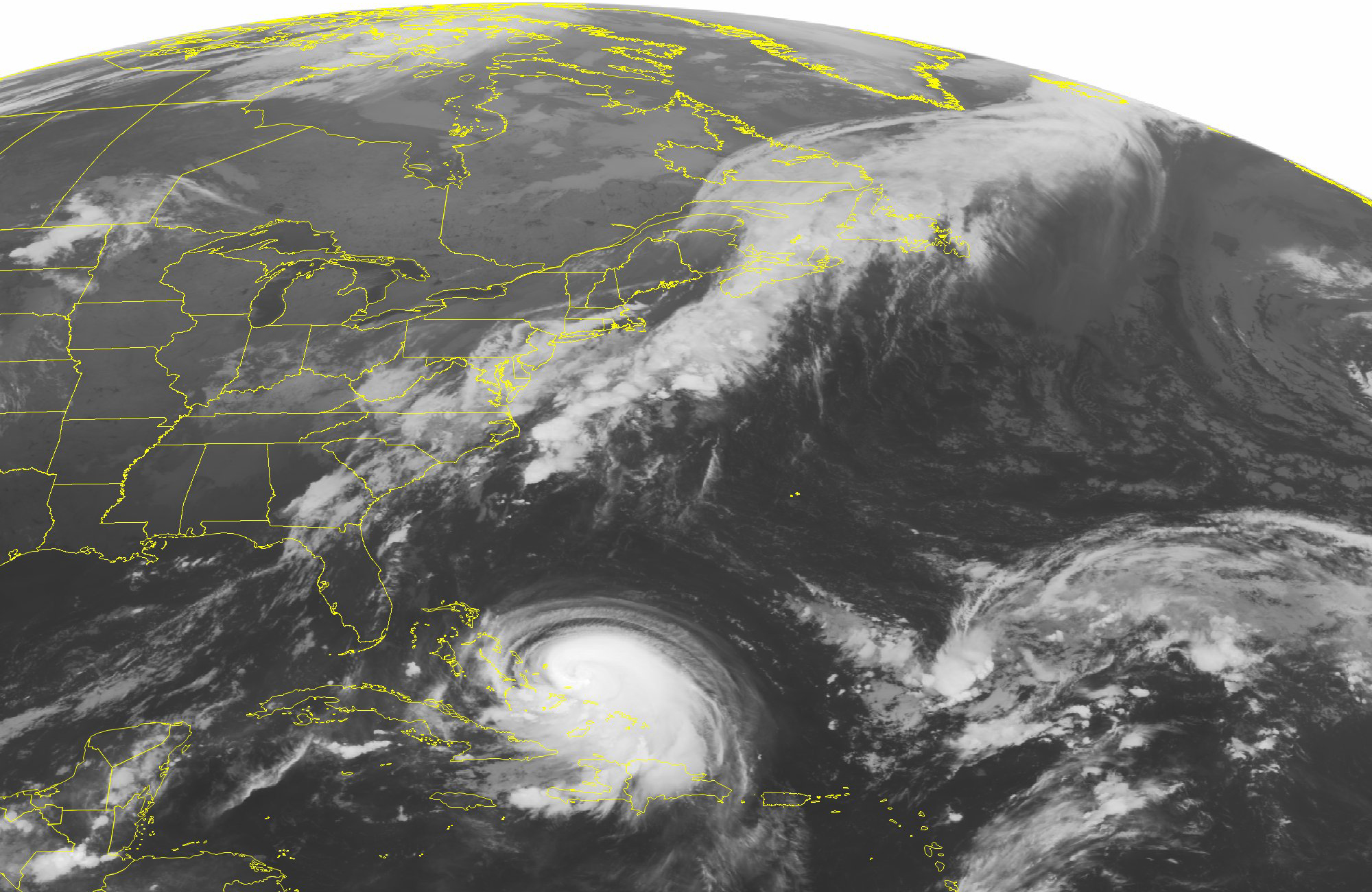
The hurricane reached the Bahamas Thursday afternoon and was expected to stay in the area for at least another day before likely turning out over the Atlantic Ocean. As of Thursday evening, the Carolinas and Virginia were no longer in the cone of uncertainty.
The time that the hurricane spends in the Bahamas serves to strengthen it further, as the warm waters in the area enabled the storm to pick up steam and jump to a Category 4 storm, which is qualified as a storm with winds exceeding 130 mph.
“We still don't know where Joaquin will go next,” Craig Fugate, the administrator of the Federal Emergency Management Agency, said at today's new conference. “We’re not taking any chances; that’s why we’re telling the public to make sure you have a plan and get ready."
Will It Hit The East Coast?
While the potential impact on the Bahamas is clear, with weather experts predicting huge waves of up to 30 feet and a storm surge that could go up to 8 feet, the fate of the U.S. East Coast was uncertain earlier but now seems to be less troublesome.
The Global Forecast System, widely known as the model used to predict U.S. weather, now suggests that the hurricane is most likely to stay out to sea.
The GFS's earlier prediction that the storm would make landfall in the United States ran counter to the European model, which has been consistently saying the hurricane would remain largely over water.
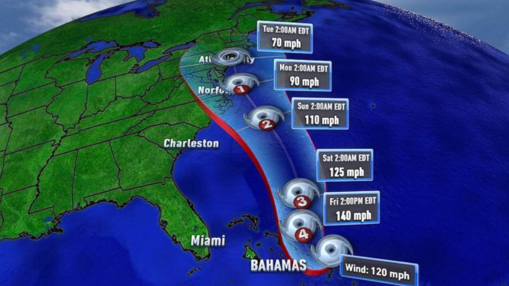
"There's still a distinct possibility that this could make landfall somewhere in the U.S.," meteorologist and hurricane center spokesman Dennis Feltgen told The Associated Press.
The U.S. National Hurricane Center had predicted that the storm effects will be close to both North Carolina and Virginia Sunday, according to the AP.
What Is Being Done to Prepare?
Precautions are underway, nevertheless, with governors in many coastal states warning residents to be ready for wet storms, power outages and road closures.
States like New Jersey and New York that were devastated by Hurricane Sandy in 2012 are particularly wary.
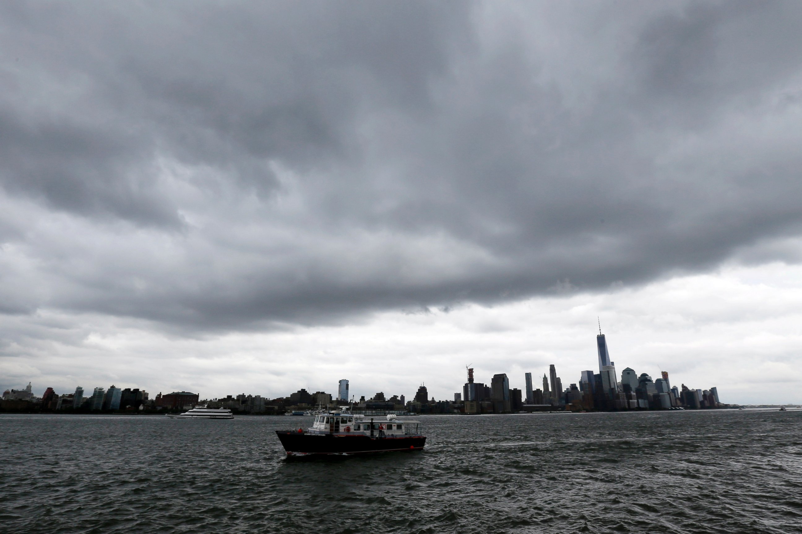
"Our state has seen the damage that extreme weather can cause time and time again," New York Gov. Andrew Cuomo said, according to the AP.
Today, Gov. Chris Christie declared a state of emergency in New Jersey, as have governors in North Carolina, South Carolina and Virginia.
“The immediate threat is for severe flooding on Friday and Saturday, the second is tracking the path of Hurricane Joaquin as those forecasts become clearer over the next 24 to 72 hours,” Christie said in a statement today.
Where Is the Storm Right Now?
ABC News will be running a live radar tracker throughout the day, seen below:

Popular Reads
ABC News Live