Large storm system moving into Northeast with snow, freezing rain
The storm caused numerous accidents in the Midwest overnight.
— -- Freezing rain was responsible for numerous accidents, spinouts and crashes from Texas to Arkansas and into the Ohio Valley overnight as a potent winter storm moved into the Northeast on Wednesday.
Twelve states are under winter weather alerts from Maryland to Maine on Wednesday as the storm system stretches from the deep South to New England.
Earlier today, severe storms plagued the South, with a strong line of thunderstorms bringing wind damage and downed trees to parts of Alabama and Georgia. Tornado warnings had been issued in northern Georgia, but none were reported.
Icy and snowy roads wreaked havoc on the Ohio Valley to the Northeast. Accidents on the Tappan Zee Bridge over New York's Hudson River shut down both lanes, causing a traffic standstill.
Hundreds of flights out of New York City's three airports were canceled due to the inclement weather, while in Baltimore, a Southwest plane skidded off the runway due to icy conditions.

The snow and ice ahead of the storm hit Louisville, Detroit and Cleveland overnight, and moved into Washington, D.C., Philadelphia and New York City Wednesday morning.
In the Deep South, along the cold front, strong to severe storms are moving through Louisiana, Mississippi, Alabama and Georgia. Some of these storms could bring gusty winds, hail and even a chance for an isolated tornadoes.
By the evening commute, heavy rain will continue for I-95 corridor from Philadelphia to Boston and snow will continue for New England and upstate New York around Albany.
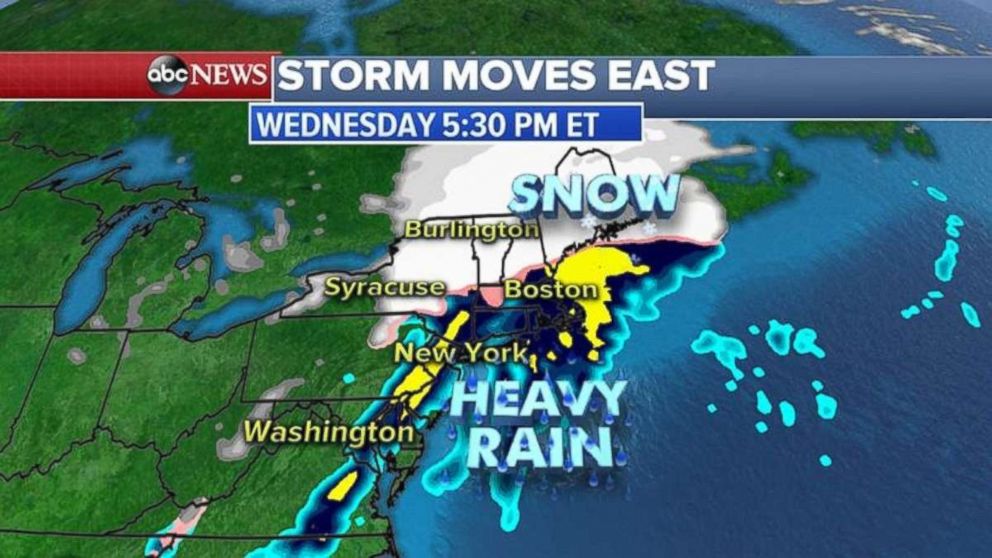
The heaviest snow will fall from western Pennsylvania into central New York and into New England where locally 6 to 12 inches of snow is possible. Some areas in the higher elevations could see more than a foot of snow.
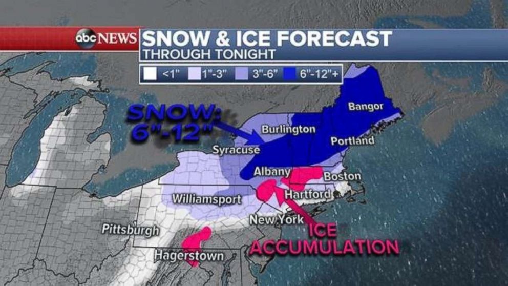
The highest ice accumulations will be in southern Pennsylvania, the Hudson Valley in New York and into southern New England, and heavy snow will continue through tonight in Vermont, New Hampshire and much of Maine.
In the South, the thunderstorms that have already caused severe damage will continue to progress east, bringing even more brutal winds, hail or possible tornadoes before it moves off the coast this evening.
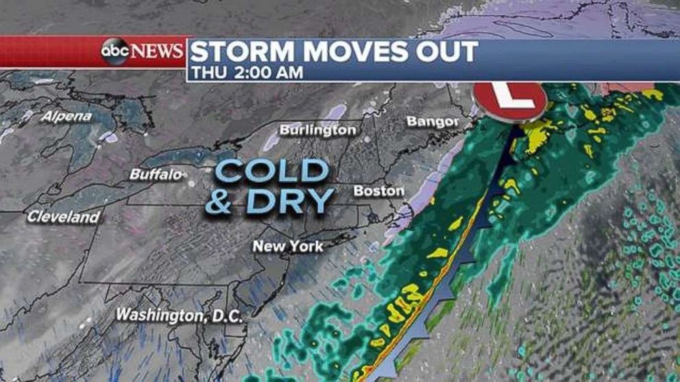
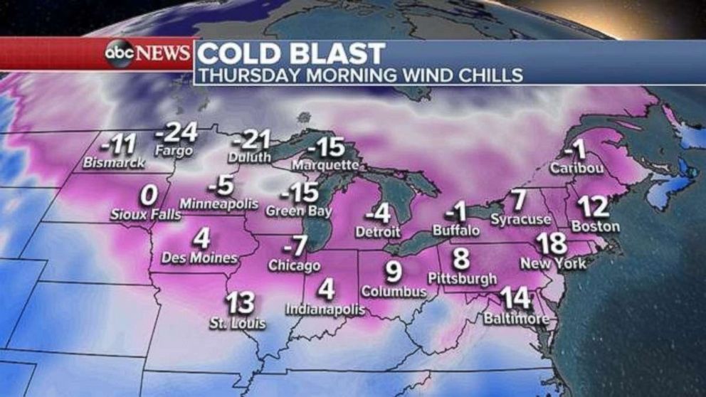
Once the storm travels into the Atlantic, colder and drier air will replace it, with wind chills below zero in the upper Midwest and the eastern Great Lakes. Wind chills will be in the single digits from the Ohio Valley to the Northeast, while Baltimore to Boston will experience wind chills in the teens.
Behind this storm system, a new storm is dropping out of Canada and is expected to bring more snow for the Midwest and Northeast for Thursday through Saturday morning.
Winter storm watches already being posted from the northern Rockies into Chicago for the end-of-week storm.
Related Topics

Top Stories
ABC News Live