Mild temperatures for Northeast and mid-Atlantic, Southeast braces for heavy rain
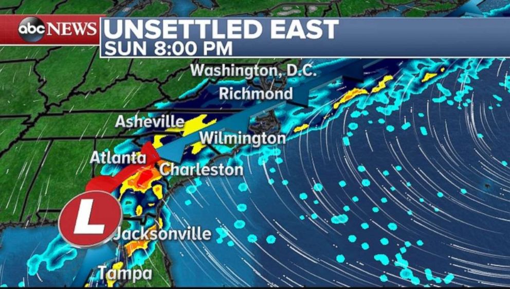
The Southeast is bracing for heavy downpour on Sunday.
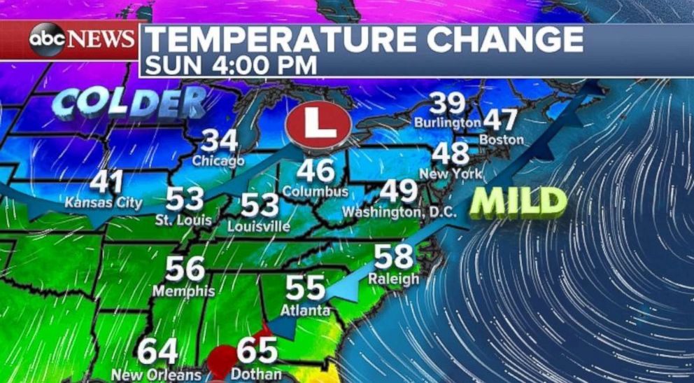
— -- Residents of the Northeast and mid-Atlantic, don't break out the hardcore winter gear quite yet: It will be another mild day on Sunday for most areas in those regions.
With temperatures nearing the 50s or higher again, from Washington to Boston, temperatures will be nearly 10 to 20 degrees above average. The mild air is reaching all the way to the Northeast's border with Canada, where temperatures are nearing the 40s or higher, all the way up through Upstate New York State and Vermont.
But all good things must come to an end. A developing system along the Gulf Coast brought heavy rain to parts of Texas and Louisiana on Saturday. It was actually the wettest day in Baton Rouge, Louisiana, in over a year, with nearly 4.5 inches of rain
The aforementioned system will bring heavy rain to the Southeast coast on Sunday, from Tampa north to Richmond, Virginia. On Monday, the storm will get a little more organized and potent and head north and east over the Atlantic Ocean.
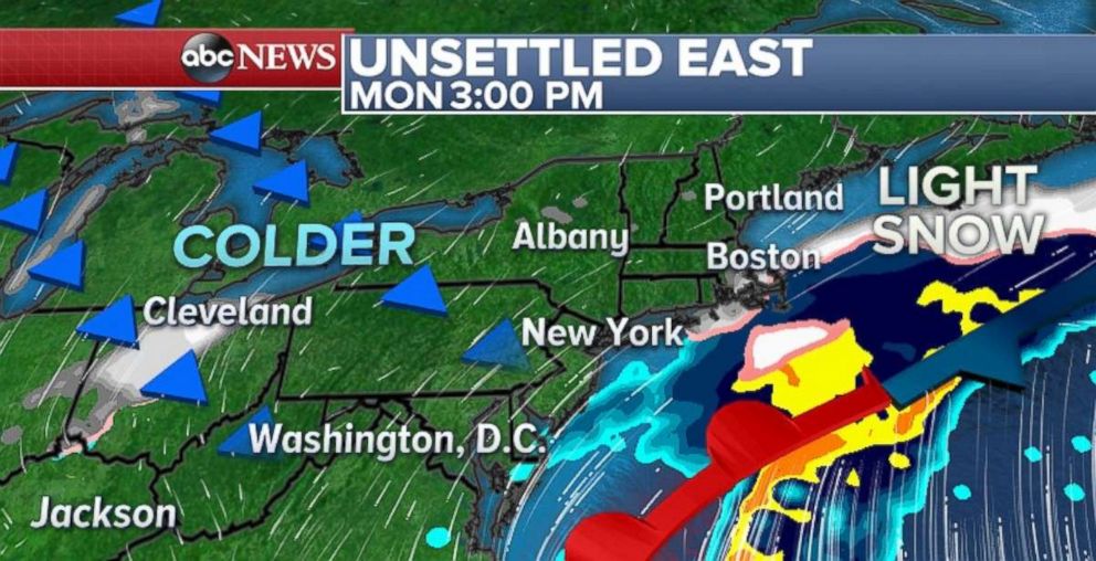
The storm appears to be just far enough to spare significant impacts to the Northeast. There is a low possibility that some snow will reach the immediate Northeast coastline on late Monday and Tuesday, but accumulations should be rather light.
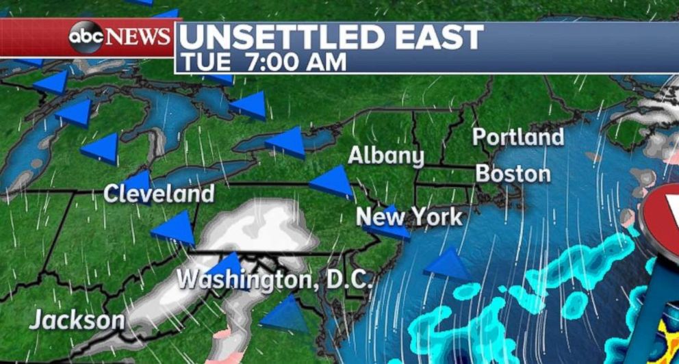
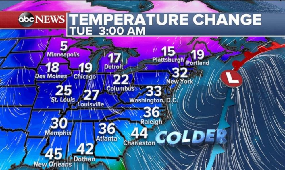
On Tuesday, reinforcing cold air coming in behind the system will bring an area of light snow that should track towards the mid-Atlantic. Accumulations, however, should remain rather light.
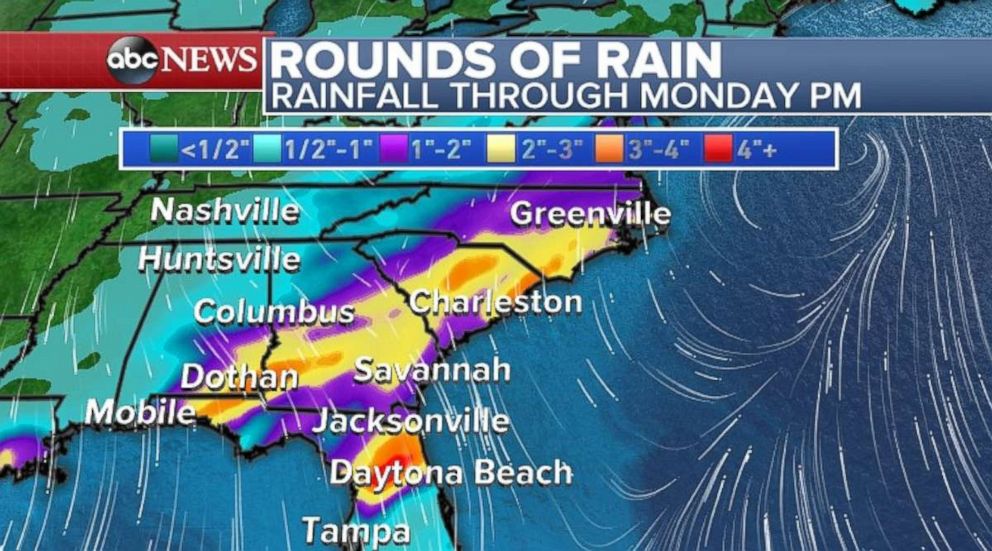
A widespread 2 to 3 inches of rain is expected across the Southeast through Monday. The region will certainly take the rainfall as most of this area is seeing drier than average conditions.
Behind this system is much colder air. By Tuesday morning, it will feel a bit more like winter again for the East Coast.
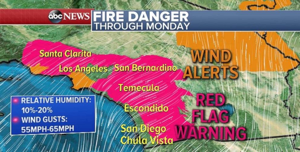
Santa Ana winds will continue Sunday across Southern California and last through Monday. Relative humidity values will be as low as 10 percent in the region. Winds could gust to over 55 mph in some areas of the hillsides. The strongest peak winds are expected Sunday morning in Southern California.
Because of this, there is a critical fire risk for most of Southern California, including the hills surrounding Los Angeles and San Diego. Red Flag warnings and wind alerts have been issued for parts of the region.
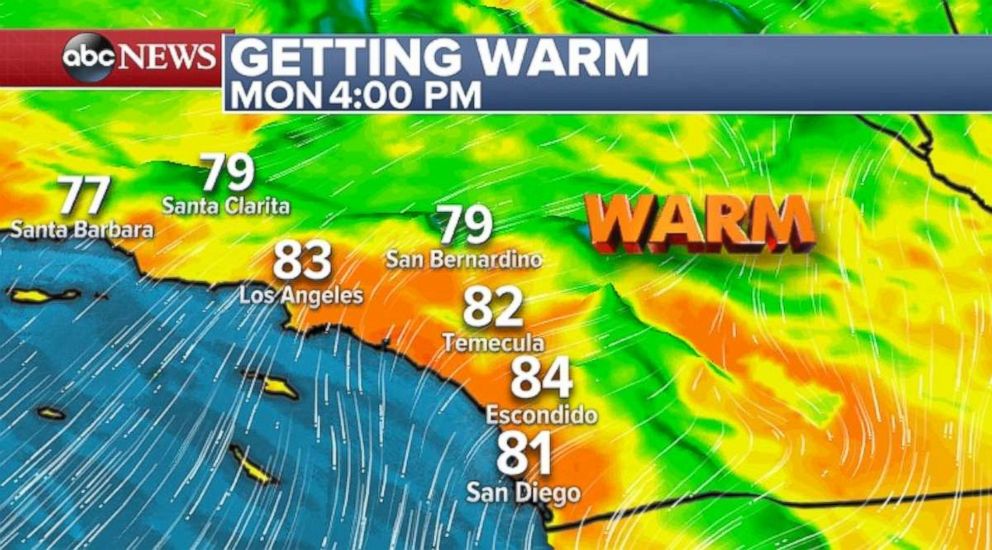
Temperatures will also increase to about 80 degrees or higher across the Los Angeles and San Diego metro areas. These temperatures will be nearing some records both today and Monday.
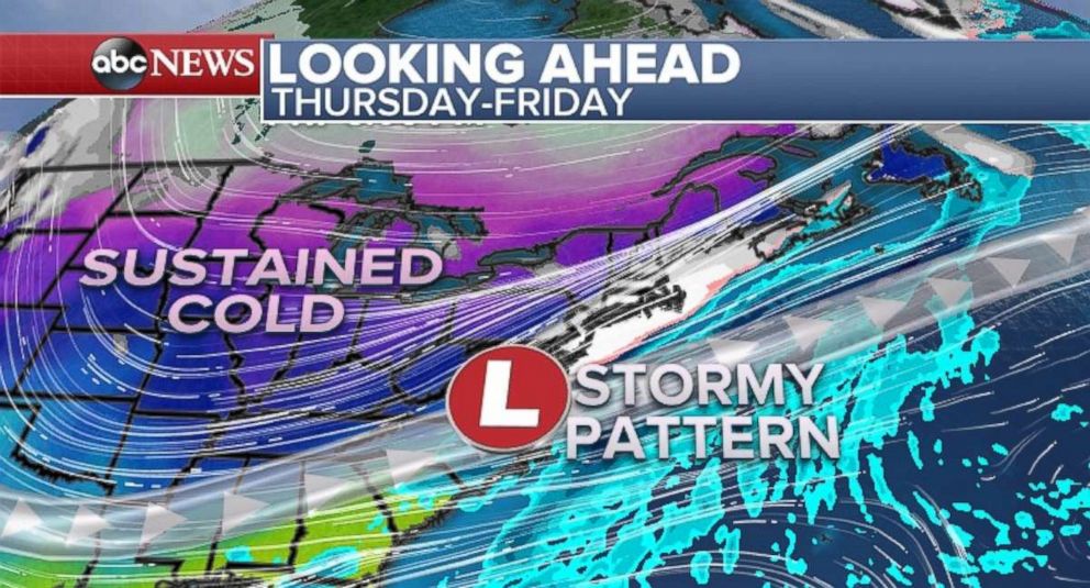
By the end of this week there should be another shot of cold air approaching the Central U.S. This one looks to be a little more pronounced and sustained compared to the past few weeks. Temperatures will likely be closer to below average for much of the Midwest and Central U.S., during the first few weeks of February.
After a break from wintry weather across much of the eastern half of the U.S., it appears the jet stream will start to favor a track to bring impactful storms to the region. By the end of this week,there is growing potential for more impactful weather to the eastern U.S.
But since any such event is still 5 to 6 days away, there is high uncertainty in the forecast. Therefore, it is too early to determine any specifics regarding impact.
Related Topics
