Risk of severe weather stretches across upper US
Washington state to New Hampshire may see extreme weather today.
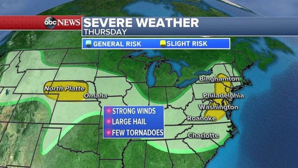
A risk of severe storms today stretches from Wyoming all the way to New Jersey.
In Wisconsin on Wednesday, two tornadoes were reported as more than 40 damaging storms were reported in Michigan and Illinois, where wind gusts exceeded 70 mph.
An active storm pattern should continue today in the Midwest, and it's moving farther into the Northeast.
Damaging winds and large hail would be the biggest threat for Binghamton, New York, to Philly to Washington D.C.
Tornado threat will be small in the Northeast, there a funnel cloud or two shouldn't be ruled out.
Another storm system in the Plains may bring severe storms to much of Nebraska.
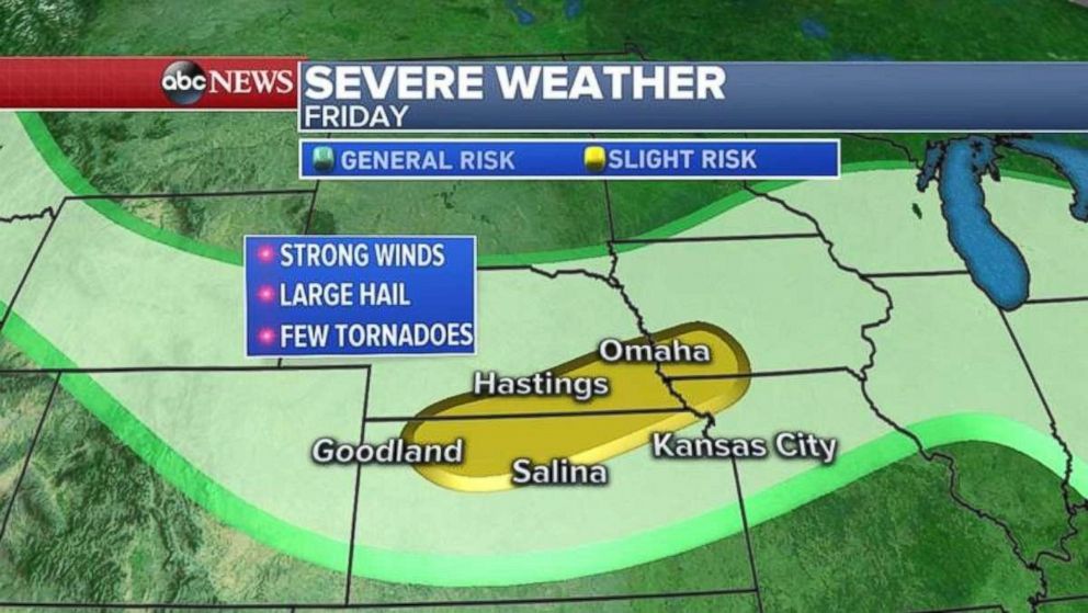
On Friday, more storms are expected in the Plains, not only in Nebraska but also Kansas, Iowa and northern Missouri.
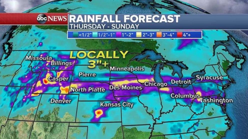
Rainfall is expected from the Rocky Mountains to the Northeast over the next few days, with some areas potentially getting more than 3 inches.
Related Topics

Popular Reads
ABC News Live