Two storms making mess across US; new nor'easter still uncertain
There is the potential for another nor'easter this week.
Two storms are moving across the United States on Saturday, bringing rain and sleet to the Midwest and snow to the Mountain West.
Storm No. 1 is bringing rain, sleet and freezing rain from Iowa into northern tornado.htm" id="ramplink_Illinois_" target="_blank">Illinois Saturday morning and will extend southeastward though West Virginia. Total ice accumulations of one-tenth of an inch or more are possible in some spots.
Meanwhile, storm No. 2 continues to bring snow to the Mountain West.
Moderate to locally heavy rain that triggered flooding in Mississippi on Friday is expected to wind down as a cold front moves into the Gulf Coast states Saturday.
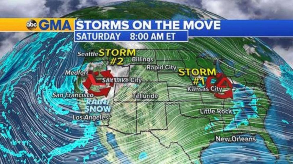
There is a slight risk of severe thunderstorms across parts of central and northern Texas on Saturday afternoon and a marginal risk exists across eastern parts of Kentucky and Tennessee this afternoon into southern Virginia and part of North Carolina this evening.
The main threats include damaging winds and large hail, and an isolated tornado cannot be ruled out.
As storm No. 2 approaches from the west on Sunday, there is a slight risk of strong to severe weather for Arkansas, Louisiana and Texas and the lower Mississippi Valley in the morning. Parts of Kansas and Oklahoma are susceptible during Sunday afternoon.
Challenging forecast for Northeast storm
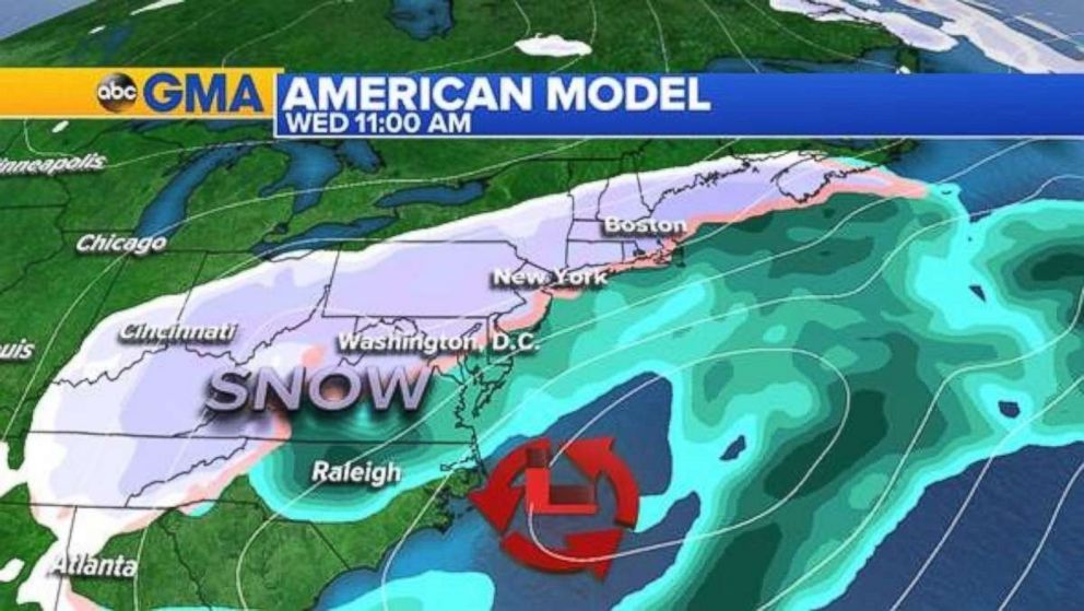
As an area of low pressure moves across the country it is forecast to develop into a coastal storm on Tuesday. The latest computer models have the track shifted further to the east at the moment.
Yesterday’s information implied a wide precipitation shield beginning Wednesday from the Ohio Valley to the Northeast as the storm tracked offshore.
The American model (GFS) from Friday morning showed a direct hit for the Northeast, including the major I-95 coastal cities. Take a look:
Now compare yesterday morning’s model run with the latest information from Saturday morning and it turns into a near-miss:
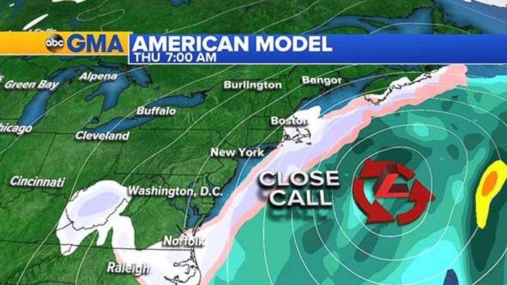
The location of the low is similar, but the precipitation does not extend as far inland.
The European model has a similar solution, keeping the bulk of the precipitation further south on Tuesday and Wednesday, then quickly sweeping the system offshore by Wednesday evening -- completely missing the Northeast.
Both models for now have that first round of snow, early Wednesday in the Appalachians, producing some accumulating snowfall.
But there are several moving parts that have to come together over the next 48 hours or so to give the models a better handle on what’s happening in the atmosphere.
Related Topics
