Heavy rain forecast today and tomorrow for the flooded South
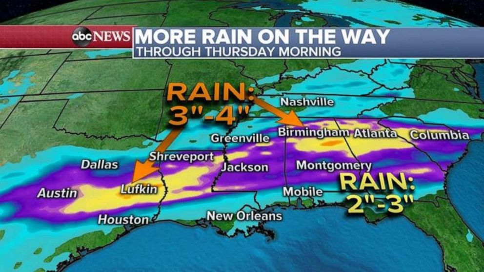
A Flash Flood Watch has been issued from Louisiana to Mississippi and Alabama.
The Pearl River in Jackson, Mississippi, crested yesterday morning at the third highest crest ever recorded in the city at 36.67 feet.
With more rain on the way, the river will continue to be in major flooding through the rest of today and then slowly recede by the weekend but will remain in flooding into early next week.
Because of more rain coming for the South in the next 48 hours, a Flash Flood Watch has been issued from Louisiana to Mississippi and into Alabama.
Flood Warnings continue for more than three dozen rivers and buoys across the entire South.
With this new storm, many areas will see up to 2 inches of rain with locally 3 or 4 inches possible from Texas to South Carolina including Mississippi.

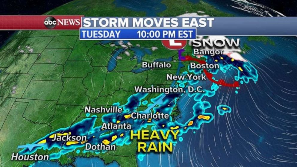
The same storm system that is bringing the rain to the South is also bringing heavy snow to the northern states from Minnesota to Michigan and over to New England.
Already almost 5 to 8 inches of snow fell in Minnesota and Wisconsin yesterday making roads very slick and causing multiple accidents on I-94 northwest of Minneapolis.
This storm moves into the Northeast and the East Coast today with snow for New England and heavy rain forecast for the Southeast.
Major cities along I-95 corridor from Washington, D.C. to Boston will mostly see rain with no snow forecast.

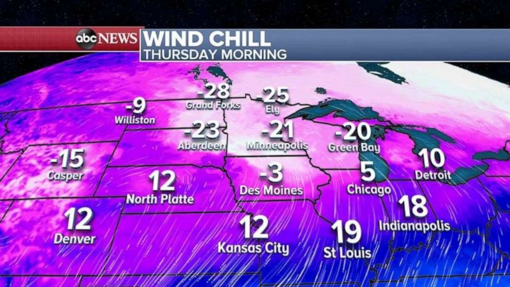
Behind this latest storm system, another cold blast is on the way from the Midwest to the Northeast.
The coldest morning in the Midwest will be on Thursday morning, when wind chills will be below zero in the Twin Cities and near zero in Chicago.

The core of the coldest air will move into the Northeast by Thursday night into Friday morning with wind chills in the single digits possible from New York City to Boston.


