Hurricane Eta, heading toward Central America, becomes Category 4 storm
As much as 3 feet of rain could fall on Nicaragua and Honduras.
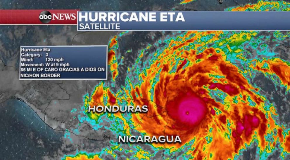
Hurricane Eta, which strengthened into a Category 4 storm on Monday, may dump as much as 3 feet of rain on several Central American countries this week when it makes landfall.
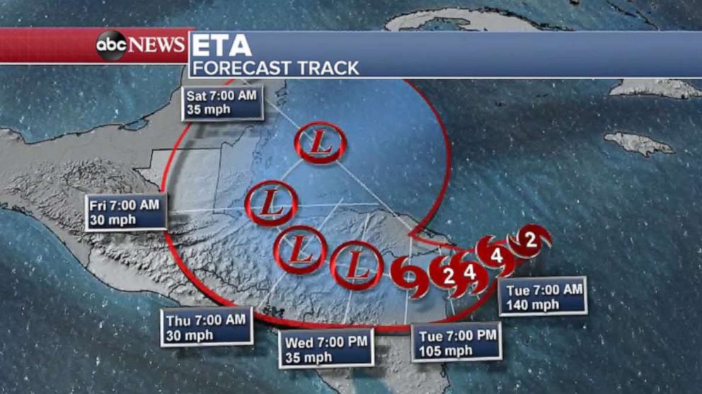
As of Monday night, the storm continued to strengthen and was about 70 miles east-southeast of the Nicaraguan-Honduran border and moving west-southwest at about 9 mph, with wind speeds greater than 150 mph, according to the National Hurricane Center. The storm is expected to strengthen into Category 5 hurricane right before making landfall along the Nicaragua coastline, according to the Air Force Reserve Hurricane Hunters. The NHC forecast said wind speeds could reach above 156 mph.
The most recent forecast on Monday for both Nicaragua and Honduras is 35 inches of rain, which could lead to deadly flash flooding or landslides.

Eta is predicted to create storm surge of 12 to 18 feet along the Nicaraguan coast, while catastrophic wind damage is expected Monday night into Tuesday morning near the storm's eyewall.
Hondurans and Nicaraguans already dealing with regional flooding now must prepare for Eta.

Parts of Belize and Guatemala also may see downpours in excess of 1 foot.
Eta is the 28th named storm of the 2020 Atlantic hurricane season, which ties 2005 for the most ever. The storm is currently tied with Hurricane Laura as the most powerful hurricane of the 2020 Atlantic season, and if it continues to strengthen, as forecasted, it will become the most powerful of the season.
It has already surpassed Hurricane Delta as the strongest Greek Alphabet hurricane on record for the Atlantic.

After making landfall in Central America, Eta could reemerge in the Caribbean Sea, restrengthen and head toward Cuba, several computer models show. Should that happen, the storm could move toward the Gulf of Mexico, affecting Florida.


