Powerful storm to bring blizzard to Colorado, dangerous winds to central US
The storm will bring dangerous weather to 100 million Americans.
A massive, powerful storm will overtake the central U.S. on Wednesday, bringing dangerous weather to 100 million Americans -- from crippling blizzard conditions to dangerous winds, heavy rain and severe thunderstorms. This storm will impact everyone from the Rockies to the Ohio River Valley, and from the Mexican border to the Canadian border.
The storm already brought two reported tornadoes, including one that reportedly destroyed 10 homes and injured five people, in Chaves County, New Mexico.
The same line of severe storms was rapidly moving across Texas early Wednesday. Some tornado warnings have been issued through the morning with this line of storm. The main threat with this line of storms is damaging winds. A severe thunderstorm watch is in effect for part of central Texas until 11 a.m. local time and southern Oklahoma until 9 a.m.
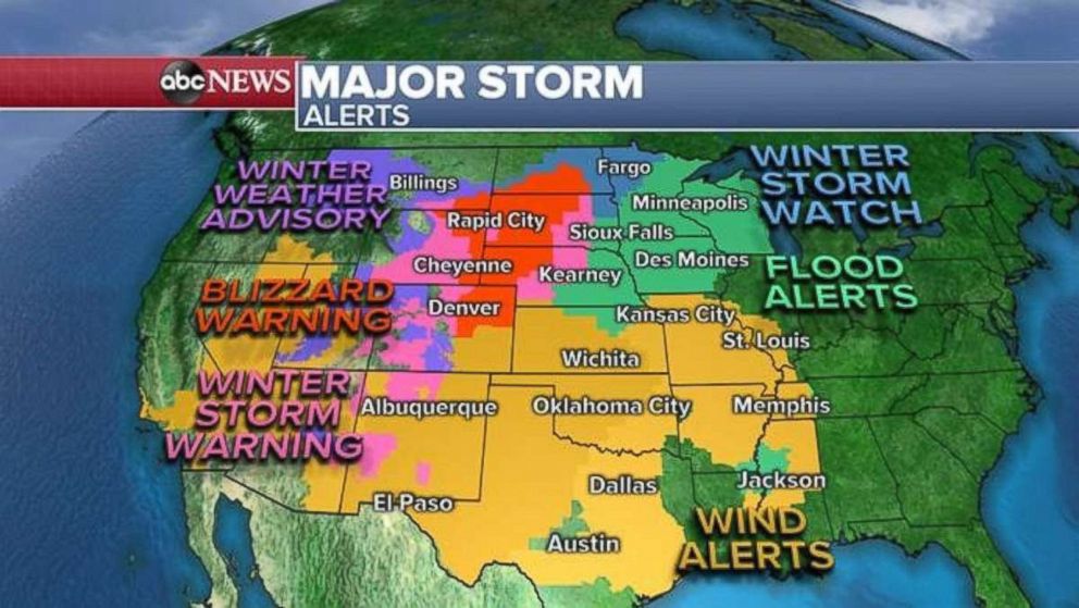
The storm is rapidly organizing Wednesday and will dramatically intensify through the day. The storm is clearly visible on radar with snow over the Rocky Mountains, and heavy rain and strong storms moving through the Central Plains. Wind alerts stretch form the Southwest all the way to the Mississippi River Valley.
Flood alerts have been issued for parts of the Upper Midwest for heavy rain combined with snow melt, and winter weather alerts stretch from the Rockies to northwest Minnesota. A blizzard warning is in effect from northern Colorado, including Denver, to southern North Dakota.
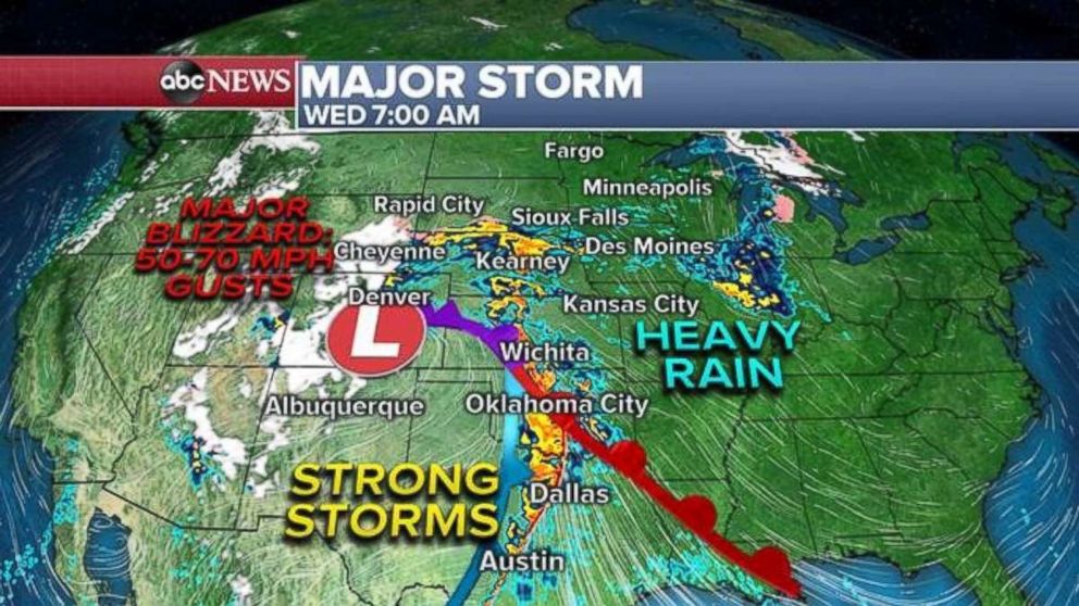
The storm will continue to rapidly intensify Wednesday morning and bring strong storms to the Southern Plains. Conditions will deteriorate in the High Plains, including Denver, late Wednesday morning. Winds will rapidly increase from Wyoming to New Mexico throughout the day.
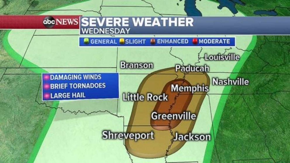
Out ahead of this major storm, severe weather will develop across the Mississippi River Valley from Louisiana to Kentucky, including Memphis, Tennessee, and Little Rock, Arkansas. Damaging winds are the main threat but brief tornadoes cannot be ruled out.
A crippling blizzard will develop by Wednesday night across parts of the High Plains from Colorado to South Dakota. Wind gusts of 50 to 70 mph, combined with snowfall rates of 1 to 2 inches per hour, will cripple travel and make it extremely dangerous to venture outside.
Heavy rain will move into the Upper Midwest. Although rainfall totals should will not be prolific, heavy rain combined with rapid snow melt will cause flooding issues, especially along rivers across the Upper Midwest.
As the storm intensifies, wind gusts will dramatically increase across nearly the entire central U.S. Wind gusts over 50 mph are likely across nearly the entire region. Wind gusts this high could cause widespread power outages and damaging winds.
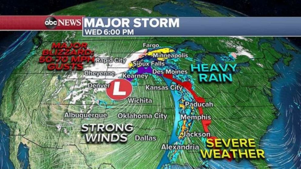
By Thursday morning, snow will have moved farther north into the Dakotas. Strong winds will wrap around the storm into the Central Plains. The severe weather threat will slide slightly east stretching from Michigan to Mississippi.
Wind gusts approaching and exceeding 50 mph will be possible across the Northern Plains, Upper Midwest and into some parts of the Ohio River Valley.
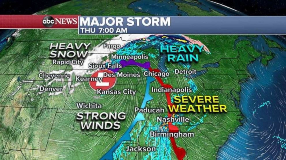
The storm will move into southern Canada and track across the northern Great Lakes late Thursday. However, it begins to weaken and lose its intensity. At this time, no significant or notable impacts are expected along the East Coast from this storm.
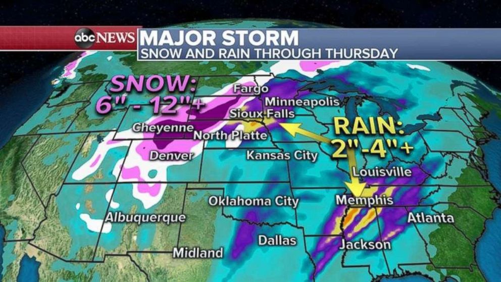
Locally, over a foot of snow is possible from Colorado to South Dakota, with wind gusts of 50 to 70 mph. Snow drifts in this region could be excessive and dramatic.
The Upper Midwest and Tennessee River Valley could see 2 to 4 inches of rain in places.
Looking ahead to the weekend, there will finally be a break in the active weather with no major weather concerns across much of the U.S.


