River flooding continues in Midwest with more rain heading toward region
Also, temperatures will feel more like winter in the Northeast on Saturday.
The Missouri River and Mississippi River continue to wreak havoc on parts of the Plains and Midwest as record river flooding continues to pose a threat to communities.
Parts of the Missouri River near St. Joseph, Missouri; Atchison, Kansas; Leavenworth, Kansas; and Parkville, Missouri, are seeing river flooding currently at -- or expected to rise to -- moderate and major flood stage. The Missouri River is receding below notable flood stage in Omaha.
However, the Missouri River is expected to flood downstream near Plattsmouth, Nebraska, through next week. The flooding will continue to cause stress on levees along the Missouri River.
There is also river flooding on the Mississippi River along the borders of Illinois, Iowa and Missouri. The river will likely remain high through the weekend.
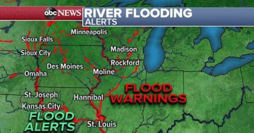
In Minnesota and Wisconsin, gradual snow melt will cause rising river levels into next week. Flooding could occur due to ice jams as well.
Rainfall is expected to move into this area on Saturday, with a storm developing and moving across the Plains. Locally, a half inch or more of rain is possible in this region through this weekend.
The rain should not have a major influence on area rivers, but there is potential for some local exacerbation of ongoing river flooding.
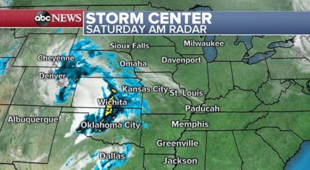
The storm entering the Plains was responsible for three reported tornadoes on Friday in parts of Texas and Colorado and hail over 2 inches in diameter across parts of Texas.
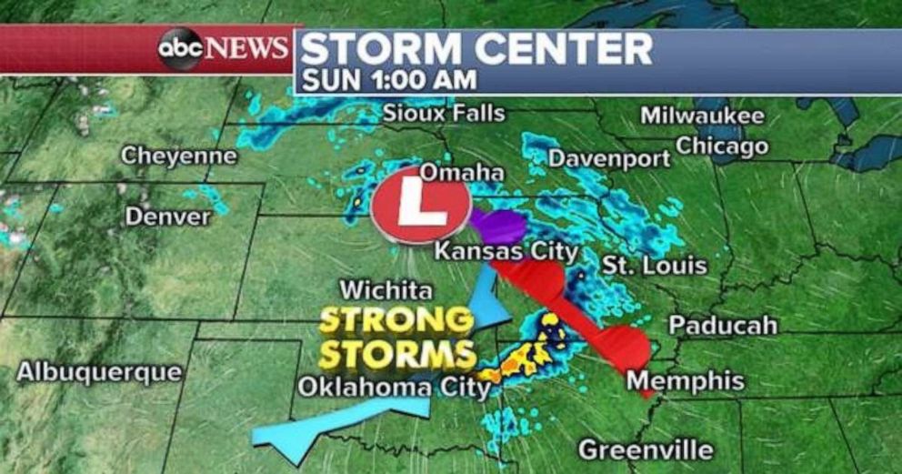
The storm will move fairly quickly and not strengthen tremendously, therefore impacts should be marginal across the Plains this weekend. Some rain will move across Plains into Sunday morning. A few strong thunderstorms will move across Oklahoma and Arkansas, however, the threat should remain marginal, with gusty winds and some hail being the concern.
Northeast feels chill on Saturday, spring on Sunday
A coastal storm that brought rain and some coastal flooding to the Interstate 95 corridor is moving out of the area Saturday morning.
Parts of the interior Northeast, especially in the higher elevations west of Albany, New York, reported nearly 4 inches of snow on Friday. Overnight, there were reports of over 10 inches across the mountains of Vermont and New Hampshire.
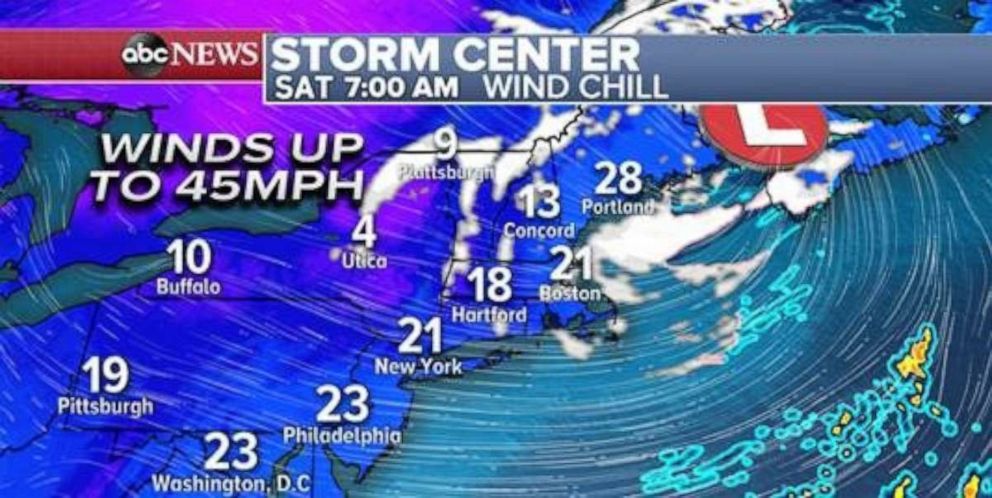
A couple of snow showers will be in the region Saturday, along with gusty winds at time approaching 45 mph. It will feel quite cold in the Northeast for late March with wind chills in the 20s and teens for a large part of the region.
Relief will come as early as Saturday afternoon, with Sunday temperatures much more seasonable. Temperatures will rise into the 50s, and evens some 60s, across the I-95 corridor.
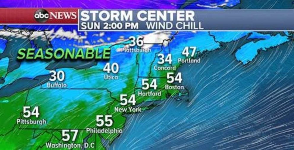
Another March chill will arrive on the East Coast early next week.
Weak storms impacting West Coast
A storm is arriving Saturday in the western U.S. and bringing some heavy rain to parts of California and some mountain snow to parts of the Sierra Nevada Mountains.
Locally, up to 1 foot of snow is expected in the Sierra Nevada Mountains this weekend.
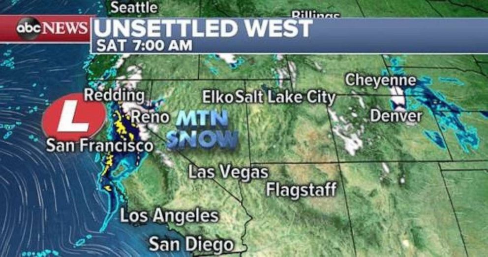
Another storm will arrive in the region on Sunday night and early Monday with heavy rain mainly concentrated in Northern California.
A more-potent storm will arrive in the middle of the upcoming week that could have significant impacts across parts of the region.


