Severe storms move through heartland, Southeast as heat wave begins in West
Severe storms moved through the Plains and the Southeast Tuesday.
Severe Storms
Severe storms moved through the Plains and the Southeast Tuesday, with seven tornadoes touching down in Colorado and Minnesota. Winds gusted to 80 mph in Nebraska and 82 mph in Kansas, where semi-trucks were flipped over on I-70, blocking traffic on the interstate.
Huge hail up to 5 inches in diameter was reported in Colorado, and 2 to 3 inches of rain fell in central Illinois, causing flash flooding in some areas. Flash flooding was also reported in the Minnesota's Twin Cities, where a quick 1 to 3 inches of rain flooded streets.
In the Carolinas and Tennessee, severe storms produced gusty winds near 60 mph, leading to damage near Nashville.

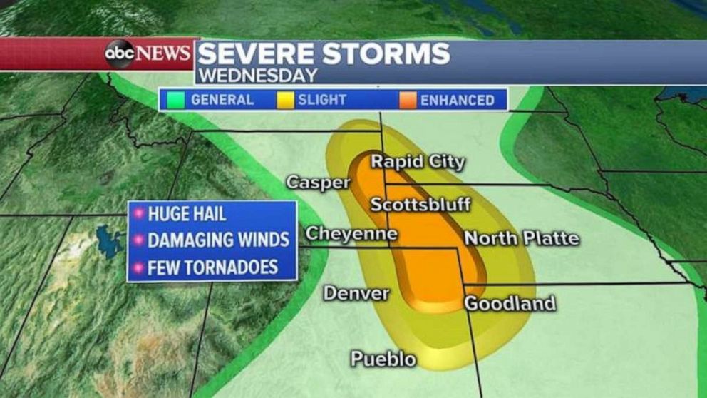
On Wednesday the greatest severe storm threat continues into the Great Plains, from Kansas ad Colorado into Nebraska, Wyoming and South Dakota, where huge hail, damaging winds and a few tornadoes are possible.
Summer Heat
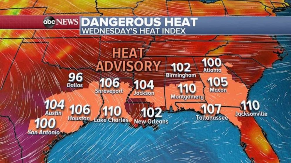
Houston reached 103 degrees Tuesday, marking the warmest temperature in the city since 2015. Some of the heat will break in the mid-South as the storms move in Wednesday afternoon, but a lot of the Gulf Coast from Houston to Tallahassee and even into Atlanta will continue to be dangerously hot and humid.
Seven states from Texas to South Carolina are under Heat Advisory Wednesday, with the heat index expected to reach near 110 degrees.

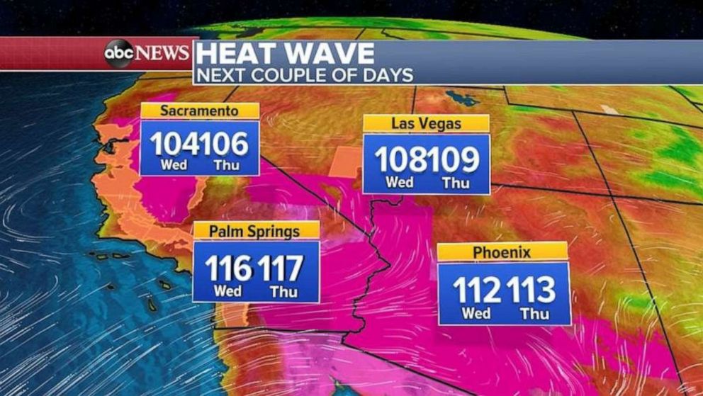
The heat wave is just beginning in the West, where California, Nevada and Arizona are under heat warnings and advisories. Some areas in the Southwest could reach higher than 115 degrees.
Even the usually cool San Francisco Bay area is under a Heat Advisory, with temperatures possibly reaching into the mid to upper 90s.


