Snow moves into Northern Plains as Midwest, Northeast brace for arctic cold
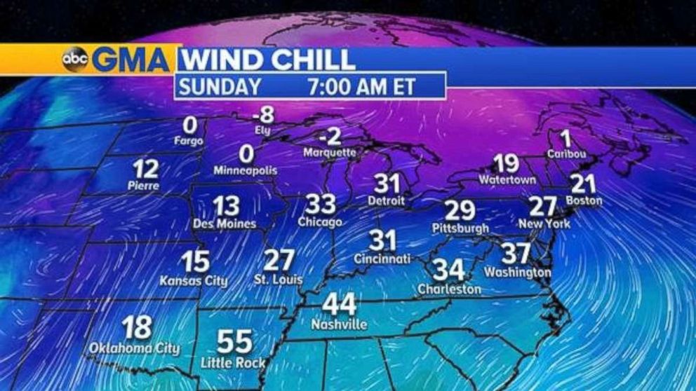
Wind chills will be in the 20s and 30s in the Midwest and Northeast Sunday.

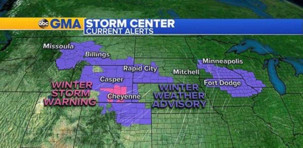
Winter weather alerts are in place across nine states on Saturday as a clipper system will deliver snow from the Rockies through the Central Plains into the Great Lakes.
Slick travel conditions are to be expected Saturday morning.
Snow associated with a cold front is being pushed to the south by an arctic high pressure system to the north. The snow will begin in Wyoming and move south through the day, ending in Colorado and northern Kansas. Another area of snow will be working through the Great Lakes region Saturday.

Snowfall totals in the Rockies will be 1 to 3 inches throughout the area and up to a foot in higher elevations.
Further east, the snow associated with the low pressure brings will generally bring 1 to 3 inches of snow to parts of Iowa, Wisconsin and Illinois. There will be slippery driving conditions during the early part of the day.

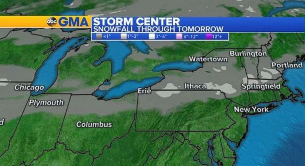
A weak cold front will push across the Great Lakes and bring light snowfall into interior New England through Sunday.
Snowfall accumulations are expected to be low, but roadways will be slick, especially overnight Sunday into early Monday when there is the risk for re-freezing.

It will be cold on Sunday for a majority of the country due to the arctic air being ushered in by the high pressure in the Plains. Wind chills will be in the 20s Sunday morning in New York City. It will feel like minus 8 degrees in Ely, Minnesota.


