Strong storms, heavy rain threaten Northeast and Mid-Atlantic
There were six reported tornadoes in three states on Friday.
People will be dodging raindrops across much of the East Coast for the first half of the weekend.
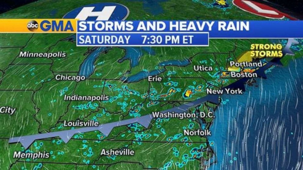
Showers and thunderstorms will pop up throughout the early afternoon Saturday in the Mid-Atlantic and Northeast. Storms are expected to become more robust in the Northeast in the evening hours as the cold front passes through. Damaging winds and possibly some small hail, especially in coastal Maine and southern New Hampshire, are possible.

General rainfall totals from Saturday’s frontal passage will amount to about 1 inch. However, some areas could see locally heavy downpours resulting in rainfall totals close to 2 inches within a few hours. This could trigger flash flooding from central Ohio through the Appalachian Mountains and into coastal New England.
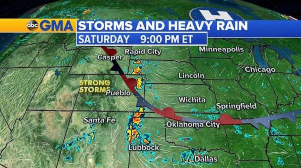
As a stationary boundary creeps through the mountain west Saturday evening it will produce showers and thunderstorms. There is the potential for some storms to be severe in Wyoming, Colorado, South Dakota and Nebraska.

Saturday’s severe threats are large hail and damaging wind gusts with a few tornadoes also possible. Heavy downpours will also be associated with the storms.
Oppressive heat
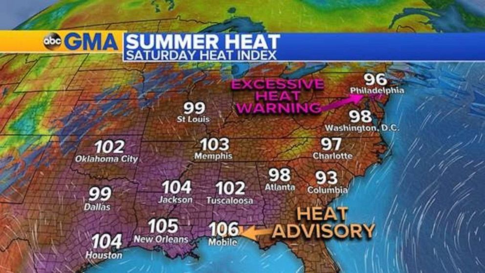
The combination of high temperatures coupled with very moist air is bringing the heat index value near 100 for much of the Southeast and into the Midwest and Mid-Atlantic. This can be considered dangerously hot for people with health problems or without access to air conditioning.
A heat advisory is in effect until 7 p.m. Central time for Alabama and the Florida Panhandle. An excessive heat warning is in effect for the Philadelphia area until 7 p.m. Eastern time.


