Winter storm bids farewell to the snow-covered Northeast, blast of cold air is next
Following the snow, a bitter blast of cold air is expected mid-week.
— -- So long, snow.
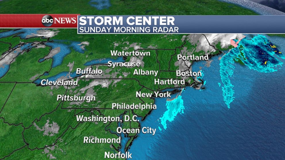
After a winter storm dumped the white stuff on parts of the Gulf Coast and Southeast on Friday, the mid-Atlantic, Northeast and New England were hit with heavy snow on Saturday. But as of Sunday morning, the storm is leaving the Northeast.
Final snow totals in northern Georgia approached nearly one foot, while more than 10 inches of snowfall was reported in western North Carolina.
Farther north, in the Washington, D.C area, 2 inches of snow was reported at Ronald Reagan Washington National Airport, 2.6 inches was reported at Baltimore-Washington International Airport, and 4 inches was reported at Washington Dulles International Airport. All of the aforementioned figures are all new daily snow records.
While the storm may have left the South and East Coast, as of Sunday morning, 40,000 customers were still without power from Georgia to New Jersey. This is an improvement, though, from thenearly 275,000 outages on Saturday afternoon.
The South was hit with the first measurable snowfall to the region. In fact, there's more snow on the ground in parts of the South than Minnesota's Twin Cities have seen all season. There's only been 3.1 inches to date in the Twin Cities.
Now, back to the Northeast. The storm is pulling away from the Northeast Sunday morning. Snow will continue to taper off from west to east through the morning hours with much calmer weather expected through Sunday.
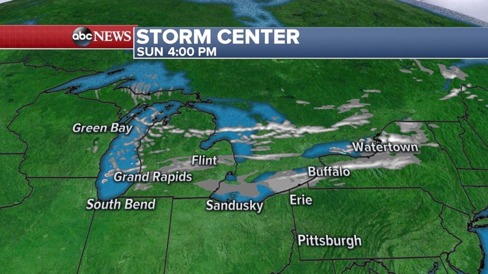
The main concern Sunday will be patches of ice from melting and refreezing of snow. Behind this storm, lake-effect snow will continue again Sunday across the Great Lakes region.
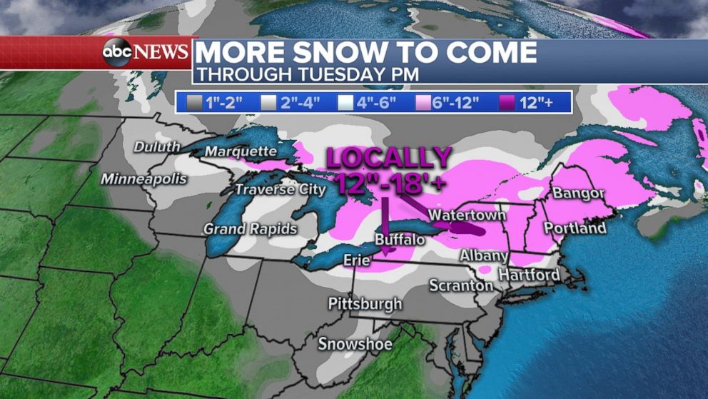
Upstate New York, from Buffalo to Watertown, may experience significant lake-effect snow, with up to 18 inches in the forecast. Travel delays in parts of New York State and Michigan are possible as a result.
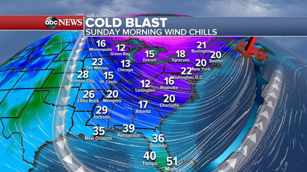
Cold air is locked in place for much of the eastern U.S. Sunday morning. The most notable area of cold air is Florida, where wind chills in the central part of the state over the next few mornings will be in the 30s.
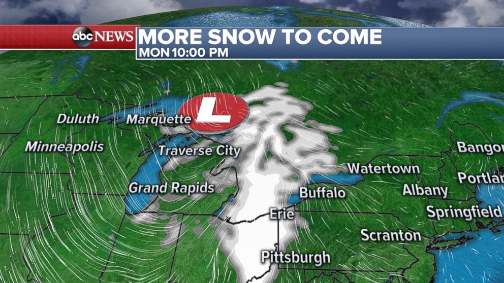
Looking farther north, very farther north, a disturbance will develop in southern Canada by late Sunday, and cross the border into the U.S. Northern Plains by Monday. This classic disturbance, called an Alberta Clipper, will bring some light snow from the Northern Plains to the Northeast from Monday to Tuesday. With the exception of enhanced lake-effect snow, accumulations from Alberta Clippers tend to be fairly light, though.
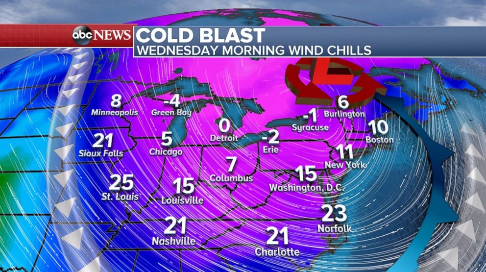
Expect a significant blast of cold air right behind the Clipper. Wind Chills spanning an area from the Midwest to the Northeast will be the coldest so far this season, with it feeling like the temperature is in the low teens in the I-95 corridor by Wednesday morning.
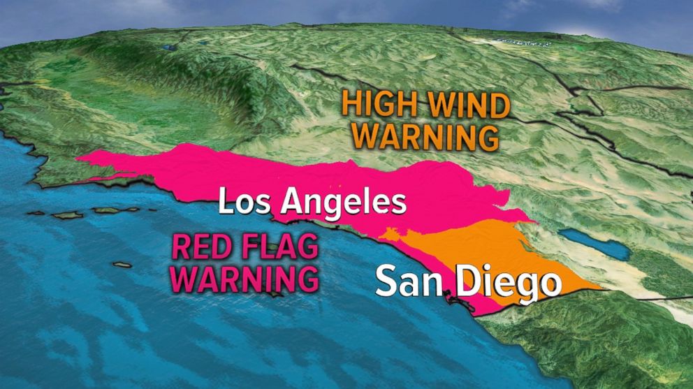
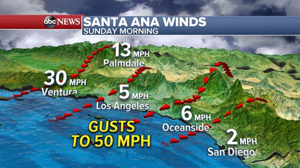
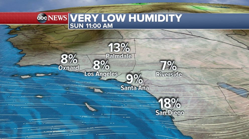
Over on the West Coast, the Santa Ana winds are expected to ramp up again Sunday morning and through the day on Sunday.
Gusts locally will exceed 50 mph through the hillsides and mountains. Relative humidity will be as low as 3 percent in some areas over the next several days -- not an ideal condition for battling the blazes.
Popular Reads
ABC News Live
