You Can Help Map the Ebola Zone and Fight the Outbreak
Red Cross volunteers scouring satellite photographs to find roads, towns.
— -- To fight the worst Ebola outbreak in history, the American Red Cross is attempting to get ahead of the virus by creating the most detailed maps of rural towns and villages so officials can track the deadly virus as it spreads.
The aid group is enlisting volunteers -- maybe even you -- to help map the areas hard hit by the virus through its Geographic Information System program. Anyone who wants to volunteer can join online.
Dale Kunce, the leader of the American Red Cross Geographic Information System (GIS) team, said it works with input from people in the field to oversee volunteers as they detail maps by poring over satellite imagery of houses, schools and remote villages.
“One of the more interesting requests was from the [World Health Organization to] start looking at cemeteries,” said Kunce. “It’s very important in the Ebola outbreak because it’s where the infection [can occur.]”
Once the maps are detailed, Kunce said, they are sent out to Red Cross partners, including Doctors Without Borders and the International Federation of the Red Cross and Red Crescent, which are working in the field to treat victims and stop the outbreak, which has infected 1,711, killing 932.
Volunteers don’t need prior experience with maps, Kunce said, adding that the sheer number of people helping means the maps are done quickly and errors are caught by hundreds of volunteers sharing the work.
“A Wikipedia article can make an innocent mistake and then someone with more experience will catch the mistake,” said Kunce, comparing the website to the mapping program. ”But then it’s fixed. There’s 700 people and 1,400 eyes [on these maps.] The maps will improve over time.”
Stories From the Front Lines of the Ebola Epidemic
How Did U.S. Ebola Patients Get Experimental Drug?
People working in the remote areas will also send in notes, such as GPS locations for a village that has never been mapped before.
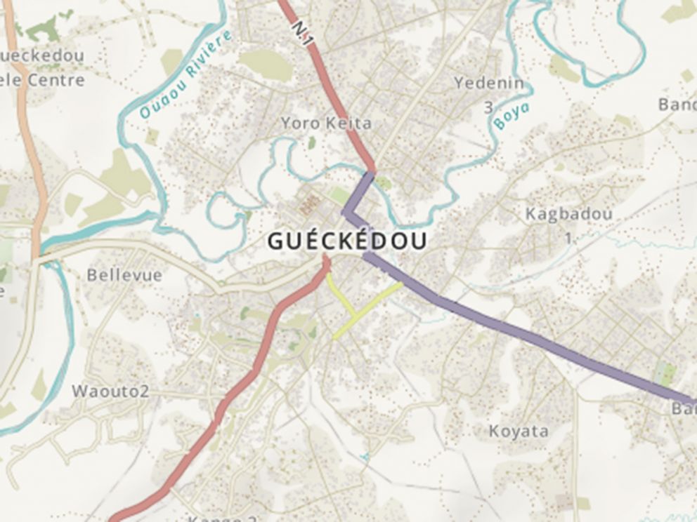
As a result of the efforts, Kunce said, the volunteers have been able to reimagine entire cities. The original map for the remote town of Guéckédou in Guinea showed just nine roads. After mappers looked at satellite photographs, they were able to add hundreds of roads and streams to the map of the town located near the epicenter of the outbreak.
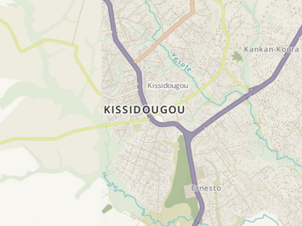
The maps can be vital to fight Ebola in rural areas where road signs, maps and GPS locations are scarce. Epidemiologists can track where and how fast the disease is spreading. If an aid worker hears a person is sick in a village, he or she can pick up these new maps and figure out a route to that location.
One American Red Cross volunteer, David Schindler, said the maps were key for relief workers trying to navigate rural roads, towns and neighborhoods for the first time.
“The hard copy maps were very useful; they were posted up on the wall and referenced constantly by relief workers,” Schindler said, who helped provide IT support for aid workers in Sierra Leone. “And people were posting maps on to their GPS regularly.”

Trending Reader Picks
ABC News Live