Boston Braces For More Snow as Strong Winds Take Aim on the Northeast
Boston will be setting another snow record this weekend.
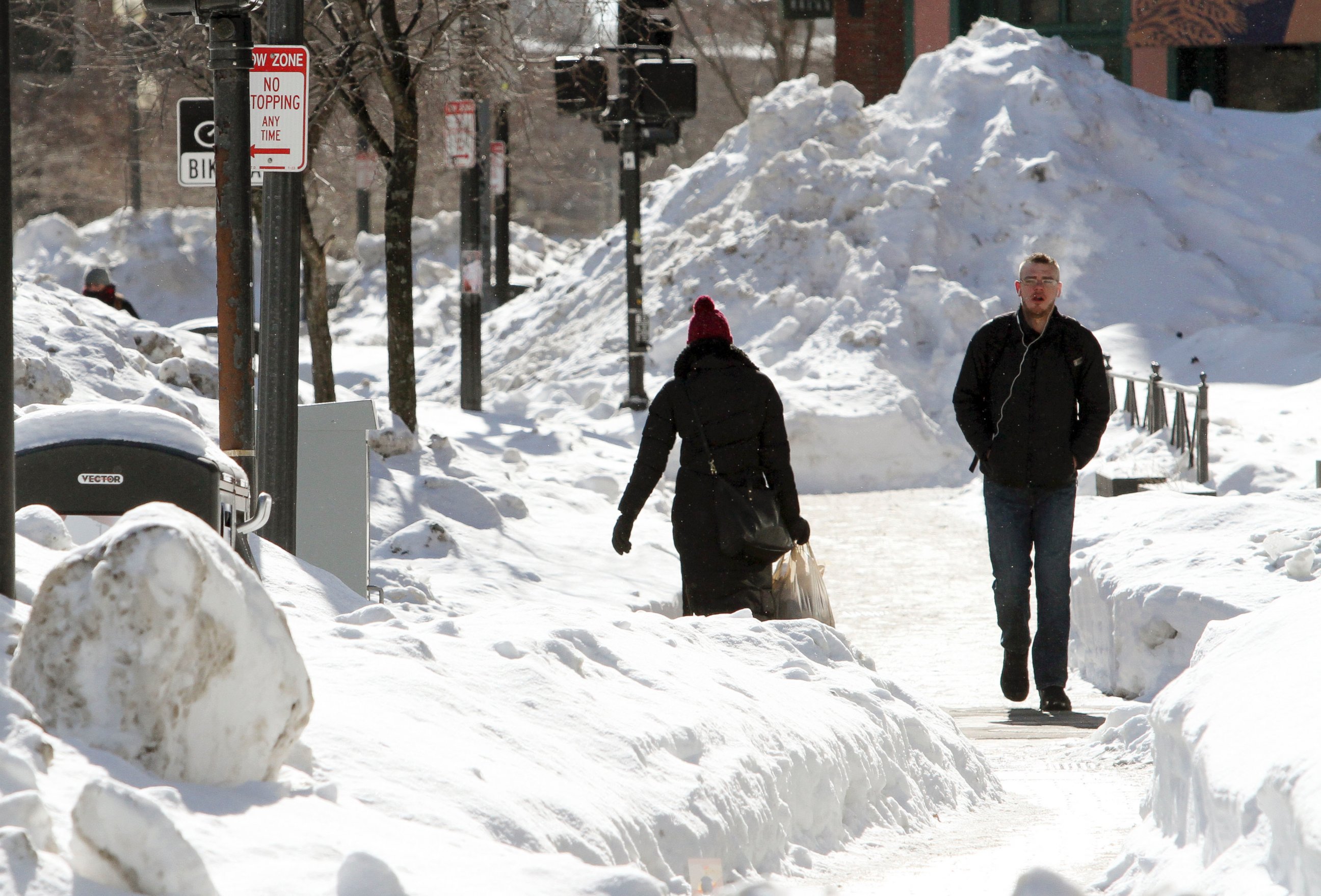
— -- Boston was bracing for its fourth straight weekend of snow as another major winter storm geared up to batter the New England coast yet again.
The developing storm is part of another bitter blast of arctic air that began plunging southward on Saturday morning across the northern Plains. Wind chills as low as 43 degrees below zero were reported in parts northern Minnesota, with blinding snow squalls developing along the leading edge of the arctic air.
More than a half foot of snow was reported in parts of western Michigan, and white-out conditions played a role in numerous accidents across the Midwest on Saturday afternoon.
The worst of the cold, snow, and the developing winter storm continued to push east today, heading toward the Northeast.

Areas of snow will continue from the mid-Atlantic to the Northeast through Saturday night as the storm continues to rapidly intensify. The accumulating snow will occur for much of the Northeast into Saturday night with any remaining snow falling on New England by Sunday morning.
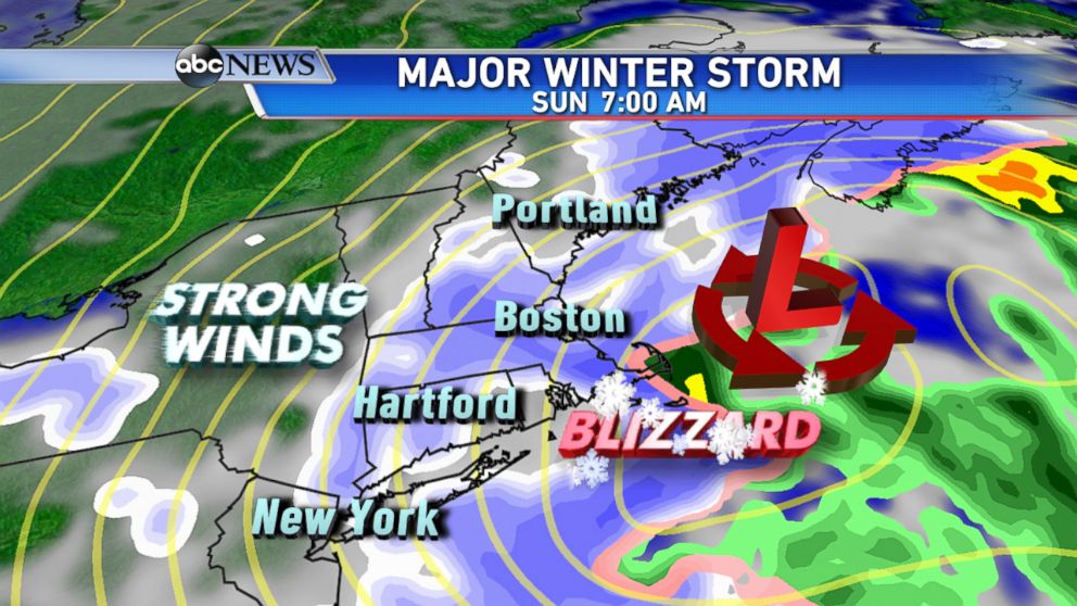
However, it's not just accumulating snow that is a concern from this storm. Strong winds are expected throughout the Northeast as the winter storm becomes a powerful nor'easter off the New England coast by Sunday morning.
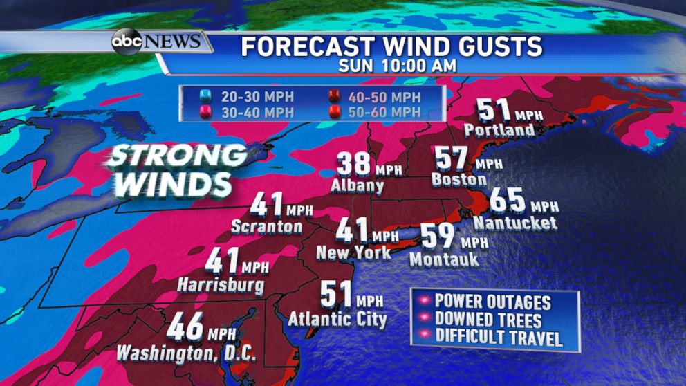
High wind warnings are in effect for much of the Northeast, with wind gusts up to 60 mph possible Sunday in Washington D.C., Philadelphia, and New York City. The highest gusts are forecast for eastern Long Island and coastal New England, closer to where the center of the winter storm will track.

The ABC News Weather team has been emphasizing that the impending storm will be remembered more for its wind than numerous big snow totals across the Northeast region. Residents should prepare for possible power outages as the winds continue to increase Saturday night.
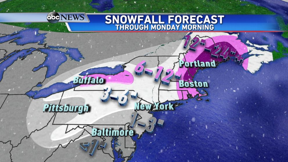
Coastal New England is forecast to see the brunt of the heavy snowfall as well, with one to two feet of snow forecast for the extreme northeastern coast of Massachusetts to Maine.
The city of Boston will be on the fringe of the higher snow totals, likely seeing double digit totals once again. However, the greatest amounts will be focused further north along parts of the Maine coast.
Blizzard conditions in Boston are expected once again with extremely low visibility, strong winds, hazardous travel conditions developing on Sunday morning.

The storm will begin to clear out Sunday night, but the bitter cold temperatures will remain through Monday. By early Monday morning, major cities in the Northeast will feel like they are in the -10s and -20s and freezing temperatures will settle in all the way down to northern Florida.
Some of the major cities in the Northeast may see their lowest temperatures in more than a decade, with the frigid cold possibly breaking some records by Monday morning. The current forecast low for New York City is 1 degree above zero on early Monday morning. If this occurs, it would be the coldest temperature observed in the city in years.
For those weary of the bitter cold, no relief is in sight. Another blast of arctic air is expected towards the end of the week with more chances for snow across an already winter-whipped region.


