Christmas Forecast: Stormy Week to Bring Severe Weather and Lots of Rain
Travel will get harder for much of the country.
— -- The weather outside will be frightful this week just in time for Christmas.
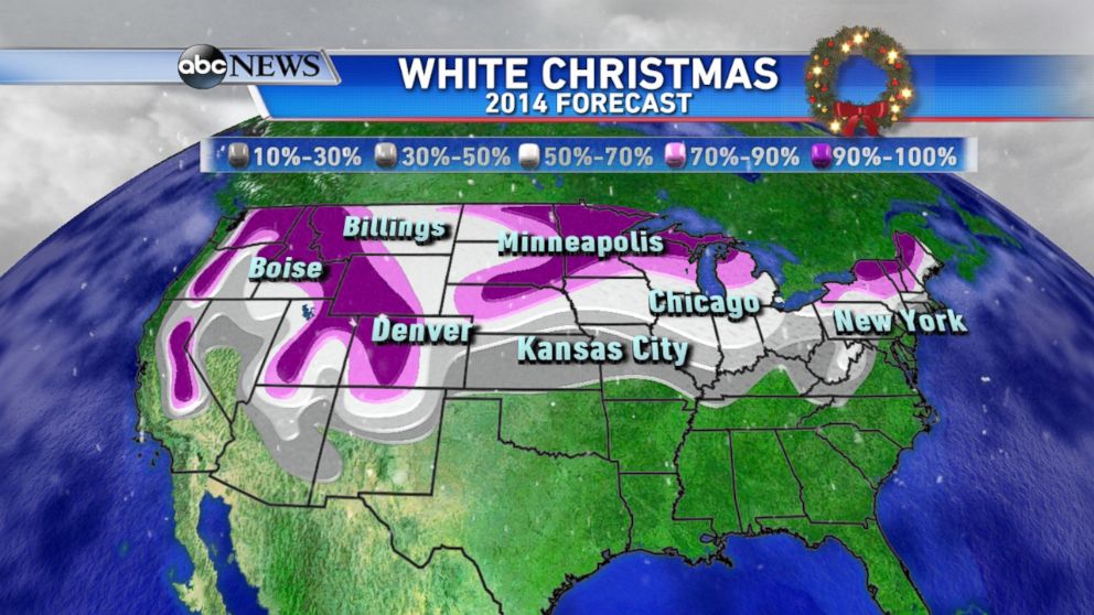
Will we get a white Christmas this year? For some, there will be abundant snow out West and in the Mountains over the past couple of days.
Christmas Forecast: Live Weather Radar
A developing storm will also bring a new round of accumulating snow to the Northern Plains and Midwest through Wednesday. Accumulations will not be very high, generally 1-3 inches, but that is still enough for a White Christmas.
Let’s get back to that storm system which will be coming together to affect for the eastern half of the country starting tonight and through the Christmas week.
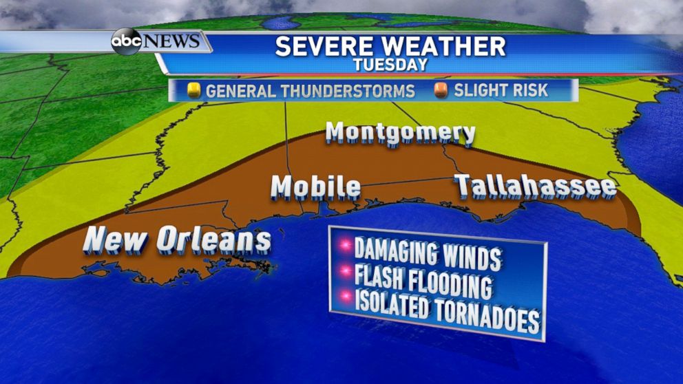
By today, the Southeast will need to prepare for severe weather and flash flooding. Heavy rain and storms will begin to move into the Southeast and Gulf States lasting into Wednesday.
Extreme rain is expected with some of these storms -– flash flood watches for parts of Florida, Georgia and Alabama, where there is potential for widespread rainfall totals of 4-6 inches. Along with the flooding, severe thunderstorms are also likely during this time. The threat exists for damaging wind gusts, large hail, and even isolated tornadoes through the day today, from New Orleans to Tallahassee.
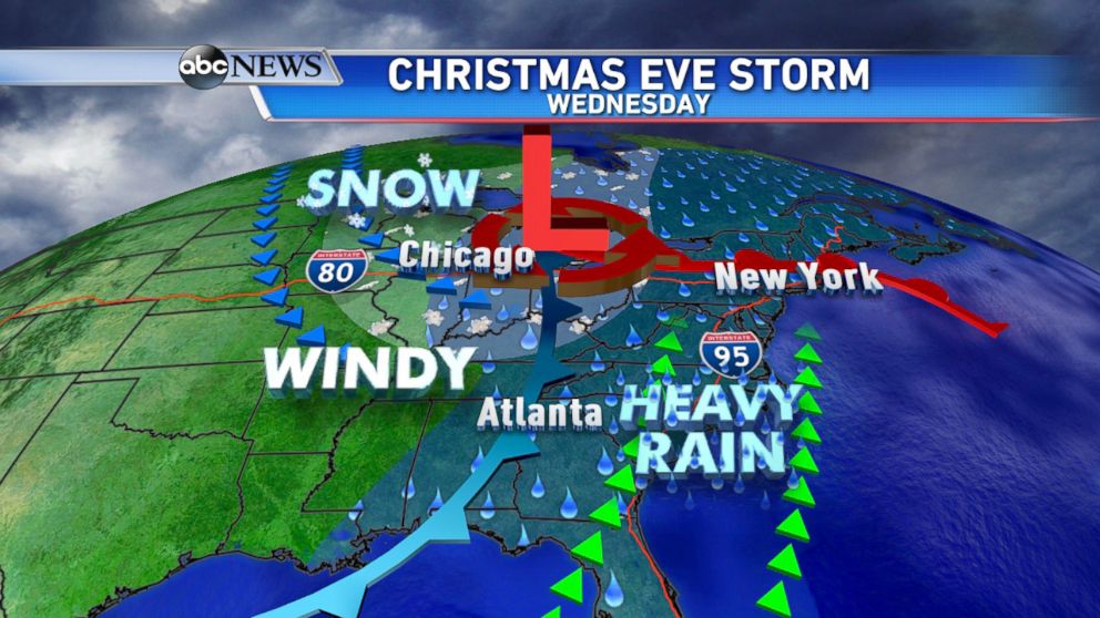
As Christmas Eve approaches the storm further strengthens, bringing a variety of weather to the east, including high winds, heavy rain, and snow.
Rainfall totals are generally 1-3 inches, with the highest amounts in the Southeast. It will be a wet and windy day for the major Northeast cities on Christmas Eve. Locally heavy rain could result in minor flooding and strong wind gusts that could reach 30 to 50 mph.
Temperatures along the East Coast will be much too warm for any snow -- so no white Christmas there!
Very mild air keep temperatures in the 50s and 60s for the Northeast and 70s further south down the coast. Colder air will be filtering in on the backside of the storm where rain will change to snow; parts of the Ohio Valley and Great Lakes should see some light snow accumulation on Christmas Eve along with strong winds.
With messy weather, comes messy travel. It’s one of the biggest travel times of the season, and it may not be the easiest.
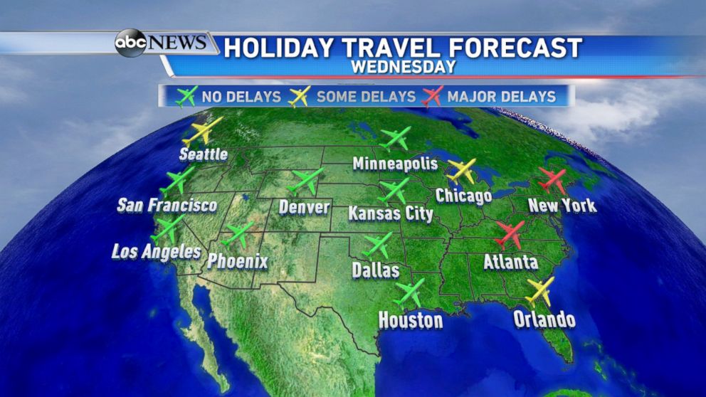
Roads will be slick and slippery which could cause backups and traffic problems. Major airports could see disruptive flight delays today and Wednesday, especially in New York City, Washington, D.C. and Atlanta due to the heavy rain and winds.
Delays are also expected in the Midwest, including Chicago. As we know, flight delays can be like a domino effect, one can turn into many.
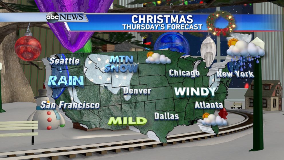
The good news for Christmas Day is that the storm will begin to move out, leaving behind drier, cooler, and blustery conditions. Lingering showers are expected for New England, and a few light snow showers are possible for parts of the Great Lakes. Out West, mountain snow continues and another round of rain moves into the Pacific Northwest. Overall, improving conditions are expected for much of the country by Christmas Day.
