East Coast expecting winter weather first day of spring
The storm will likely not be a direct hit for the Northeast.
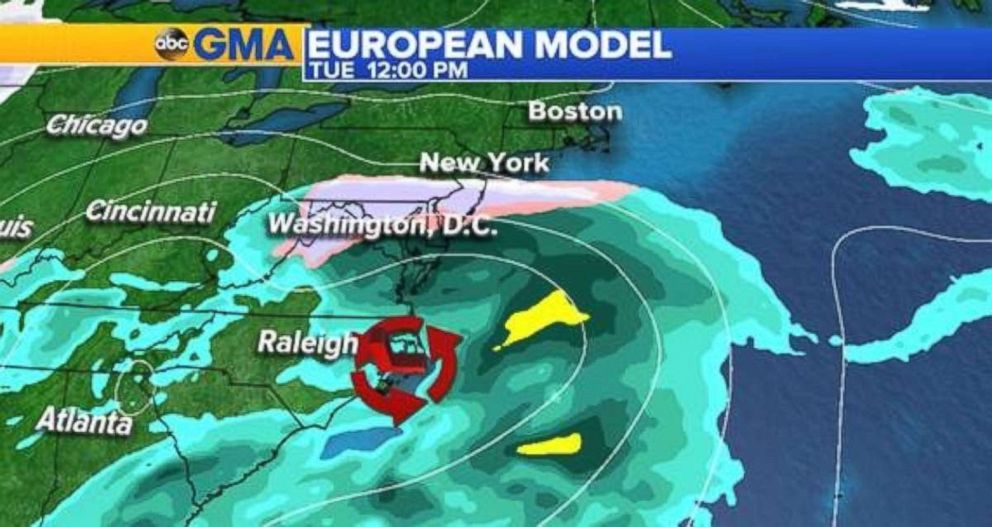
A series of late winter storms will continue on the first day of spring in the East as snow and rain pelt the region on Tuesday and Wednesday.
The weather models are mostly in agreement as it gets closer that the storm won't be a major one.
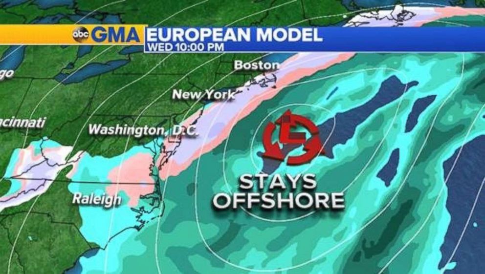
The European model has been the most consistent at keeping the low offshore. The American, or GFS model, is also in agreement with this track, but with slightly less precipitation.
Some snow could be seen Tuesday morning into the afternoon ahead of the approaching low from Virginia to New Jersey. This may transition back to rain as the low begins to pull offshore.
The changeover back to snow for the Appalachian Mountains and Mid-Atlantic begins early Wednesday, but the storm quickly moves offshore and out to sea by Wednesday night.
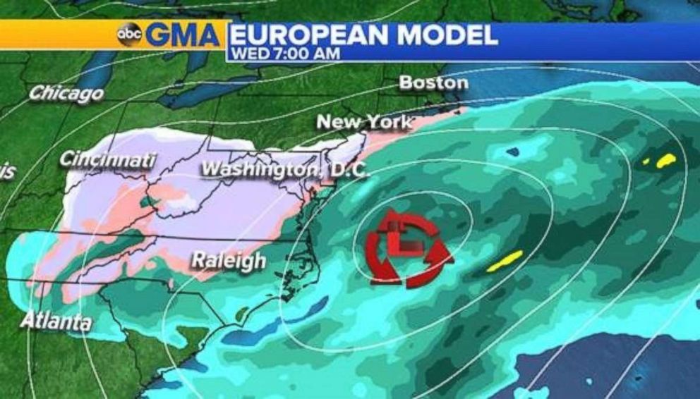
Any chance of accumulating snow will likely be elevation driven in places such as Roanoke and Harrisonburg, Virginia.
Stay tuned for updates as we get more information and a better indication of who will be seeing what in terms of precipitation types.
Wind whopping the West
There are weather alerts across 13 states through Sunday afternoon, including a winter weather advisory for the Pacific Northwest and parts of the northern Rockies, an avalanche warning in Utah and fire alerts in New Mexico, western Oklahoma and western Texas.
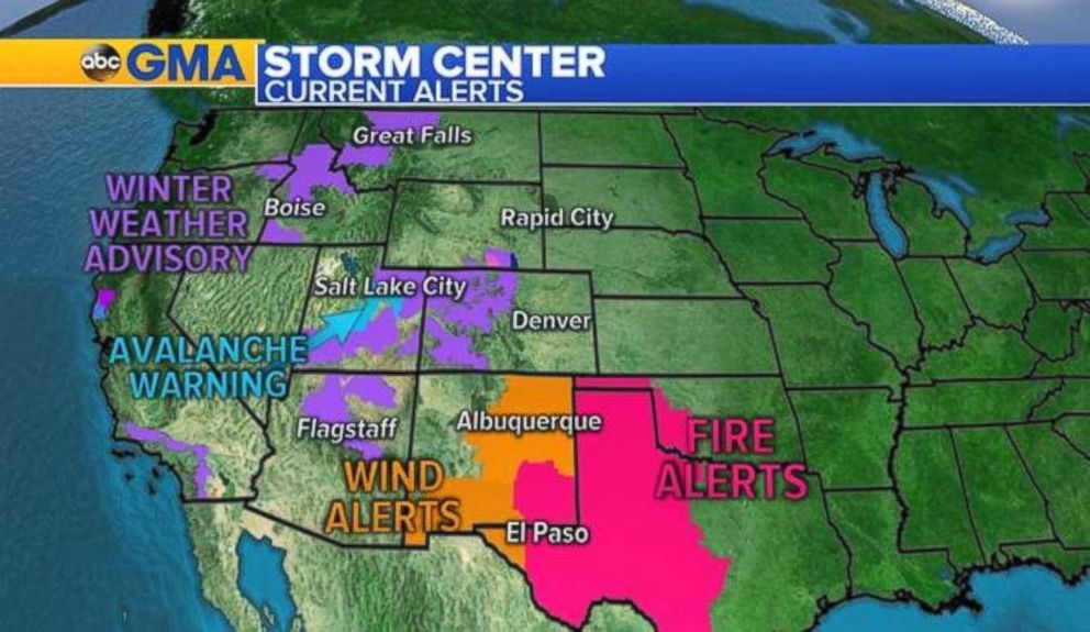
Portions of central and east-central New Mexico will be contending with high winds Sunday afternoon and evening. Sustained winds of 35 to 45 mph are expected with gusts of 55 to 70 mph possible.
This will cause reduced visibility at times due to blowing dust as well as potential property damage.
Related Topics

Popular Reads
ABC News Live