Almost 3 feet of snow falls in Calif. mountains as storm moves east
The storm is now expected to dump heavy snow on the Rockies.
— -- Almost 3 feet of snow has fallen over the past 48 hours in the Sierra Nevada mountains in a storm expected to dump heavy rain on the Midwest and Northeast at the start of next week.
The Sierra Nevada in California has seen 30 inches of snow since Wednesday. Oregon's Cascades Mountains have seen heavy snow in the past week, with 5 feet of snow on the ground -- the highest snowpack ever recorded this early in the season.
As the storm moves through the Rockies and into the western plains, watches and warnings have been extended from California to Oklahoma and up into the northern plains.
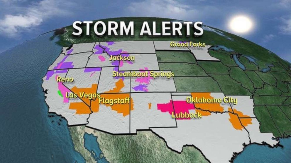
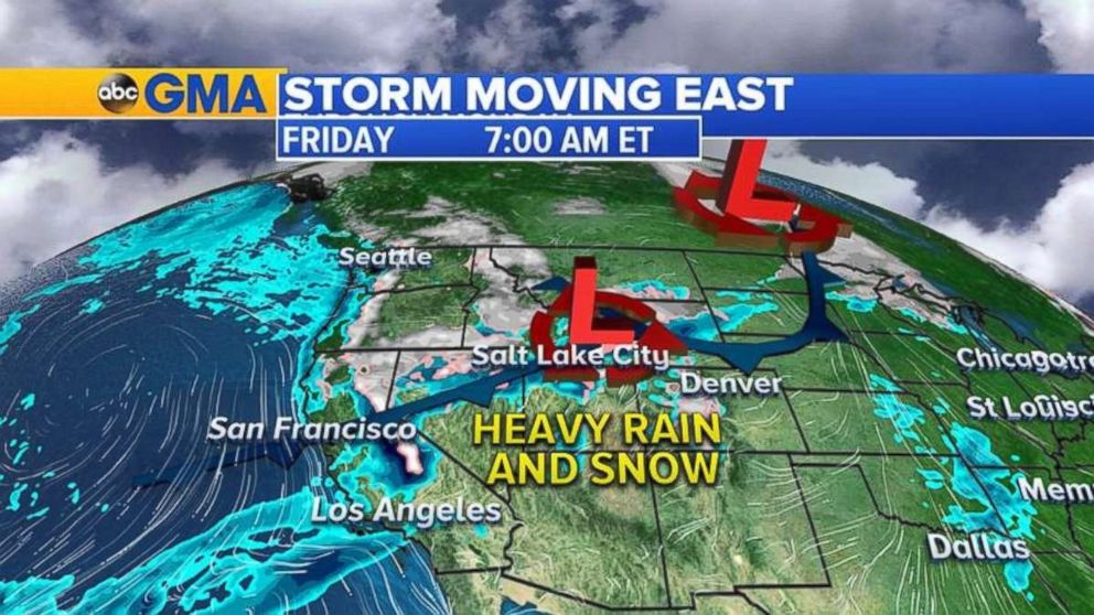
The storm system is moving out of California on Friday and moving through the Rockies with heavy snow expected.
Midwest, Northeast next in sight
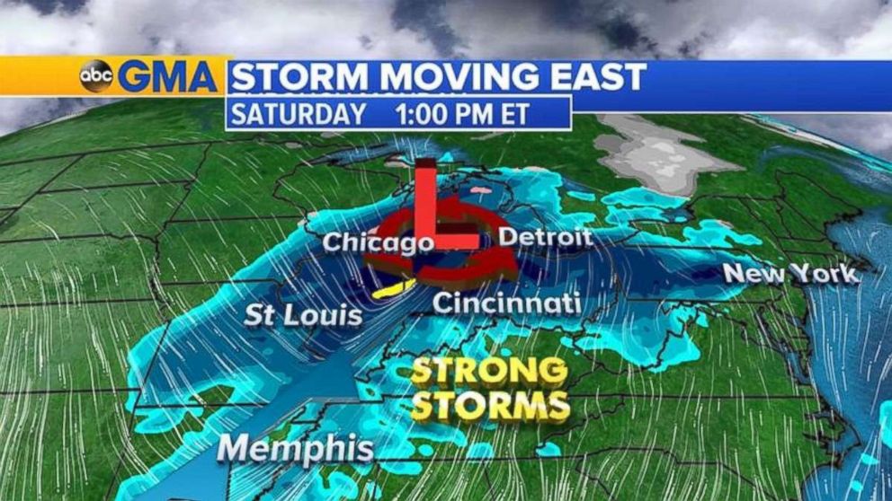
As the storm moves into the Midwest and Tennessee Valley, strong to possibly severe storms could develop on Saturday. The biggest threat with these storms will be damaging winds, and possibly tornadoes.
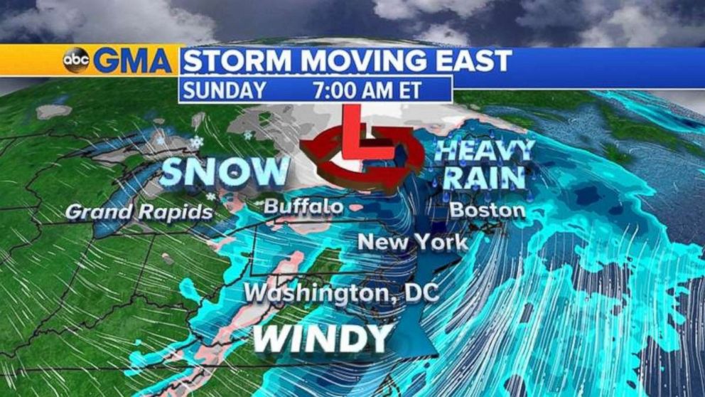
By Saturday evening, the storm system moves into the Northeast with heavy rain and wind from Washington, D.C. to Boston. Delays at major airports in the region are likely due to the gusty winds and low visibility.
Additional western snow
Additional snowfall is forecast for the west through the next 24 hours, with up to 2 feet of snow possible in Colorado, and additional 6 to 12 inches is still possible for the Sierra Nevada mountains.
The storm system will also bring snow to the Great Lakes and inland Northeast due to the cold air moving over the relatively warm Great Lakes. Some areas could see several inches from Wisconsin to New York state.
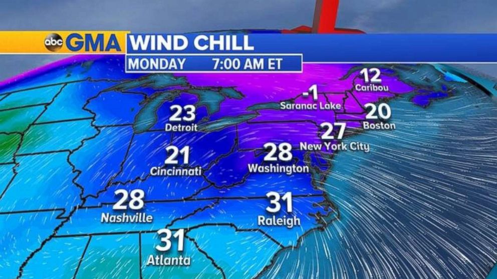
Behind the storm system, much colder air and gusty winds will cover the eastern half of the United States, with freezing wind chills to kick off the Thanksgiving holiday week.
Related Topics

Popular Reads
ABC News Live